 |
|
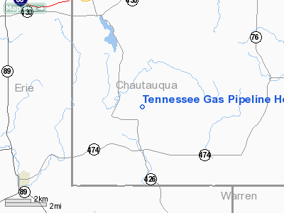
Tennessee Gas Pipeline Heliport |
Location & QuickFacts
| FAA Information Effective: | 2008-09-25 |
| Airport Identifier: | 5NY2 |
| Airport Status: | Operational |
| Longitude/Latitude: | 079-41-40.1790W/42-03-17.1980N
-79.694494/42.054777 (Estimated) |
| Elevation: | 1650 ft / 502.92 m (Estimated) |
| Land: | 0 acres |
| From nearest city: | 4 nautical miles NW of Clymer, NY |
| Location: | Chautauqua County, NY |
| Magnetic Variation: | 09W (1990) |
Owner & Manager
| Ownership: | Privately owned |
| Owner: | Tennesse Gas Pipeline Co |
| Address: | P O Box 338ravlin Hill Rd
Clymer, NY 14724 |
| Phone number: | 716-355-4224 |
| Manager: | Bill Tasker |
| Address: | P O Box 338 Ravlin Hill Rd
Clymer, NY 14724 |
| Phone number: | 716-355-4224 |
Airport Operations and Facilities
| Airport Use: | Private |
| Segmented Circle: | No |
| Control Tower: | No |
| Sectional chart: | Detroit |
| Region: | AEA - Eastern |
| Boundary ARTCC: | ZOB - Cleveland |
| Tie-in FSS: | BUF - Buffalo |
| FSS on Airport: | No |
| FSS Toll Free: | 1-800-WX-BRIEF |
Runway Information
Helipad H1
| Dimension: | 40 x 40 ft / 12.2 x 12.2 m |
| Surface: | CONC, |
| |
Runway H1 |
Runway |
| Traffic Pattern: | Left | Left |
|
Radio Navigation Aids
| ID |
Type |
Name |
Ch |
Freq |
Var |
Dist |
| ORJ | NDB | Corry | | 258.00 | 09W | 8.8 nm |
| CQD | NDB | Cascade | | 372.00 | 08W | 18.7 nm |
| FKL | VOR | Franklin | | 109.60 | 06W | 37.7 nm |
| JHW | VOR/DME | Jamestown | 094X | 114.70 | 07W | 26.8 nm |
| TDT | VORTAC | Tidioute | 123X | 117.60 | 09W | 24.0 nm |
| ERI | VORTAC | Erie | 031X | 109.40 | 06W | 26.8 nm |
| DKK | VORTAC | Dunkirk | 109X | 116.20 | 07W | 32.2 nm |
Remarks
Images and information placed above are from
http://www.airport-data.com/airport/5NY2/
We thank them for the data!
| General Info
|
| Country |
United States
|
| State |
NEW YORK
|
| FAA ID |
5NY2
|
| Latitude |
42-03-17.198N
|
| Longitude |
079-41-40.179W
|
| Elevation |
1650 feet
|
| Near City |
CLYMER
|
We don't guarantee the information is fresh and accurate. The data may
be wrong or outdated.
For more up-to-date information please refer to other sources.
|
|


