 |
|
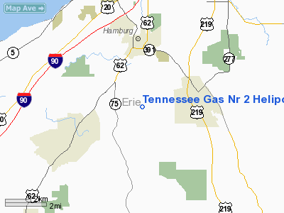
Tennessee Gas Nr 2 Heliport |
Location & QuickFacts
| FAA Information Effective: | 2008-09-25 |
| Airport Identifier: | 48NY |
| Airport Status: | Operational |
| Longitude/Latitude: | 078-49-49.1150W/42-40-30.2150N
-78.830310/42.675060 (Estimated) |
| Elevation: | 1050 ft / 320.04 m (Estimated) |
| Land: | 0 acres |
| From nearest city: | 3 nautical miles N of Hamburg, NY |
| Location: | Erie County, NY |
| Magnetic Variation: | 10W (1985) |
Owner & Manager
| Ownership: | Privately owned |
| Owner: | Tennessee Gas Pipeline Co. |
| Address: | 7586 E Eden Rd
Eden, NY 14057 |
| Phone number: | 716-649-5610 |
| Manager: | R.s. Redmond |
| Address: | 7586 E Eden Rd
Eden, NY 14057 |
| Phone number: | 716-649-5610 |
Airport Operations and Facilities
| Airport Use: | Private |
| Wind indicator: | Yes |
| Segmented Circle: | No |
| Control Tower: | No |
| Landing fee charge: | No |
| Sectional chart: | Detroit |
| Region: | AEA - Eastern |
| Boundary ARTCC: | ZOB - Cleveland |
| Tie-in FSS: | BUF - Buffalo |
| FSS on Airport: | No |
| FSS Toll Free: | 1-800-WX-BRIEF |
Runway Information
Helipad H1
| Dimension: | 50 x 50 ft / 15.2 x 15.2 m |
| Surface: | ASPH, |
| |
Runway H1 |
Runway |
| Traffic Pattern: | Left | Left |
| Obstruction: | 300 ft ant, 1000.0 ft from runway | |
|
Radio Navigation Aids
| ID |
Type |
Name |
Ch |
Freq |
Var |
Dist |
| LYS | NDB | Olean | | 360.00 | 09W | 32.2 nm |
| SN | NDB | St Catherines | | 408.00 | 01E | 34.0 nm |
| IAG | TACAN | Niagara Falls | 047X | | 10W | 26.9 nm |
| BUF | VOR/DME | Buffalo | 111X | 116.40 | 08W | 17.3 nm |
| JHW | VOR/DME | Jamestown | 094X | 114.70 | 07W | 32.0 nm |
| GEE | VOR/DME | Geneseo | 019X | 108.20 | 09W | 49.4 nm |
| DKK | VORTAC | Dunkirk | 109X | 116.20 | 07W | 22.6 nm |
| BUF | VOT | Buffalo | | 109.00 | | 16.4 nm |
Remarks
Images and information placed above are from
http://www.airport-data.com/airport/48NY/
We thank them for the data!
| General Info
|
| Country |
United States
|
| State |
NEW YORK
|
| FAA ID |
48NY
|
| Latitude |
42-40-30.215N
|
| Longitude |
078-49-49.115W
|
| Elevation |
1050 feet
|
| Near City |
HAMBURG
|
We don't guarantee the information is fresh and accurate. The data may
be wrong or outdated.
For more up-to-date information please refer to other sources.
|
|


