|
 |
|
||||
|
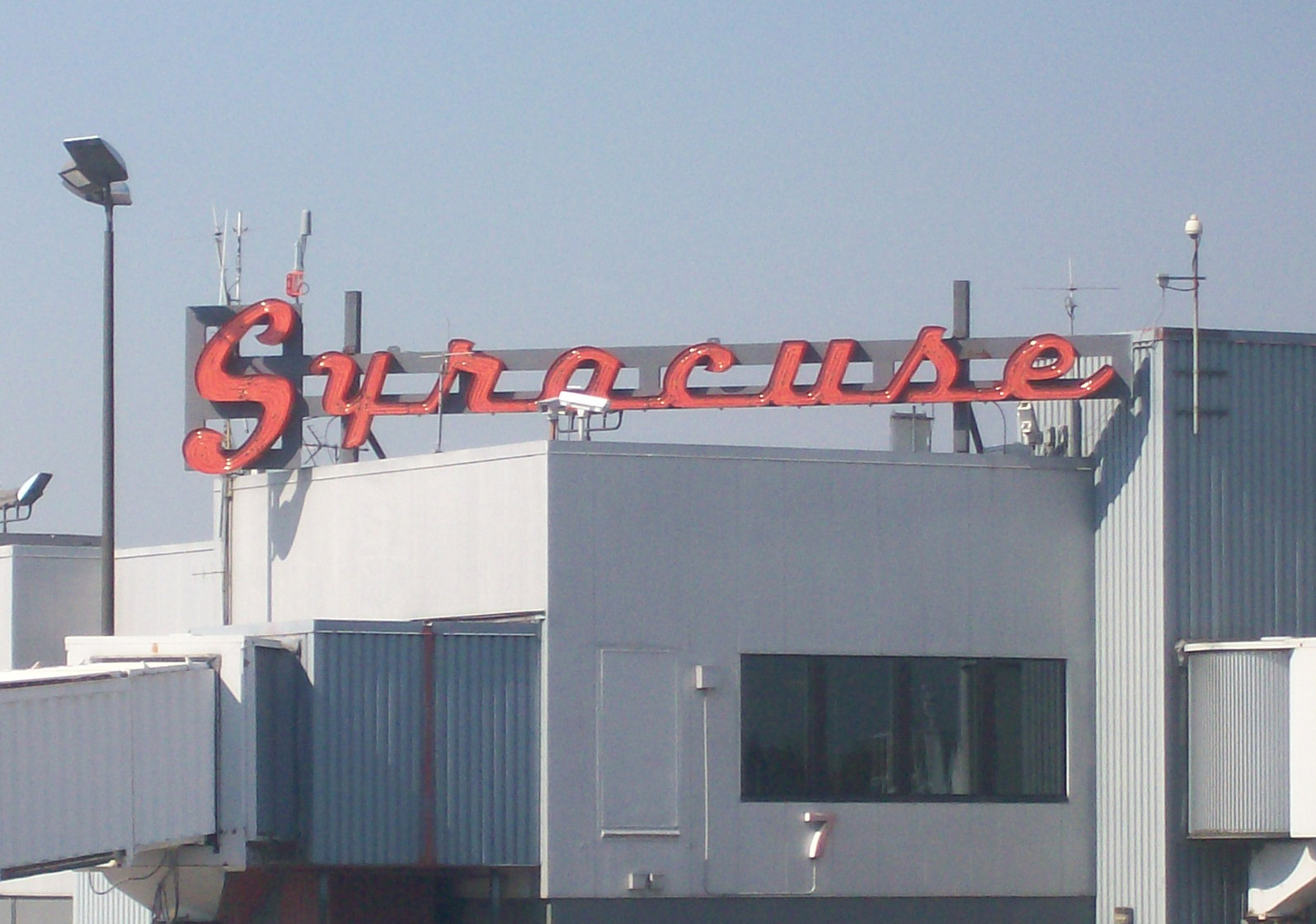
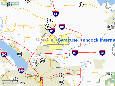
Syracuse Hancock International Airport (IATA: SYR, ICAO: KSYR) is a joint civil-military public airport located 4 NM (7.4 km; 4.6 mi) northeast of Syracuse, in Onondaga County, New York, off of Interstate 81 near Mattydale, New York. The main terminal complex is located at the eastern end of Colonel Eileen Collins Boulevard. HistoryIn 1927 Syracuse mayor Charles Hanna felt that his city needed an airport. A location at Amboy in the town of Camillus, New York was purchased for $50,000, and by 1928, the "Syracuse City Airport at Amboy" was handling airmail. At the end of World War II the United States Army Air Corps leased their bomber base near Mattydale, New York to the city. On September 17, 1949, the Clarence E. Hancock Airport opened to the public using a renovated machine shop as a terminal, and replaced the airport at Amboy. American, Buffalo, Colonial and Robinson Airlines were the first airlines to operate at the airport, and American Airlines still does to this day. In 1962 a new terminal opened, at the site of the present-day terminals. The location allowed the airport to be directly connected to Interstate 81, which was built shortly afterwards. In 1970 the airport was awarded international airport status by the International Civil Aviation Organization, and thus renamed Syracuse Hancock International Airport. When the United States deregulated the airline industry in 1978, Syracuse was predominantly served by two "trunk carriers" (American Airlines and Eastern Air Lines) and one "local service carrier" (Allegheny Airlines, which renamed itself USAir in 1979). American and Eastern used the airport's south concourse, and Allegheny used the north concourse. Shortly after deregulation American began cutting back on regional point-to-point flights at medium-sized airports in the Northeast such as Syracuse, as Chairman Robert Crandall built up the airline's hub at Dallas-Fort Worth International Airport. Other airlines entered or grew service at Syracuse to meet demand as the industry grew following deregulation. Airlines that served Syracuse after deregulation include (but are not limited to):
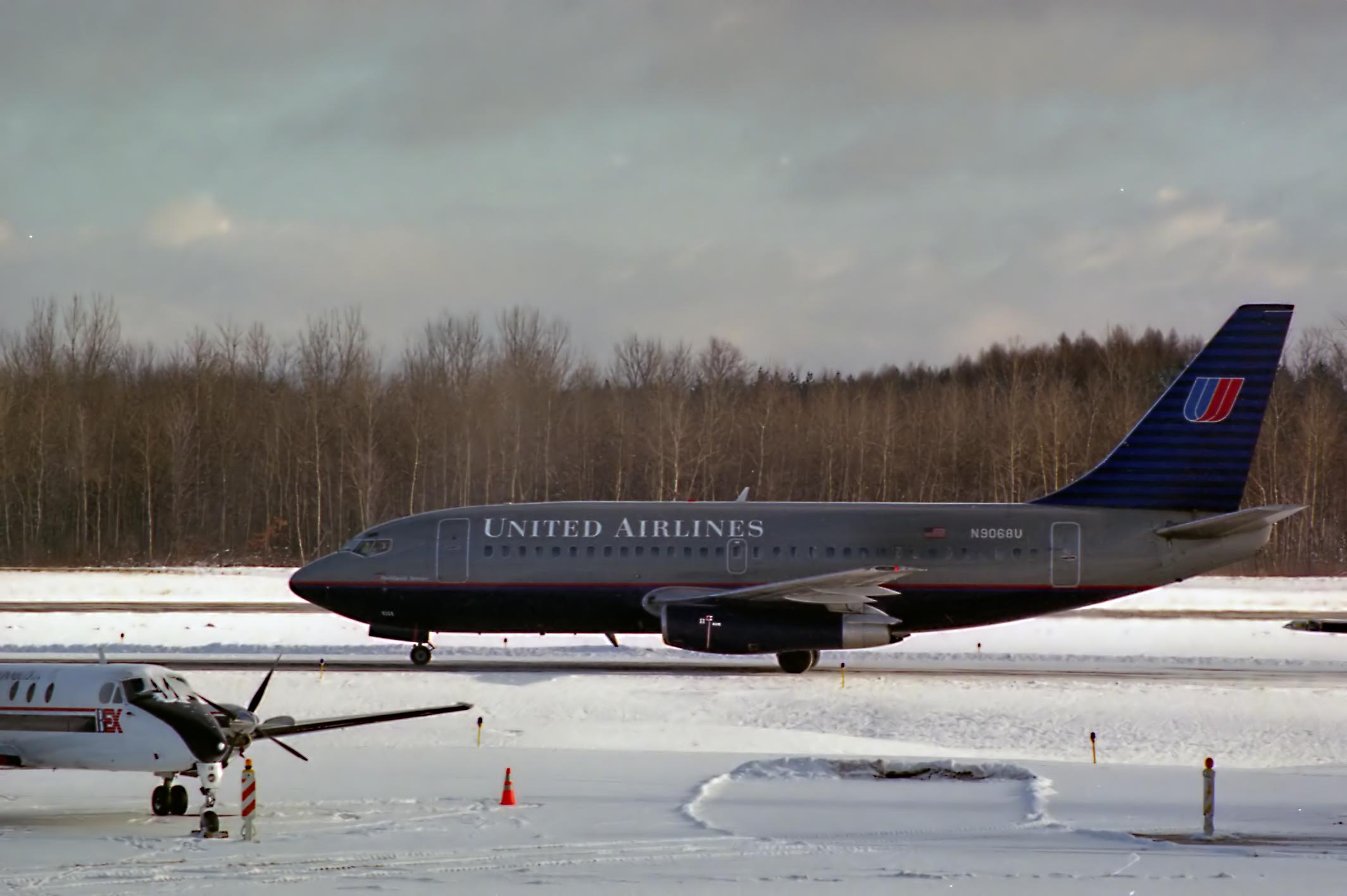
Throughout the 1970s and 1980s the airport went through several expansions to meet increasing demand. Empire Airlines, which was founded in 1976, made Syracuse a hub, and over two million passengers a year were using the airport. Piedmont Airlines absorbed Empire in 1986 and kept the Syracuse hub. The mid-to-late 1980s were the best years in Hancock history, with a record 3.17 million passengers using the airport in 1987, second in Upstate New York only to Buffalo, and its 253 daily flights even made it the top Upstate New York airport in terms of flights. Hub-carrier Piedmont operated most of the gates in Terminal A, operating 58 jet flights and 12 commuter flights a day in 1987. Terminal A was expanded that year, adding more gates, a Piedmont Presidential Club (a US Airways Club until 2004), and a larger customs area. With USAir's purchase of Piedmont in 1989, things started going sour for Hancock International. USAir closed the Syracuse hub, and Syracuse therefore lost its advantage over other upstate airports. A final terminal expansion was completed in 1996, along with an overall overhaul and renovation, which created two separate terminal areas with individual, checkin, security, and baggage claim. USAir still maintained a large presence at the airport but reduced flights throughout the 1990s. After the September 11, 2001 attacks, the now-renamed US Airways cut even more flights and did not renew its leases for many of its gates in Terminal A, upon which the airport essentially "boarded them up." US Airways is still the number one carrier at Hancock in terms of both departures and destinations served.
However, a new era began on May 7, 2001 when JetBlue inaugurated low-cost service to Hancock. Mainly using the first gate of Terminal A, Gate 15, most of this terminal still remains asleep. In 2007, JetBlue also expanded its operation to include usage of gates 3 and 11. More discount carriers followed suit and began servicing Syracuse. Charter airline TransMeridian Airlines began its first scheduled routes ever when it started flying six weekly flights to Orlando Sanford International Airport in 2003. It flew the route until its bankruptcy in 2005. JetBlue began flying non-stop to Orlando International Airport daily in July 2006. Independence Air began flying eight daily roundtrips to Washington Dulles International Airport in 2004, but Independence Air's parent company filed for bankruptcy protection in November 2005 and flew its last flight in January 2006. US Airways announced on May 10, 2004 that it would increase service to Hancock, lower fares, and add seats by converting flights from turboprop to regional jet. In 2004, Syracuse Mayor Matthew Driscoll created a Fly Syracuse television and internet campaign in an attempt to lower fares and increase passenger traffic at the airport. The airport has since experienced a period of growth thanks to the efforts of local politicians and business contributions toward the campaign. If the ambitious plans of mall developer The Pyramid Companies to build Destiny USA, a multi-billion dollar tourism attraction which could attract millions of new visitors by air, ever become reality, then Hancock would have to be expanded again. Its current capacity is estimated at about 3.35 million passengers a year. There has even been talk of a monorail to Hancock from Syracuse University via downtown and DestiNY USA (estimated cost $750 million). There are also plans to lengthen runway 10/28 and to build a parallel runway on the north side of the airport. It would become runway 10L/28R. (The existing runway 10/28 would become 10R/28L). Operations
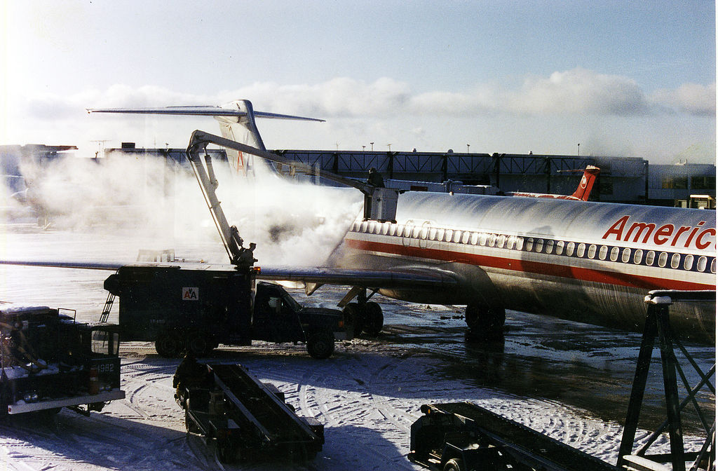
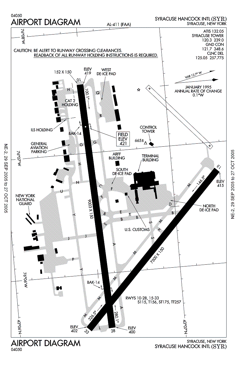
The Syracuse region receives an average 114 inches (289.56 cm) of snow annually. The airport has a vast amount of snow removal devices, including the world's largest snowplow with a blade measuring 32 feet 3 inches (9.83 m) wide and 4 feet (1.2 m) tall . On average, the airport is closed less than 24 hours annually due to snowfall. The airport has received the Balchen/Post Award for Excellence in the Performance of Snow and Ice Control a total of seven times, most recently in 2006.[1] Runway 10/28 has a Category II Instrument Landing System (ILS). Airlines and destinations
Military facilitiesThe airport is also home to Hancock Field Air National Guard Base. The host wing at Hancock Field ANGB is the 174th Fighter Wing (174 FW), with the 274th Air Support Operations Squadron (274 ASOS) as an additional tenant command. Both units belong to the New York Air National Guard and are operationally gained by the Air Combat Command (ACC). The installation consists of approximately 350 acres of flight line, aircraft ramp and support facilities on the south side of the airport. The base employs approximately 2,000 personnel consisting of full-time Active Guard and Reserve (AGR), Air Reserve Technicians (ART) and traditional part-time Air National Guardsmen. The facility maintains the BAK-14 arresting gear on the airport's primary runway for emergency use by military tactical jet aircraft and also operates its own fire station with USAF crash vehicles that augment the airport's civilian Aircraft Rescue and Fire Fighting (ARFF) organization. The 174 FW was formed on October 28, 1947 as the 138th Fighter Squadron (138 FS), the first post-World War II Air National Guard flying unit in New York State, and initially flew P-47 Thunderbolts from the former Army Air Force facilities at Hancock Field. The wing has been flown fighters or attack aircraft for nearly its entire existence, to include the such aircraft as the F-86 Sabre, A-37 Dragonfly, A-10 Thunderbolt II and the F-16 Fighting Falcon in its F-16A and F-16C Block 25 and Block 30 variants. The wing was also one of two Air National Guard fighter wings that was totally mobilized to active duty and deployed to Southwest Asia in 1990-91 to conduct combat flight operations in support of Operation Desert Storm, as well as providing additional support to Operation NORTHERN WATCH in the late 1990s. As a result of Base Realignment and Closure (BRAC) 2005, the 174 FW was identified for transition to an unmanned aircraft flying mission, operating the MQ-9 Reaper weapon system. In October 2008, the first of the 174 FW's F-16s departed Hancock Field ANGB for transfer to other units and the wing began its transition. The wing will anticipates being operationally capable with the MQ-9 in mid-2010. Flight SchoolsSyracuse Hancock International is home to the third component of [2] Waypoint Flight School - which was once the former ExecAir Flight Training Center. Runways
The above content comes from Wikipedia and is published under free licenses – click here to read more.
Location & QuickFacts
Owner & Manager
Airport Operations and Facilities
Airport Communications
Airport Services
Runway InformationRunway 10/28
Runway 15/33
Radio Navigation Aids
Remarks
Images and information placed above are from We thank them for the data!
We don't guarantee the information is fresh and accurate. The data may
be wrong or outdated.
|
|||||||||||||||||||||||||||||||||||||||||||||||||||||||||||||||||||||||||||||||||||||||||||||||||||||||||||||||||||||||||||||||||||||||||||||||||||||||||||||||||||||||||||||||||||||||||||||||||||||||||||||||||||||||||||||||||||||||||||||||||||||||||||||||||||||||||||||||||||||||||||||||||||||||||||||||||||||||||||||||||||||||||||||||||||||||||||||||||||||||||||||||||||||||||||||||||||||||||||||||||||||||||||||||||||||||||||||||||||||||

 |
|
Copyright 2004-2026 © by Airports-Worldwide.com, Vyshenskoho st. 36, Lviv 79010, Ukraine Legal Disclaimer |