 |
|
Location & QuickFacts
| FAA Information Effective: | 2008-09-25 |
| Airport Identifier: | 9NY3 |
| Airport Status: | Operational |
| Longitude/Latitude: | 076-13-28.7520W/42-05-50.2670N
-76.224653/42.097296 (Estimated) |
| Elevation: | 884 ft / 269.44 m (Estimated) |
| Land: | 0 acres |
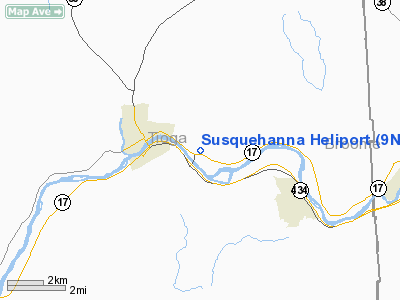
| From nearest city: | 2 nautical miles SE of Owego, NY |
| Location: | Tioga County, NY |
| Magnetic Variation: | 12W (1985) |
Owner & Manager
| Ownership: | Privately owned |
| Owner: | Ibm Fed Systems Co |
| Address: | Route 17c
Owego, NY 13827 |
| Phone number: | 607-751-5336 |
| Manager: | Herb Gorham |
| Address: | 0534 Ibm Rt 1 17c
Owego, NY 13827 |
| Phone number: | 607-751-5336 |
Airport Operations and Facilities
| Airport Use: | Private |
| Wind indicator: | Yes |
| Segmented Circle: | No |
| Control Tower: | No |
| Landing fee charge: | No |
| Sectional chart: | New York |
| Region: | AEA - Eastern |
| Boundary ARTCC: | ZNY - New York |
| Tie-in FSS: | BUF - Buffalo |
| FSS on Airport: | No |
| FSS Toll Free: | 1-800-WX-BRIEF |
Airport Communications
Airport Services
| Fuel available: | A |
| Airframe Repair: | NONE |
| Power Plant Repair: | NONE |
Runway Information
Helipad H1
| Dimension: | 100 x 100 ft / 30.5 x 30.5 m |
| Surface: | CONC, |
| |
Runway H1 |
Runway |
| Traffic Pattern: | Left | Left |
|
Helipad H2
| Dimension: | 70 x 70 ft / 21.3 x 21.3 m |
| Surface: | CONC, |
| |
Runway H2 |
Runway |
| Traffic Pattern: | Left | Left |
|
Radio Navigation Aids
| ID |
Type |
Name |
Ch |
Freq |
Var |
Dist |
| ALP | NDB | Alpine | | 245.00 | 12W | 25.5 nm |
| PYA | NDB | Penn Yan | | 260.00 | 12W | 49.4 nm |
| ITH | VOR/DME | Ithaca | 055X | 111.80 | 10W | 26.1 nm |
| ULW | VOR/DME | Elmira | 033Y | 109.65 | 12W | 35.7 nm |
| HNK | VOR/DME | Hancock | 115X | 116.80 | 11W | 40.6 nm |
| RKA | VOR/DME | Rockdale | 073X | 112.60 | 11W | 49.1 nm |
| CFB | VORTAC | Binghamton | 059X | 112.20 | 10W | 5.3 nm |
| GGT | VORTAC | Georgetown | 125X | 117.80 | 11W | 45.2 nm |
Images and information placed above are from
http://www.airport-data.com/airport/9NY3/
We thank them for the data!
| General Info
|
| Country |
United States
|
| State |
NEW YORK
|
| FAA ID |
9NY3
|
| Latitude |
42-05-50.267N
|
| Longitude |
076-13-28.752W
|
| Elevation |
884 feet
|
| Near City |
OWEGO
|
We don't guarantee the information is fresh and accurate. The data may
be wrong or outdated.
For more up-to-date information please refer to other sources.
|
|


