 |
|
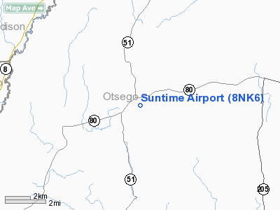
Location & QuickFacts
| FAA Information Effective: | 2008-09-25 |
| Airport Identifier: | 8NK6 |
| Airport Status: | Operational |
| Longitude/Latitude: | 075-10-06.0000W/42-42-47.0000N
-75.168333/42.713056 (Estimated) |
| Elevation: | 1650 ft / 502.92 m () |
| Land: | 0 acres |
| From nearest city: | 1 nautical miles NE of West Burlington, NY |
| Location: | Otsego County, NY |
| Magnetic Variation: | () |
Owner & Manager
| Ownership: | Privately owned |
| Owner: | Neal Schultz |
| Address: | 2624 State Hwy 80
Burlington Flats, NY 13315 |
| Phone number: | 607-965-8111 |
| Manager: | Neal Schultz |
| Address: | 2624 State Hwy 80
Burlington Flats, NY 13315 |
| Phone number: | 607-965-8111 |
Airport Operations and Facilities
| Airport Use: | Private |
| Wind indicator: | Yes |
| Control Tower: | No |
| Region: | AEA - Eastern |
| Boundary ARTCC: | ZBW - Boston |
| Tie-in FSS: | BUF - Buffalo |
| FSS Toll Free: | 1-800-WX-BRIEF |
Runway Information
Runway 15/33
| Dimension: | 1200 x 75 ft / 365.8 x 22.9 m |
| Surface: | TURF, |
| |
Runway 15 |
Runway 33 |
| Traffic Pattern: | Left | Left |
|
Radio Navigation Aids
| ID |
Type |
Name |
Ch |
Freq |
Var |
Dist |
| CJY | NDB | Clay | | 275.00 | 12W | 20.9 nm |
| BK | NDB | Plein | | 329.00 | 12W | 33.6 nm |
| JJH | NDB | Johnstown | | 523.00 | 14W | 40.7 nm |
| GSS | TACAN | Griffiss | 057X | | 12W | 33.0 nm |
| RKA | VOR/DME | Rockdale | 073X | 112.60 | 11W | 15.2 nm |
| DNY | VOR/DME | De Lancey | 058X | 112.10 | 11W | 33.5 nm |
| HNK | VOR/DME | Hancock | 115X | 116.80 | 11W | 39.6 nm |
| UCA | VORTAC | Utica | 049X | 111.20 | 12W | 18.8 nm |
| GGT | VORTAC | Georgetown | 125X | 117.80 | 11W | 29.4 nm |
Remarks
- PRVDD VFR OPNS & PVT USE.
Images and information placed above are from
http://www.airport-data.com/airport/8NK6/
We thank them for the data!
|
|


