 |
|
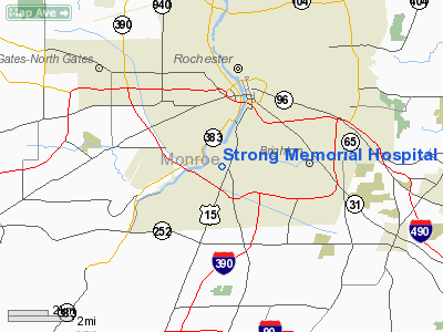
Strong Memorial Hospital Heliport |
Location & QuickFacts
| FAA Information Effective: | 2008-09-25 |
| Airport Identifier: | 2NY5 |
| Airport Status: | Operational |
| Longitude/Latitude: | 077-37-22.0440W/43-07-20.2240N
-77.622790/43.122284 (Estimated) |
| Elevation: | 554 ft / 168.86 m (Estimated) |
| Land: | 0 acres |
| From nearest city: | 2 nautical miles SW of Rochester, NY |
| Location: | Monroe County, NY |
| Magnetic Variation: | 11W (1990) |
Owner & Manager
| Ownership: | Privately owned |
| Owner: | Strong Memorial Hospital |
| Address: | 601 Elmwood Ave
Rochester, NY 14627 |
| Phone number: | 716-275-7964 |
| Manager: | Roger Frankel |
| Address: | 601 Elmwood Ave
Rochester, NY 14627 |
| Phone number: | 716-275-7964 |
Airport Operations and Facilities
| Airport Use: | Private
MEDICAL USE. |
| Wind indicator: | Yes |
| Segmented Circle: | No |
| Control Tower: | No |
| Lighting Schedule: | PHONE REQ
FOR ROTG BCN & PERIMETER LGTS CALL 716-275-7964. |
| Beacon Color: | Clear-Green-Yellow (heliport) |
| Sectional chart: | Detroit |
| Region: | AEA - Eastern |
| Boundary ARTCC: | ZOB - Cleveland |
| Tie-in FSS: | BUF - Buffalo |
| FSS on Airport: | No |
| FSS Toll Free: | 1-800-WX-BRIEF |
Runway Information
Helipad H1
| Dimension: | 48 x 48 ft / 14.6 x 14.6 m |
| Surface: | MATS,
ROOFTOP. |
| |
Runway H1 |
Runway |
| Traffic Pattern: | Left | Left |
| Markings: | Basic, | , |
|
Radio Navigation Aids
| ID |
Type |
Name |
Ch |
Freq |
Var |
Dist |
| AVN | NDB | Avon | | 344.00 | 09W | 9.3 nm |
| PYA | NDB | Penn Yan | | 260.00 | 12W | 38.1 nm |
| GEE | VOR/DME | Geneseo | 019X | 108.20 | 09W | 18.0 nm |
| BUF | VOR/DME | Buffalo | 111X | 116.40 | 08W | 46.5 nm |
| ROC | VORTAC | Rochester | 037X | 110.00 | 09W | 2.2 nm |
Remarks
- VFR USE ONLY; LIMITED TO ACFT WEIGHING 12500 LBS OR LESS; COORDINATE WITH ROCHESTER ATCT TO ASSURE THAT OPNS TO AND FROM HELIPORT ARE COMPATIBLE WITH THOSE AT GREATER ROCHESTER INTL ARPT.
Images and information placed above are from
http://www.airport-data.com/airport/2NY5/
We thank them for the data!
| General Info
|
| Country |
United States
|
| State |
NEW YORK
|
| FAA ID |
2NY5
|
| Latitude |
43-07-20.224N
|
| Longitude |
077-37-22.044W
|
| Elevation |
554 feet
|
| Near City |
ROCHESTER
|
We don't guarantee the information is fresh and accurate. The data may
be wrong or outdated.
For more up-to-date information please refer to other sources.
|
|


