 |
|
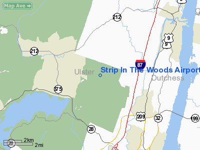
Strip In The Woods Airport |
Location & QuickFacts
| FAA Information Effective: | 2008-09-25 |
| Airport Identifier: | 18NY |
| Airport Status: | Operational |
| Longitude/Latitude: | 074-02-56.5020W/42-00-59.3300N
-74.049028/42.016481 (Estimated) |
| Elevation: | 500 ft / 152.40 m (Estimated) |
| Land: | 0 acres |
| From nearest city: | 3 nautical miles SE of Woodstock, NY |
| Location: | Ulster County, NY |
| Magnetic Variation: | 13W (1985) |
Owner & Manager
| Ownership: | Privately owned |
| Owner: | Anita J. Yuran |
| Address: | Po Box 217
Woodstock, NY 12498 |
| Phone number: | 914-679-9763 |
| Manager: | Anita J. Yuran |
| Address: | Po Box 217
Woodstock, NY 12498 |
| Phone number: | 914-679-9763 |
Airport Operations and Facilities
| Airport Use: | Private |
| Wind indicator: | Yes |
| Segmented Circle: | No |
| Control Tower: | No |
| Lighting Schedule: | PHONE REQ
FOR LIRL RY 05/23 CALL 914-679-9763. |
| Landing fee charge: | No |
| Sectional chart: | New York |
| Region: | AEA - Eastern |
| Boundary ARTCC: | ZBW - Boston |
| Tie-in FSS: | ISP - New York |
| FSS on Airport: | No |
| FSS Toll Free: | 1-800-WX-BRIEF |
Runway Information
Runway 05/23
| Dimension: | 2000 x 40 ft / 609.6 x 12.2 m |
| Surface: | TURF, |
| Edge Lights: | Non-standard lighting system
NSTD LIRL. |
| |
Runway 05 |
Runway 23 |
| Traffic Pattern: | Right | Left |
| Obstruction: | 30 ft trees, 812.0 ft from runway | 40 ft trees, 350.0 ft from runway |
|
Radio Navigation Aids
| ID |
Type |
Name |
Ch |
Freq |
Var |
Dist |
| SKU | FAN MARKER | Stanwyck | | | 12W | 29.4 nm |
| GBR | FAN MARKER | Sheffield | | | 13W | 31.3 nm |
| PSF | FAN MARKER | Abyss | | | 13W | 45.6 nm |
| PFH | NDB | Philmont | | 272.00 | 13W | 20.3 nm |
| PO | NDB | Meier | | 403.00 | 12W | 26.8 nm |
| SKU | NDB | Stanwyck | | 261.00 | 12W | 29.4 nm |
| GBR | NDB | Great Barrington | | 395.00 | 14W | 30.5 nm |
| SW | NDB | Neely | | 335.00 | 14W | 32.9 nm |
| MS | NDB | Monga | | 359.00 | 12W | 39.3 nm |
| DXT | NDB | Dalton | | 370.00 | 15W | 47.7 nm |
| IGN | VOR/DME | Kingston | 123X | 117.60 | 12W | 23.4 nm |
| PWL | VOR/DME | Pawling | 090X | 114.30 | 12W | 25.0 nm |
| DNY | VOR/DME | De Lancey | 058X | 112.10 | 11W | 41.6 nm |
| HUO | VOR/DME | Huguenot | 108X | 116.10 | 11W | 43.9 nm |
| CMK | VOR/DME | Carmel | 113X | 116.60 | 12W | 49.0 nm |
| ALB | VORTAC | Albany | 100X | 115.30 | 13W | 45.3 nm |
| ALB | VOT | Albany County | | 108.20 | | 44.8 nm |
Remarks
- PROVIDED VFR, WARNING SIGNS ARE NEAR ROAD CROSSING EXTENSION IN ORDER TO WARN ROAD USERS OF ACFT OPNS.
Images and information placed above are from
http://www.airport-data.com/airport/18NY/
We thank them for the data!
| General Info
|
| Country |
United States
|
| State |
NEW YORK
|
| FAA ID |
18NY
|
| Latitude |
42-00-59.330N
|
| Longitude |
074-02-56.502W
|
| Elevation |
500 feet
|
| Near City |
WOODSTOCK
|
We don't guarantee the information is fresh and accurate. The data may
be wrong or outdated.
For more up-to-date information please refer to other sources.
|
|


