 |
|
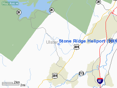
Location & QuickFacts
| FAA Information Effective: | 2008-09-25 |
| Airport Identifier: | 1NK1 |
| Airport Status: | Operational |
| Longitude/Latitude: | 074-09-07.5190W/41-53-26.3330N
-74.152089/41.890648 (Estimated) |
| Elevation: | 285 ft / 86.87 m (Estimated) |
| Land: | 60 acres |
| From nearest city: | 1 nautical miles W of Stone Ridge, NY |
| Location: | Ulster County, NY |
| Magnetic Variation: | 13W (1980) |
Owner & Manager
| Ownership: | Privately owned |
| Owner: | Donald Schupak |
| Address: | 730 Fifth Ave., Suite 1901
New York, NY 10022 |
| Phone number: | 914-687-7427 |
| Address: |
|
| Phone number: | 914-687-7427 |
Airport Operations and Facilities
| Airport Use: | Private |
| Wind indicator: | Yes |
| Segmented Circle: | No |
| Control Tower: | No |
| Lighting Schedule: | SS-SR |
| Beacon Color: | Clear-Green-Yellow (heliport) |
| Landing fee charge: | No |
| Sectional chart: | New York |
| Region: | AEA - Eastern |
| Boundary ARTCC: | ZBW - Boston |
| Tie-in FSS: | ISP - New York |
| FSS on Airport: | No |
| FSS Toll Free: | 1-800-WX-BRIEF |
Runway Information
Helipad H1
| Dimension: | 100 x 100 ft / 30.5 x 30.5 m |
| Surface: | ASPH, |
| |
Runway H1 |
Runway |
| Traffic Pattern: | Left | Left |
|
Radio Navigation Aids
| ID |
Type |
Name |
Ch |
Freq |
Var |
Dist |
| SKU | FAN MARKER | Stanwyck | | | 12W | 22.3 nm |
| GBR | FAN MARKER | Sheffield | | | 13W | 38.0 nm |
| PO | NDB | Meier | | 403.00 | 12W | 20.7 nm |
| SKU | NDB | Stanwyck | | 261.00 | 12W | 22.3 nm |
| SW | NDB | Neely | | 335.00 | 14W | 24.6 nm |
| PFH | NDB | Philmont | | 272.00 | 13W | 29.0 nm |
| MS | NDB | Monga | | 359.00 | 12W | 32.6 nm |
| GBR | NDB | Great Barrington | | 395.00 | 14W | 37.7 nm |
| IGN | VOR/DME | Kingston | 123X | 117.60 | 12W | 20.0 nm |
| PWL | VOR/DME | Pawling | 090X | 114.30 | 12W | 25.7 nm |
| HUO | VOR/DME | Huguenot | 108X | 116.10 | 11W | 35.0 nm |
| DNY | VOR/DME | De Lancey | 058X | 112.10 | 11W | 39.9 nm |
| CMK | VOR/DME | Carmel | 113X | 116.60 | 12W | 44.8 nm |
Images and information placed above are from
http://www.airport-data.com/airport/1NK1/
We thank them for the data!
| General Info
|
| Country |
United States
|
| State |
NEW YORK
|
| FAA ID |
1NK1
|
| Latitude |
41-53-26.333N
|
| Longitude |
074-09-07.519W
|
| Elevation |
285 feet
|
| Near City |
STONE RIDGE
|
We don't guarantee the information is fresh and accurate. The data may
be wrong or outdated.
For more up-to-date information please refer to other sources.
|
|


