 |
|
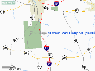
Location & QuickFacts
| FAA Information Effective: | 2008-09-25 |
| Airport Identifier: | 16NY |
| Airport Status: | Operational |
| Longitude/Latitude: | 076-06-53.7260W/42-56-23.2390N
-76.114924/42.939789 (Estimated) |
| Elevation: | 1380 ft / 420.62 m (Estimated) |
| Land: | 15 acres |
| From nearest city: | 12 nautical miles S of Syracuse, NY |
| Location: | Onondaga County, NY |
| Magnetic Variation: | 12W (1990) |
Owner & Manager
| Ownership: | Privately owned |
| Owner: | Tennessee Gas Pipeline |
| Address: | 3447 Sentinel Heights Road
Lafayette, NY 13084 |
| Phone number: | 315-492-9441 |
| Manager: | Jack Braden |
| Address: | 3447 Sentinel Heights Road
Lafayette, NY 13084 |
| Phone number: | 315-492-9441 |
Airport Operations and Facilities
| Airport Use: | Private |
| Segmented Circle: | No |
| Control Tower: | No |
| Sectional chart: | New York |
| Region: | AEA - Eastern |
| Boundary ARTCC: | ZBW - Boston |
| Tie-in FSS: | BUF - Buffalo |
| FSS on Airport: | No |
| FSS Toll Free: | 1-800-WX-BRIEF |
Runway Information
Helipad H1
| Dimension: | 25 x 25 ft / 7.6 x 7.6 m |
| Surface: | CONC, |
| |
Runway H1 |
Runway |
| Traffic Pattern: | Left | Left |
|
Radio Navigation Aids
| ID |
Type |
Name |
Ch |
Freq |
Var |
Dist |
| BK | NDB | Plein | | 329.00 | 12W | 32.6 nm |
| CJY | NDB | Clay | | 275.00 | 12W | 38.0 nm |
| PYA | NDB | Penn Yan | | 260.00 | 12W | 45.2 nm |
| GSS | TACAN | Griffiss | 057X | | 12W | 35.5 nm |
| ITH | VOR/DME | Ithaca | 055X | 111.80 | 10W | 30.8 nm |
| RKA | VOR/DME | Rockdale | 073X | 112.60 | 11W | 48.0 nm |
| SYR | VORTAC | Syracuse | 117X | 117.00 | 11W | 13.8 nm |
| GGT | VORTAC | Georgetown | 125X | 117.80 | 11W | 15.6 nm |
| UCA | VORTAC | Utica | 049X | 111.20 | 12W | 42.1 nm |
| CFB | VORTAC | Binghamton | 059X | 112.20 | 10W | 47.0 nm |
Images and information placed above are from
http://www.airport-data.com/airport/16NY/
We thank them for the data!
| General Info
|
| Country |
United States
|
| State |
NEW YORK
|
| FAA ID |
16NY
|
| Latitude |
42-56-23.239N
|
| Longitude |
076-06-53.726W
|
| Elevation |
1380 feet
|
| Near City |
SYRACUSE
|
We don't guarantee the information is fresh and accurate. The data may
be wrong or outdated.
For more up-to-date information please refer to other sources.
|
|


