 |
|
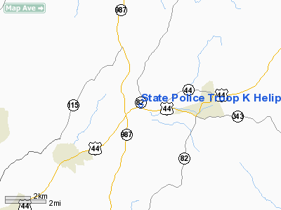
State Police Troop K Heliport |
Location & QuickFacts
| FAA Information Effective: | 2008-09-25 |
| Airport Identifier: | 7NY5 |
| Airport Status: | Operational |
| Longitude/Latitude: | 073-45-15.4670W/41-47-00.3370N
-73.754296/41.783427 (Estimated) |
| Elevation: | 350 ft / 106.68 m (Estimated) |
| Land: | 0 acres |
| From nearest city: | 3 nautical miles NW of Millbrook, NY |
| Location: | Dutchess County, NY |
| Magnetic Variation: | 13W (1985) |
Owner & Manager
| Ownership: | Publicly owned |
| Owner: | Ny State Police |
| Address: | Bldg 22 State Campus
Albany, NY 12226 |
| Phone number: | 518-457-5688 |
| Manager: | Cdr, Troop K, Ny State Police |
| Address: | Box 3000
Poughkeepsie, NY 12603-0030 |
| Phone number: | 914-677-6321 |
Airport Operations and Facilities
| Airport Use: | Private |
| Wind indicator: | No |
| Segmented Circle: | No |
| Control Tower: | No |
| Lighting Schedule: | DUSK-DAWN |
| Landing fee charge: | No |
| Sectional chart: | New York |
| Region: | AEA - Eastern |
| Boundary ARTCC: | ZBW - Boston |
| Tie-in FSS: | ISP - New York |
| FSS on Airport: | No |
| FSS Toll Free: | 1-800-WX-BRIEF |
Airport Services
| Airframe Repair: | NONE |
| Power Plant Repair: | NONE |
Runway Information
Helipad H1
| Dimension: | 60 x 60 ft / 18.3 x 18.3 m |
| Surface: | ASPH, |
| Edge Lights: | Medium |
| |
Runway H1 |
Runway |
| Traffic Pattern: | Left | Left |
|
Radio Navigation Aids
| ID |
Type |
Name |
Ch |
Freq |
Var |
Dist |
| SKU | FAN MARKER | Stanwyck | | | 12W | 20.2 nm |
| GBR | FAN MARKER | Sheffield | | | 13W | 27.1 nm |
| PSF | FAN MARKER | Abyss | | | 13W | 47.1 nm |
| PO | NDB | Meier | | 403.00 | 12W | 15.7 nm |
| SKU | NDB | Stanwyck | | 261.00 | 12W | 20.2 nm |
| SW | NDB | Neely | | 335.00 | 14W | 27.8 nm |
| PFH | NDB | Philmont | | 272.00 | 13W | 28.3 nm |
| GBR | NDB | Great Barrington | | 395.00 | 14W | 28.7 nm |
| TBY | NDB | Waterbury | | 257.00 | 14W | 31.4 nm |
| MMK | NDB | Meriden | | 238.00 | 14W | 44.7 nm |
| DXT | NDB | Dalton | | 370.00 | 15W | 48.8 nm |
| MS | NDB | Monga | | 359.00 | 12W | 49.6 nm |
| PWL | VOR/DME | Pawling | 090X | 114.30 | 12W | 6.9 nm |
| IGN | VOR/DME | Kingston | 123X | 117.60 | 12W | 7.7 nm |
| CMK | VOR/DME | Carmel | 113X | 116.60 | 12W | 31.2 nm |
| HUO | VOR/DME | Huguenot | 108X | 116.10 | 11W | 43.8 nm |
| BDR | VOR/DME | Bridgeport | 25X | 108.80 | 12W | 47.0 nm |
| CTR | VOR/DME | Chester | 098X | 115.10 | 13W | 47.1 nm |
| BDL | VORTAC | Bradley | 027X | 109.00 | 14W | 48.6 nm |
| BDR | VOT | Bridgeport | | 109.25 | | 46.9 nm |
| BDL | VOT | Bradley Intl | | 111.40 | | 48.8 nm |
| HFD | VOT | Hartford | | 108.20 | | 49.5 nm |
Images and information placed above are from
http://www.airport-data.com/airport/7NY5/
We thank them for the data!
| General Info
|
| Country |
United States
|
| State |
NEW YORK
|
| FAA ID |
7NY5
|
| Latitude |
41-47-00.337N
|
| Longitude |
073-45-15.467W
|
| Elevation |
350 feet
|
| Near City |
MILLBROOK
|
We don't guarantee the information is fresh and accurate. The data may
be wrong or outdated.
For more up-to-date information please refer to other sources.
|
|


