 |
|
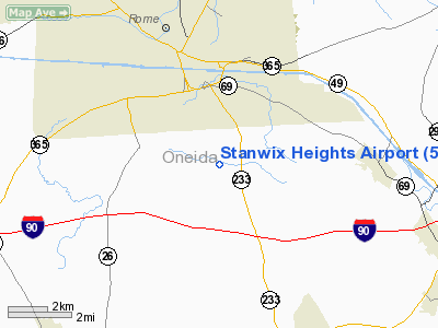
Location & QuickFacts
| FAA Information Effective: | 2008-09-25 |
| Airport Identifier: | 5NY4 |
| Airport Status: | Operational |
| Longitude/Latitude: | 075-25-50.6240W/43-09-27.2500N
-75.430729/43.157569 (Estimated) |
| Elevation: | 610 ft / 185.93 m (Estimated) |
| Land: | 0 acres |
| From nearest city: | 4 nautical miles S of Rome, NY |
| Location: | Oneida County, NY |
| Magnetic Variation: | 13W (1985) |
Owner & Manager
| Ownership: | Privately owned |
| Owner: | Brian C. Alessi |
| Address: | 1304 Franklyn St
Rome, NY 13440 |
| Phone number: | 315-339-1844 |
| Manager: | Brian C. Alessi |
| Address: | 1304 Franklyn St
Rome, NY 13440 |
| Phone number: | 315-339-1844 |
Airport Operations and Facilities
| Airport Use: | Private |
| Segmented Circle: | No |
| Control Tower: | No |
| Sectional chart: | New York |
| Region: | AEA - Eastern |
| Boundary ARTCC: | ZBW - Boston |
| Tie-in FSS: | BUF - Buffalo |
| FSS on Airport: | No |
| FSS Toll Free: | 1-800-WX-BRIEF |
Runway Information
Runway 11/29
| Dimension: | 2000 x 50 ft / 609.6 x 15.2 m |
| Surface: | TURF, |
| |
Runway 11 |
Runway 29 |
| Traffic Pattern: | Left | Left |
| Obstruction: | 50 ft plines, 400.0 ft from runway | 30 ft trees, 200.0 ft from runway |
|
Radio Navigation Aids
| ID |
Type |
Name |
Ch |
Freq |
Var |
Dist |
| BK | NDB | Plein | | 329.00 | 12W | 4.5 nm |
| CJY | NDB | Clay | | 275.00 | 12W | 9.6 nm |
| JJH | NDB | Johnstown | | 523.00 | 14W | 49.1 nm |
| GSS | TACAN | Griffiss | 057X | | 12W | 4.5 nm |
| RKA | VOR/DME | Rockdale | 073X | 112.60 | 11W | 42.4 nm |
| UCA | VORTAC | Utica | 049X | 111.20 | 12W | 14.1 nm |
| GGT | VORTAC | Georgetown | 125X | 117.80 | 11W | 28.2 nm |
| SYR | VORTAC | Syracuse | 117X | 117.00 | 11W | 33.9 nm |
Remarks
- PRVDD LOA IS EXECUTED WITH MGR UCA ATCT REFERENCE OPERATING PROCEDURES.
Images and information placed above are from
http://www.airport-data.com/airport/5NY4/
We thank them for the data!
| General Info
|
| Country |
United States
|
| State |
NEW YORK
|
| FAA ID |
5NY4
|
| Latitude |
43-09-27.250N
|
| Longitude |
075-25-50.624W
|
| Elevation |
610 feet
|
| Near City |
ROME
|
We don't guarantee the information is fresh and accurate. The data may
be wrong or outdated.
For more up-to-date information please refer to other sources.
|
|


