 |
|
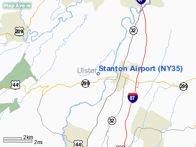
Location & QuickFacts
| FAA Information Effective: | 2008-09-25 |
| Airport Identifier: | NY35 |
| Airport Status: | Operational |
| Longitude/Latitude: | 074-06-58.5180W/41-45-00.3360N
-74.116255/41.750093 (Estimated) |
| Elevation: | 303 ft / 92.35 m (Estimated) |
| Land: | 30 acres |
| From nearest city: | 2 nautical miles W of New Paltz, NY |
| Location: | Ulster County, NY |
| Magnetic Variation: | 13W (1985) |
Owner & Manager
| Ownership: | Privately owned |
| Owner: | Patricia A. Flanagan |
| Address: | 101 Airport Lane
New Paltz, NY 12561 |
| Phone number: | 303-837-5969 |
| Manager: | Patricia A. Flanagan |
| Address: | 101 Airport Lane
New Paltz, NY 12561 |
| Phone number: | 303-837-5969
0R 914-255-5687. |
Airport Operations and Facilities
| Airport Use: | Private |
| Wind indicator: | Yes |
| Segmented Circle: | No |
| Control Tower: | No |
| Landing fee charge: | No |
| Sectional chart: | New York |
| Region: | AEA - Eastern |
| Traffic Pattern Alt: | 1100 ft |
| Boundary ARTCC: | ZBW - Boston |
| Responsible ARTCC: | ZNY - New York |
| Tie-in FSS: | ISP - New York |
| FSS on Airport: | No |
| FSS Toll Free: | 1-800-WX-BRIEF |
Airport Services
| Airframe Repair: | MAJOR |
| Power Plant Repair: | MINOR |
| Bottled Oxygen: | NONE |
| Bulk Oxygen: | NONE |
Runway Information
Runway 14/32
| Dimension: | 2400 x 23 ft / 731.5 x 7.0 m |
| Surface: | ASPHRVL, Good Condition |
| |
Runway 14 |
Runway 32 |
| Traffic Pattern: | Left | Left |
| Markings: | None, | None, |
| Runway End Identifier: | No | No |
| Centerline Lights: | No | No |
| Touchdown Lights: | No | No |
| Obstruction: | 25 ft tree, 200.0 ft from runway, 40 ft left of centerline
12' TREE 50' FM RWY END 100' L. | 50 ft trees, 200.0 ft from runway, 100 ft right of centerline
31' TREE 85' FM RWY END 105' R. |
|
Radio Navigation Aids
| ID |
Type |
Name |
Ch |
Freq |
Var |
Dist |
| SKU | FAN MARKER | Stanwyck | | | 12W | 13.7 nm |
| GBR | FAN MARKER | Sheffield | | | 13W | 40.6 nm |
| PO | NDB | Meier | | 403.00 | 12W | 12.5 nm |
| SKU | NDB | Stanwyck | | 261.00 | 12W | 13.7 nm |
| SW | NDB | Neely | | 335.00 | 14W | 16.7 nm |
| MS | NDB | Monga | | 359.00 | 12W | 33.4 nm |
| PFH | NDB | Philmont | | 272.00 | 13W | 35.0 nm |
| GBR | NDB | Great Barrington | | 395.00 | 14W | 41.1 nm |
| TBY | NDB | Waterbury | | 257.00 | 14W | 45.7 nm |
| PNJ | NDB | Paterson | | 347.00 | 12W | 48.3 nm |
| IGN | VOR/DME | Kingston | 123X | 117.60 | 12W | 14.1 nm |
| PWL | VOR/DME | Pawling | 090X | 114.30 | 12W | 23.2 nm |
| HUO | VOR/DME | Huguenot | 108X | 116.10 | 11W | 29.6 nm |
| CMK | VOR/DME | Carmel | 113X | 116.60 | 12W | 37.1 nm |
| DNY | VOR/DME | De Lancey | 058X | 112.10 | 11W | 45.5 nm |
| SAX | VORTAC | Sparta | 104X | 115.70 | 11W | 45.2 nm |
Remarks
- DEER ON & INVOF RY.
- NO NGT LNDGS OR TKOFS.
- PARKING RAMP UNPAVED.
- VFR USE ONLY.
Images and information placed above are from
http://www.airport-data.com/airport/NY35/
We thank them for the data!
| General Info
|
| Country |
United States
|
| State |
NEW YORK
|
| FAA ID |
NY35
|
| Latitude |
41-45-00.336N
|
| Longitude |
074-06-58.518W
|
| Elevation |
303 feet
|
| Near City |
NEW PALTZ
|
We don't guarantee the information is fresh and accurate. The data may
be wrong or outdated.
For more up-to-date information please refer to other sources.
|
|


