 |
|
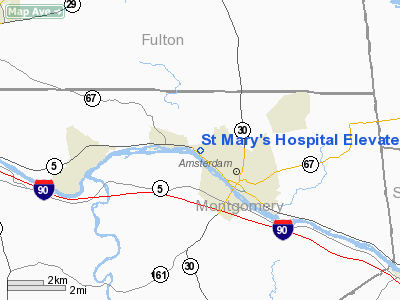
St Mary's Hospital Elevated Heliport |
Location & QuickFacts
| FAA Information Effective: | 2008-09-25 |
| Airport Identifier: | NK50 |
| Airport Status: | Operational |
| Longitude/Latitude: | 074-12-55.4710W/42-57-15.2670N
-74.215409/42.954241 (Estimated) |
| Elevation: | 335 ft / 102.11 m (Estimated) |
| Land: | 0 acres |
| From nearest city: | 0 nautical miles N of Amsterdam, NY |
| Location: | Montgomery County, NY |
| Magnetic Variation: | 14W (1985) |
Owner & Manager
| Ownership: | Privately owned |
| Owner: | Saint Mary's Hospital |
| Address: | 427 Guy Park Avenue
Amsterdam, NY 12010 |
| Phone number: | 518-842-1900 |
| Manager: | Herbert C. Frank |
| Address: | 427 Guy Park Avenue
Amsterdam, NY 12010 |
| Phone number: | 518-842-1900 |
Airport Operations and Facilities
| Airport Use: | Private |
| Wind indicator: | Yes |
| Segmented Circle: | Yes |
| Control Tower: | No |
| Landing fee charge: | No |
| Sectional chart: | New York |
| Region: | AEA - Eastern |
| Boundary ARTCC: | ZBW - Boston |
| Tie-in FSS: | BTV - Burlington |
| FSS on Airport: | No |
| FSS Toll Free: | 1-800-WX-BRIEF |
Runway Information
Helipad H1
| Dimension: | 190 x 144 ft / 57.9 x 43.9 m |
| Surface: | CONC-GRVL, |
| |
Runway H1 |
Runway |
| Traffic Pattern: | Left | Left |
| Markings: | Basic, | , |
|
Radio Navigation Aids
| ID |
Type |
Name |
Ch |
Freq |
Var |
Dist |
| JJH | NDB | Johnstown | | 523.00 | 14W | 5.8 nm |
| HEU | NDB | Hunter | | 356.00 | 14W | 13.8 nm |
| CJY | NDB | Clay | | 275.00 | 12W | 46.5 nm |
| PFH | NDB | Philmont | | 272.00 | 13W | 47.4 nm |
| CAM | VOR/DME | Cambridge | 097X | 115.00 | 14W | 38.4 nm |
| ALB | VORTAC | Albany | 100X | 115.30 | 13W | 22.0 nm |
| GFL | VORTAC | Glens Falls | 039X | 110.20 | 14W | 35.3 nm |
| UCA | VORTAC | Utica | 049X | 111.20 | 12W | 42.0 nm |
| ALB | VOT | Albany County | | 108.20 | | 21.5 nm |
Images and information placed above are from
http://www.airport-data.com/airport/NK50/
We thank them for the data!
| General Info
|
| Country |
United States
|
| State |
NEW YORK
|
| FAA ID |
NK50
|
| Latitude |
42-57-15.267N
|
| Longitude |
074-12-55.471W
|
| Elevation |
335 feet
|
| Near City |
AMSTERDAM
|
We don't guarantee the information is fresh and accurate. The data may
be wrong or outdated.
For more up-to-date information please refer to other sources.
|
|


