 |
|
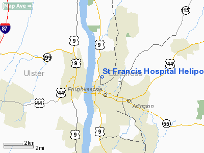
St Francis Hospital Heliport |
Location & QuickFacts
| FAA Information Effective: | 2008-09-25 |
| Airport Identifier: | NK96 |
| Airport Status: | Operational |
| Longitude/Latitude: | 073-55-38.4930W/41-43-07.3360N
-73.927359/41.718704 (Estimated) |
| Elevation: | 163 ft / 49.68 m (Estimated) |
| Land: | 0 acres |
| From nearest city: | 0 nautical miles N of Poughkeepsie, NY |
| Location: | Dutchess County, NY |
| Magnetic Variation: | 13W (1985) |
Owner & Manager
| Ownership: | Privately owned |
| Owner: | St. Francis Hospital |
| Address: | North Road
Poughkeepsie, NY 12601 |
| Phone number: | 914-471-2000 |
| Address: |
|
Airport Operations and Facilities
| Airport Use: | Private |
| Wind indicator: | Yes |
| Segmented Circle: | No |
| Control Tower: | No |
| Lighting Schedule: | PHONE REQ
FOR PERIMETER LIGHTS PPR CALL - 914-471-2000. |
| Landing fee charge: | No |
| Sectional chart: | New York |
| Region: | AEA - Eastern |
| Boundary ARTCC: | ZBW - Boston |
| Responsible ARTCC: | ZNY - New York |
| Tie-in FSS: | ISP - New York |
| FSS on Airport: | No |
| FSS Toll Free: | 1-800-WX-BRIEF |
Runway Information
Helipad H1
| Dimension: | 90 x 90 ft / 27.4 x 27.4 m |
| Surface: | ASPH, |
| |
Runway H1 |
Runway |
| Traffic Pattern: | Left | Left |
|
Radio Navigation Aids
| ID |
Type |
Name |
Ch |
Freq |
Var |
Dist |
| SKU | FAN MARKER | Stanwyck | | | 12W | 12.6 nm |
| GBR | FAN MARKER | Sheffield | | | 13W | 35.2 nm |
| PO | NDB | Meier | | 403.00 | 12W | 8.8 nm |
| SKU | NDB | Stanwyck | | 261.00 | 12W | 12.6 nm |
| SW | NDB | Neely | | 335.00 | 14W | 19.5 nm |
| PFH | NDB | Philmont | | 272.00 | 13W | 33.4 nm |
| GBR | NDB | Great Barrington | | 395.00 | 14W | 36.4 nm |
| TBY | NDB | Waterbury | | 257.00 | 14W | 37.0 nm |
| MS | NDB | Monga | | 359.00 | 12W | 42.0 nm |
| PNJ | NDB | Paterson | | 347.00 | 12W | 47.5 nm |
| IGN | VOR/DME | Kingston | 123X | 117.60 | 12W | 5.7 nm |
| PWL | VOR/DME | Pawling | 090X | 114.30 | 12W | 15.0 nm |
| CMK | VOR/DME | Carmel | 113X | 116.60 | 12W | 30.6 nm |
| HUO | VOR/DME | Huguenot | 108X | 116.10 | 11W | 35.2 nm |
| BDR | VOR/DME | Bridgeport | 25X | 108.80 | 12W | 49.3 nm |
| SAX | VORTAC | Sparta | 104X | 115.70 | 11W | 47.9 nm |
| BDR | VOT | Bridgeport | | 109.25 | | 49.3 nm |
Remarks
- SITE IS CLEARED OF TREES & LIGHT POLE & GRADED TO A LEVEL AREA 1.5 TIMES THE OVERALL LENGTH OF THE LARGEST HELICOPTER EXPECTED TO USE IT; 15' OBSTRUCTION FREE AREA AROUND THE PAD; TREES ARE REMOVED OR TOPPED TO ASSURE 8:1 APP/DEP AREAS; SITE IS LIGHTED IF NIGHT OPERATIONS ARE TO BE CONDUCTED.
Images and information placed above are from
http://www.airport-data.com/airport/NK96/
We thank them for the data!
| General Info
|
| Country |
United States
|
| State |
NEW YORK
|
| FAA ID |
NK96
|
| Latitude |
41-43-07.336N
|
| Longitude |
073-55-38.493W
|
| Elevation |
163 feet
|
| Near City |
POUGHKEEPSIE
|
We don't guarantee the information is fresh and accurate. The data may
be wrong or outdated.
For more up-to-date information please refer to other sources.
|
|


