 |
|
Location & QuickFacts
| FAA Information Effective: | 2008-09-25 |
| Airport Identifier: | 94NY |
| Airport Status: | Operational |
| Longitude/Latitude: | 076-41-28.8140W/42-49-30.2470N
-76.691337/42.825069 (Estimated) |
| Elevation: | 540 ft / 164.59 m (Estimated) |
| Land: | 0 acres |
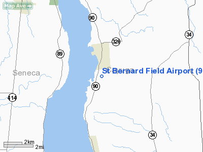
| From nearest city: | 1 nautical miles S of Union Springs, NY |
| Location: | Cayuga County, NY |
| Magnetic Variation: | 12W (1985) |
Owner & Manager
| Ownership: | Privately owned |
| Owner: | David G. Palmer |
| Address: | Paradise Hill Dr
Union Springs, NY 13160 |
| Phone number: | 315-889-5889
OR 315-889-5988. |
| Address: |
|
Airport Operations and Facilities
| Airport Use: | Private
MEDICAL USE. |
| Wind indicator: | No |
| Segmented Circle: | No |
| Control Tower: | No |
| Landing fee charge: | Yes |
| Sectional chart: | New York |
| Region: | AEA - Eastern |
| Boundary ARTCC: | ZOB - Cleveland |
| Tie-in FSS: | BUF - Buffalo |
| FSS on Airport: | No |
| FSS Toll Free: | 1-800-WX-BRIEF |
Airport Services
| Airframe Repair: | NONE |
| Power Plant Repair: | NONE |
Runway Information
Runway N/S
| Dimension: | 1400 x 60 ft / 426.7 x 18.3 m |
| Surface: | TURF, |
| |
Runway N |
Runway S |
| Traffic Pattern: | Left | Left |
|
Radio Navigation Aids
| ID |
Type |
Name |
Ch |
Freq |
Var |
Dist |
| PYA | NDB | Penn Yan | | 260.00 | 12W | 19.4 nm |
| ALP | NDB | Alpine | | 245.00 | 12W | 35.4 nm |
| AVN | NDB | Avon | | 344.00 | 09W | 48.7 nm |
| ITH | VOR/DME | Ithaca | 055X | 111.80 | 10W | 22.3 nm |
| GEE | VOR/DME | Geneseo | 019X | 108.20 | 09W | 45.9 nm |
| ULW | VOR/DME | Elmira | 033Y | 109.65 | 12W | 46.4 nm |
| SYR | VORTAC | Syracuse | 117X | 117.00 | 11W | 29.4 nm |
| GGT | VORTAC | Georgetown | 125X | 117.80 | 11W | 38.2 nm |
| ROC | VORTAC | Rochester | 037X | 110.00 | 09W | 46.7 nm |
| CFB | VORTAC | Binghamton | 059X | 112.20 | 10W | 47.1 nm |
Images and information placed above are from
http://www.airport-data.com/airport/94NY/
We thank them for the data!
| General Info
|
| Country |
United States
|
| State |
NEW YORK
|
| FAA ID |
94NY
|
| Latitude |
42-49-30.247N
|
| Longitude |
076-41-28.814W
|
| Elevation |
540 feet
|
| Near City |
UNION SPRINGS
|
We don't guarantee the information is fresh and accurate. The data may
be wrong or outdated.
For more up-to-date information please refer to other sources.
|
|


