 |
|
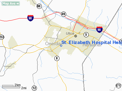
St. Elizabeth Hospital Heliport |
Location & QuickFacts
| FAA Information Effective: | 2008-09-25 |
| Airport Identifier: | 71NY |
| Airport Status: | Operational |
| Longitude/Latitude: | 075-15-56.5940W/43-04-56.0000N
-75.265721/43.082222 (Estimated) |
| Elevation: | 600 ft / 182.88 m (Estimated) |
| Land: | 0 acres |
| From nearest city: | 0 nautical miles N of Utica, NY |
| Location: | Oneida County, NY |
| Magnetic Variation: | 13W (1990) |
Owner & Manager
| Ownership: | Privately owned |
| Owner: | St. Elizabeth Hospital |
| Address: | 2209 Genesee St.
Utica, NY 13501 |
| Phone number: | 315-798-8123 |
| Manager: | Administrator On Call |
| Address: | 2209 Genesee Street
Utica, NY 13501 |
| Phone number: | 315-798-8100 |
Airport Operations and Facilities
| Airport Use: | Private
MEDICAL USE |
| Segmented Circle: | No |
| Control Tower: | No |
| Lighting Schedule: | PHONE REQ
FOR FLOODLIGHTS CALL 315-798-8123. |
| Sectional chart: | New York |
| Region: | AEA - Eastern |
| Boundary ARTCC: | ZBW - Boston |
| Tie-in FSS: | BUF - Buffalo |
| FSS Toll Free: | 1-800-WX-BRIEF |
Runway Information
Helipad H1
| Dimension: | 90 x 60 ft / 27.4 x 18.3 m |
| Surface: | CONC,
ELEVATED PAD. |
| |
Runway H1 |
Runway |
| Traffic Pattern: | Left | Left |
|
Radio Navigation Aids
| ID |
Type |
Name |
Ch |
Freq |
Var |
Dist |
| CJY | NDB | Clay | | 275.00 | 12W | 1.8 nm |
| BK | NDB | Plein | | 329.00 | 12W | 12.7 nm |
| JJH | NDB | Johnstown | | 523.00 | 14W | 41.3 nm |
| GSS | TACAN | Griffiss | 057X | | 12W | 11.0 nm |
| RKA | VOR/DME | Rockdale | 073X | 112.60 | 11W | 37.0 nm |
| UCA | VORTAC | Utica | 049X | 111.20 | 12W | 5.6 nm |
| GGT | VORTAC | Georgetown | 125X | 117.80 | 11W | 30.3 nm |
| SYR | VORTAC | Syracuse | 117X | 117.00 | 11W | 41.5 nm |
Remarks
- PRVDD TKOF/LDG AREA IS ACTUALLY 90' X 60'; LGTS ADJUSTED DOWNWARD TO LGT PAD; & AREA KEPT CLEAN TO MINIMISE THE EFFECTS OF ROTOR WASH.
Images and information placed above are from
http://www.airport-data.com/airport/71NY/
We thank them for the data!
| General Info
|
| Country |
United States
|
| State |
NEW YORK
|
| FAA ID |
71NY
|
| Latitude |
43-04-56.000N
|
| Longitude |
075-15-56.594W
|
| Elevation |
600 feet
|
| Near City |
UTICA
|
We don't guarantee the information is fresh and accurate. The data may
be wrong or outdated.
For more up-to-date information please refer to other sources.
|
|


