 |
|
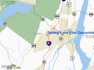
Spring Lake Fire Department Heliport |
Location & QuickFacts
| FAA Information Effective: | 2008-09-25 |
| Airport Identifier: | 09NY |
| Airport Status: | Operational |
| Longitude/Latitude: | 074-02-56.0000W/41-55-44.0000N
-74.048889/41.928889 (Estimated) |
| Elevation: | 254 ft / 77.42 m () |
| Land: | 3 acres |
| From nearest city: | 3 nautical miles S of Kingston, NY |
| Location: | Ulster County, NY |
| Magnetic Variation: | 14W (2000) |
Owner & Manager
| Ownership: | Privately owned |
| Owner: | Spring Lake Fire Dept |
| Address: | P.o. Box 3578
Kingston, NY 12401 |
| Phone number: | 914-338-2173 |
| Manager: | John Cranston |
| Address: | 70 Arnold Dr
Kingston, NY 12401 |
| Phone number: | 914-331-3911 |
Airport Operations and Facilities
| Airport Use: | Private |
| Wind indicator: | Yes |
| Segmented Circle: | No |
| Control Tower: | No |
| Sectional chart: | New York |
| Region: | AEA - Eastern |
| Boundary ARTCC: | ZBW - Boston |
| Tie-in FSS: | ISP - New York |
| FSS Toll Free: | 1-800-WX-BRIEF |
Runway Information
Helipad H1
| Dimension: | 100 x 100 ft / 30.5 x 30.5 m |
| Surface: | ASPH, |
| |
Runway H1 |
Runway |
| Traffic Pattern: | Left | Left |
|
Radio Navigation Aids
| ID |
Type |
Name |
Ch |
Freq |
Var |
Dist |
| SKU | FAN MARKER | Stanwyck | | | 12W | 24.1 nm |
| GBR | FAN MARKER | Sheffield | | | 13W | 32.9 nm |
| PSF | FAN MARKER | Abyss | | | 13W | 48.9 nm |
| PO | NDB | Meier | | 403.00 | 12W | 21.6 nm |
| SKU | NDB | Stanwyck | | 261.00 | 12W | 24.1 nm |
| PFH | NDB | Philmont | | 272.00 | 13W | 24.3 nm |
| SW | NDB | Neely | | 335.00 | 14W | 27.8 nm |
| GBR | NDB | Great Barrington | | 395.00 | 14W | 32.6 nm |
| MS | NDB | Monga | | 359.00 | 12W | 37.6 nm |
| TBY | NDB | Waterbury | | 257.00 | 14W | 47.2 nm |
| IGN | VOR/DME | Kingston | 123X | 117.60 | 12W | 18.8 nm |
| PWL | VOR/DME | Pawling | 090X | 114.30 | 12W | 22.2 nm |
| HUO | VOR/DME | Huguenot | 108X | 116.10 | 11W | 39.6 nm |
| DNY | VOR/DME | De Lancey | 058X | 112.10 | 11W | 43.2 nm |
| CMK | VOR/DME | Carmel | 113X | 116.60 | 12W | 44.3 nm |
| ALB | VOT | Albany County | | 108.20 | | 49.9 nm |
Remarks
- PRVDD ACCURATE INGRESS/EGRESS ROUTE WITH APPROPRIATE MKGS & CLEAR 8:1 SLOPE, LGTD WINDSOCK FOR NIGHT OPNS, VEHICLE TRAFFIC AROUND H1 CONTROLLED, MARKER BALLS ON WIRES OF 120 FT TWRS ALONG WESTERN SIDE OF AREA.
Images and information placed above are from
http://www.airport-data.com/airport/09NY/
We thank them for the data!
| General Info
|
| Country |
United States
|
| State |
NEW YORK
|
| FAA ID |
09NY
|
| Latitude |
41-55-44.000N
|
| Longitude |
074-02-56.000W
|
| Elevation |
254 feet
|
| Near City |
KINGSTON
|
We don't guarantee the information is fresh and accurate. The data may
be wrong or outdated.
For more up-to-date information please refer to other sources.
|
|


