 |
|
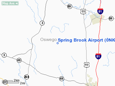
Location & QuickFacts
| FAA Information Effective: | 2008-09-25 |
| Airport Identifier: | 0NK1 |
| Airport Status: | Operational |
| Longitude/Latitude: | 076-13-12.7400W/43-21-42.2480N
-76.220206/43.361736 (Estimated) |
| Elevation: | 450 ft / 137.16 m (Estimated) |
| Land: | 6 acres |
| From nearest city: | 5 nautical miles NW of Central Square, NY |
| Location: | Oswego County, NY |
| Magnetic Variation: | 12W (1980) |
Owner & Manager
| Ownership: | Privately owned |
| Owner: | Connie Smith |
| Address: | Rd 2
Central Square, NY 13036 |
| Phone number: | 315-593-3568 |
| Address: |
|
Airport Operations and Facilities
| Airport Use: | Private |
| Wind indicator: | Yes |
| Segmented Circle: | No |
| Control Tower: | No |
| Sectional chart: | New York |
| Region: | AEA - Eastern |
| Boundary ARTCC: | ZBW - Boston |
| Tie-in FSS: | BTV - Burlington |
| FSS Toll Free: | 1-800-WX-BRIEF |
Runway Information
Runway 18/36
| Dimension: | 2100 x 100 ft / 640.1 x 30.5 m |
| Surface: | TURF, |
| |
Runway 18 |
Runway 36 |
| Traffic Pattern: | Left | Left |
|
Radio Navigation Aids
| ID |
Type |
Name |
Ch |
Freq |
Var |
Dist |
| BK | NDB | Plein | | 329.00 | 12W | 33.3 nm |
| CJY | NDB | Clay | | 275.00 | 12W | 45.8 nm |
| GTB | NDB | Drum | | 257.00 | 13W | 47.4 nm |
| GSS | TACAN | Griffiss | 057X | | 12W | 36.2 nm |
| SYR | VORTAC | Syracuse | 117X | 117.00 | 11W | 12.1 nm |
| ART | VORTAC | Watertown | 035X | 109.80 | 12W | 36.1 nm |
| GGT | VORTAC | Georgetown | 125X | 117.80 | 11W | 38.5 nm |
Images and information placed above are from
http://www.airport-data.com/airport/0NK1/
We thank them for the data!
| General Info
|
| Country |
United States
|
| State |
NEW YORK
|
| FAA ID |
0NK1
|
| Latitude |
43-21-42.248N
|
| Longitude |
076-13-12.740W
|
| Elevation |
450 feet
|
| Near City |
CENTRAL SQUARE
|
We don't guarantee the information is fresh and accurate. The data may
be wrong or outdated.
For more up-to-date information please refer to other sources.
|
|


