 |
|
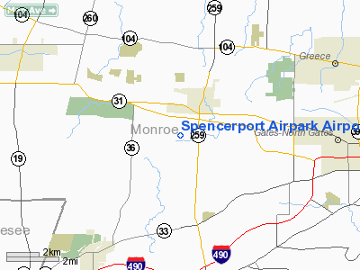
Spencerport Airpark Airport |
Location & QuickFacts
| FAA Information Effective: | 2008-09-25 |
| Airport Identifier: | D91 |
| Airport Status: | Operational |
| Longitude/Latitude: | 077-49-06.0300W/43-10-10.2200N
-77.818342/43.169506 (Estimated) |
| Elevation: | 614 ft / 187.15 m (Surveyed) |
| Land: | 44 acres |
| From nearest city: | 2 nautical miles S of Spencerport, NY |
| Location: | Monroe County, NY |
| Magnetic Variation: | 11W (1985) |
Owner & Manager
| Ownership: | Privately owned |
| Owner: | William Hollink |
| Address: | 6688 Greenwood Pkwy
Hilton, NY 14468 |
| Phone number: | 585-964-9633 |
| Manager: | William Hollink |
| Address: | 6688 Greenwood Pkwy
Hilton, NY 14468 |
| Phone number: | 585-964-9633 |
Airport Operations and Facilities
| Airport Use: | Open to public |
| Wind indicator: | Yes |
| Segmented Circle: | No |
| Control Tower: | No |
| Lighting Schedule: | DUSK-2100 |
| Landing fee charge: | No |
| Sectional chart: | Detroit |
| Region: | AEA - Eastern |
| Boundary ARTCC: | ZOB - Cleveland |
| Tie-in FSS: | BUF - Buffalo |
| FSS on Airport: | No |
| FSS Toll Free: | 1-800-WX-BRIEF |
| NOTAMs Facility: | BUF (NOTAM-d service avaliable) |
Airport Communications
Airport Services
Runway Information
Runway E/W
| Dimension: | 2450 x 90 ft / 746.8 x 27.4 m |
| Surface: | TURF, Good Condition |
| Edge Lights: | Non-standard lighting system
NSTD LIRL; ONLY 4 THLD LGTS EA RY END: 1 RED; 3 CLEAR; NO GREEN THLD LGTS; SPACING VARIES. |
| |
Runway E |
Runway W |
| Traffic Pattern: | Left | Left |
| Obstruction: | 74 ft trees | 38 ft trees, 36.0 ft from runway, 47 ft right of centerline |
|
Radio Navigation Aids
| ID |
Type |
Name |
Ch |
Freq |
Var |
Dist |
| AVN | NDB | Avon | | 344.00 | 09W | 9.8 nm |
| PYA | NDB | Penn Yan | | 260.00 | 12W | 46.1 nm |
| GEE | VOR/DME | Geneseo | 019X | 108.20 | 09W | 20.5 nm |
| BUF | VOR/DME | Buffalo | 111X | 116.40 | 08W | 39.1 nm |
| ROC | VORTAC | Rochester | 037X | 110.00 | 09W | 7.0 nm |
| BUF | VOT | Buffalo | | 109.00 | | 42.5 nm |
Remarks
- FOR RY CONDS CALL 585-338-7676 OR 585-352-1930.
- 80 FT ANT 2270 FT FM THLD RY W & 10 FT S OF CNTRLN.
Images and information placed above are from
http://www.airport-data.com/airport/D91/
We thank them for the data!
| General Info
|
| Country |
United States
|
| State |
NEW YORK
|
| FAA ID |
D91
|
| Latitude |
43-10-10.220N
|
| Longitude |
077-49-06.030W
|
| Elevation |
614 feet
|
| Near City |
SPENCERPORT
|
We don't guarantee the information is fresh and accurate. The data may
be wrong or outdated.
For more up-to-date information please refer to other sources.
|
|


