 |
|
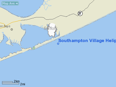
Southampton Village Heliport |
Location & QuickFacts
| FAA Information Effective: | 2008-09-25 |
| Airport Identifier: | NK29 |
| Airport Status: | Operational |
| Longitude/Latitude: | 072-24-58.3110W/40-51-00.3610N
-72.416197/40.850100 (Estimated) |
| Elevation: | 41 ft / 12.50 m (Estimated) |
| Land: | 0 acres |
| From nearest city: | 0 nautical miles E of Southampton, NY |
| Location: | Suffolk County, NY |
| Magnetic Variation: | 14W (1985) |
Owner & Manager
| Ownership: | Publicly owned |
| Owner: | Village Of Southampton |
| Address: | 23 Main St
Shouthampton, NY 11968 |
| Address: |
|
Airport Operations and Facilities
| Airport Use: | Private |
| Wind indicator: | Yes |
| Segmented Circle: | Yes |
| Control Tower: | No |
| Lighting Schedule: | PHONE REQ
FOR ROTG BCN CALL 516-283-0056. |
| Beacon Color: | Clear (unlighted land airport) |
| Landing fee charge: | No |
| Sectional chart: | New York |
| Region: | AEA - Eastern |
| Boundary ARTCC: | ZBW - Boston |
| Responsible ARTCC: | ZNY - New York |
| Tie-in FSS: | ISP - New York |
| FSS on Airport: | No |
| FSS Toll Free: | 1-800-WX-BRIEF |
Runway Information
Helipad H1
| Dimension: | 50 x 50 ft / 15.2 x 15.2 m |
| Surface: | TURF, |
| |
Runway H1 |
Runway |
| Traffic Pattern: | Left | Left |
|
Radio Navigation Aids
| ID |
Type |
Name |
Ch |
Freq |
Var |
Dist |
| OP | NDB | Old Field Point Light | | 316.00 | 13W | 32.8 nm |
| MMK | NDB | Meriden | | 238.00 | 14W | 43.9 nm |
| BBN | NDB | Babylon | | 275.00 | 14W | 45.4 nm |
| HF | NDB | Lomis | | 244.00 | 15W | 48.1 nm |
| FOK | TACAN | Suffolk Co | 047X | | 13W | 9.8 nm |
| CCC | VOR/DME | Calverton | 119X | 117.20 | 13W | 18.0 nm |
| MAD | VOR/DME | Madison | 041X | 110.40 | 13W | 30.6 nm |
| HVN | VOR/DME | New Haven | 035X | 109.80 | 13W | 32.6 nm |
| GON | VOR/DME | Groton | 45Y | 110.85 | 14W | 33.3 nm |
| BDR | VOR/DME | Bridgeport | 25X | 108.80 | 12W | 37.2 nm |
| DPK | VOR/DME | Deer Park | 124X | 117.70 | 12W | 40.5 nm |
| SEY | VOR/DME | Sandy Point | 125X | 117.80 | 15W | 42.6 nm |
| ORW | VOR/DME | Norwich | 037X | 110.00 | 14W | 46.5 nm |
| HFD | VOR/DME | Hartford | 096X | 114.90 | 13W | 47.9 nm |
| HTO | VORTAC | Hampton | 083X | 113.60 | 13W | 6.1 nm |
| ISP | VOT | Long Island Mac Arthur | | 109.40 | | 31.1 nm |
| GON | VOT | Groton | | 110.25 | | 33.0 nm |
| BDR | VOT | Bridgeport | | 109.25 | | 37.2 nm |
Images and information placed above are from
http://www.airport-data.com/airport/NK29/
We thank them for the data!
| General Info
|
| Country |
United States
|
| State |
NEW YORK
|
| FAA ID |
NK29
|
| Latitude |
40-51-00.361N
|
| Longitude |
072-24-58.311W
|
| Elevation |
41 feet
|
| Near City |
SOUTHAMPTON
|
We don't guarantee the information is fresh and accurate. The data may
be wrong or outdated.
For more up-to-date information please refer to other sources.
|
|


