 |
|
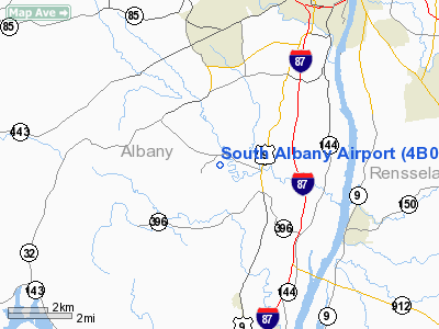
Location & QuickFacts
| FAA Information Effective: | 2008-09-25 |
| Airport Identifier: | 4B0 |
| Airport Status: | Operational |
| Longitude/Latitude: | 073-50-02.2000W/42-33-38.6000N
-73.833944/42.560722 (Estimated) |
| Elevation: | 196 ft / 59.74 m (Surveyed) |
| Land: | 66 acres |
| From nearest city: | 2 nautical miles N of South Bethlehem, NY |
| Location: | Albany County, NY |
| Magnetic Variation: | 14W (1985) |
Owner & Manager
| Ownership: | Privately owned |
| Owner: | South Albany Corp. |
| Address: | 6 Old School Road
Selkirk, NY 12158 |
| Phone number: | 518-767-9189 |
| Manager: | Jim Feil |
| Address: | 6 Old School Road
Selkirk, NY 12158 |
| Phone number: | 518-767-9189 |
Airport Operations and Facilities
| Airport Use: | Open to public |
| Wind indicator: | Yes |
| Segmented Circle: | No |
| Control Tower: | No |
| Lighting Schedule: | RDO-CTL
ACTVT LIRL RY 01/19 & WINDSOCK LGT- CTAF. |
| Landing fee charge: | No |
| Sectional chart: | New York |
| Region: | AEA - Eastern |
| Traffic Pattern Alt: | 800 ft |
| Boundary ARTCC: | ZBW - Boston |
| Tie-in FSS: | BTV - Burlington |
| FSS on Airport: | No |
| FSS Toll Free: | 1-800-WX-BRIEF |
| NOTAMs Facility: | BTV (NOTAM-d service avaliable) |
| Federal Agreements: | N |
Airport Communications
| CTAF: | 123.000 |
| Unicom: | 123.000 |
Airport Services
| Fuel available: | 100LL
FUEL AVBL 24 HRS SELF SERVICE CREDIT CARD ONLY. |
| Bottled Oxygen: | NONE |
| Bulk Oxygen: | NONE |
Runway Information
Runway 01/19
| Dimension: | 2854 x 60 ft / 869.9 x 18.3 m |
| Surface: | ASPH, Good Condition |
| Edge Lights: | Low |
| |
Runway 01 |
Runway 19 |
| Longitude: | 073-50-00.1610W | 073-50-04.2989W |
| Latitude: | 42-33-24.6032N | 42-33-52.6231N |
| Elevation: | 184.00 ft | 195.00 ft |
| Alignment: | 127 | 127 |
| Traffic Pattern: | Left | Left |
| Markings: | Non-precision instrument, Good Condition | Non-precision instrument, Good Condition |
| Displaced threshold: | 150.00 ft | 124.00 ft |
| RVR Equipment: | touchdown | |
| Runway End Identifier: | | No |
| Obstruction: | 8 ft brush, 230.0 ft from runway, 69 ft left of centerline, 3:1 slope to clear
RWY 01 APCH RATIO 8:1 TO DSPLCD THLD.
+11 FT BRUSH 0 FT OUT AND 132 FT RIGHT OF CENTERLINE | 14 ft road, 201.0 ft from runway, 112 ft right of centerline
RWY 19 +15 FT ROAD; 100 FT RIGHT; APCH RATIO 0:1 BASED ON DSPLCD THLD.
+15 FT ROAD 0 FT OUT AND 112 FT LEFT OF CENTERLINE |
|
Radio Navigation Aids
| ID |
Type |
Name |
Ch |
Freq |
Var |
Dist |
| PSF | FAN MARKER | Abyss | | | 13W | 28.2 nm |
| GBR | FAN MARKER | Sheffield | | | 13W | 33.4 nm |
| HEU | NDB | Hunter | | 356.00 | 14W | 18.1 nm |
| PFH | NDB | Philmont | | 272.00 | 13W | 19.1 nm |
| GBR | NDB | Great Barrington | | 395.00 | 14W | 29.7 nm |
| DXT | NDB | Dalton | | 370.00 | 15W | 29.9 nm |
| JJH | NDB | Johnstown | | 523.00 | 14W | 34.3 nm |
| VWD | NDB | Mount Snow | | 224.00 | 15W | 48.2 nm |
| CAM | VOR/DME | Cambridge | 097X | 115.00 | 14W | 33.9 nm |
| CTR | VOR/DME | Chester | 098X | 115.10 | 13W | 42.5 nm |
| PWL | VOR/DME | Pawling | 090X | 114.30 | 12W | 48.7 nm |
| ALB | VORTAC | Albany | 100X | 115.30 | 13W | 11.3 nm |
| GFL | VORTAC | Glens Falls | 039X | 110.20 | 14W | 47.9 nm |
| ALB | VOT | Albany County | | 108.20 | | 10.9 nm |
Remarks
- ARPT CLSD TO ACFT OVER 12500 LBS.
- BIRDS ON INVOF ARPT.
Images and information placed above are from
http://www.airport-data.com/airport/4B0/
We thank them for the data!
| General Info
|
| Country |
United States
|
| State |
NEW YORK
|
| FAA ID |
4B0
|
| Latitude |
42-33-38.614N
|
| Longitude |
073-50-02.243W
|
| Elevation |
196 feet
|
| Near City |
SOUTH BETHLEHEM
|
We don't guarantee the information is fresh and accurate. The data may
be wrong or outdated.
For more up-to-date information please refer to other sources.
|
|


