 |
|
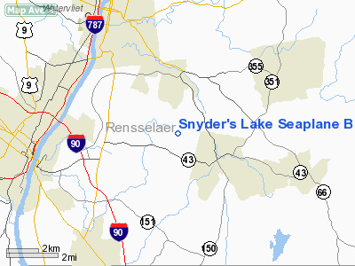
Snyder's Lake Seaplane Base Airport |
Location & QuickFacts
| FAA Information Effective: | 2008-09-25 |
| Airport Identifier: | NK13 |
| Airport Status: | Operational |
| Longitude/Latitude: | 073-38-18.4210W/42-39-30.2850N
-73.638450/42.658413 (Estimated) |
| Elevation: | 488 ft / 148.74 m (Estimated) |
| Land: | 0 acres |
| From nearest city: | 22 nautical miles S of Wynantskill, NY |
| Location: | Rensselaer County, NY |
| Magnetic Variation: | 14W (1985) |
Owner & Manager
| Ownership: | Privately owned |
| Owner: | Joseph H. Bott |
| Address: | 50 Haig Ave Snyder's Lake
Troy, NY 12180 |
| Phone number: | 518-283-4366 |
| Manager: | Joseph H. Bott |
| Address: | 50 Haig Ave Snyder's Lake
Troy, NY 12180 |
| Phone number: | 518-283-4366 |
Airport Operations and Facilities
| Airport Use: | Private |
| Wind indicator: | No |
| Segmented Circle: | No |
| Control Tower: | No |
| Landing fee charge: | No |
| Sectional chart: | New York |
| Region: | AEA - Eastern |
| Boundary ARTCC: | ZBW - Boston |
| Tie-in FSS: | BTV - Burlington |
| FSS on Airport: | No |
| FSS Toll Free: | 1-800-WX-BRIEF |
Runway Information
Runway 07/25
| Dimension: | 3000 x 150 ft / 914.4 x 45.7 m |
| Surface: | WATER, |
| |
Runway 07 |
Runway 25 |
| Traffic Pattern: | Left | Left |
|
Radio Navigation Aids
| ID |
Type |
Name |
Ch |
Freq |
Var |
Dist |
| PSF | FAN MARKER | Abyss | | | 13W | 22.4 nm |
| GBR | FAN MARKER | Sheffield | | | 13W | 34.1 nm |
| HEU | NDB | Hunter | | 356.00 | 14W | 17.5 nm |
| DXT | NDB | Dalton | | 370.00 | 15W | 23.6 nm |
| PFH | NDB | Philmont | | 272.00 | 13W | 24.7 nm |
| GBR | NDB | Great Barrington | | 395.00 | 14W | 30.4 nm |
| JJH | NDB | Johnstown | | 523.00 | 14W | 36.8 nm |
| VWD | NDB | Mount Snow | | 224.00 | 15W | 37.8 nm |
| CAM | VOR/DME | Cambridge | 097X | 115.00 | 14W | 24.0 nm |
| CTR | VOR/DME | Chester | 098X | 115.10 | 13W | 37.7 nm |
| ALB | VORTAC | Albany | 100X | 115.30 | 13W | 9.0 nm |
| GFL | VORTAC | Glens Falls | 039X | 110.20 | 14W | 41.1 nm |
| ALB | VOT | Albany County | | 108.20 | | 9.6 nm |
Remarks
Images and information placed above are from
http://www.airport-data.com/airport/NK13/
We thank them for the data!
| General Info
|
| Country |
United States
|
| State |
NEW YORK
|
| FAA ID |
NK13
|
| Latitude |
42-39-30.285N
|
| Longitude |
073-38-18.421W
|
| Elevation |
488 feet
|
| Near City |
WYNANTSKILL
|
We don't guarantee the information is fresh and accurate. The data may
be wrong or outdated.
For more up-to-date information please refer to other sources.
|
|


