 |
|
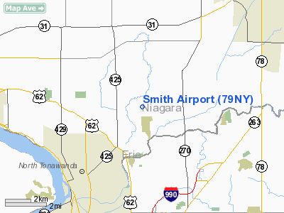
Location & QuickFacts
| FAA Information Effective: | 2008-09-25 |
| Airport Identifier: | 79NY |
| Airport Status: | Operational |
| Longitude/Latitude: | 078-48-41.1270W/43-05-13.2040N
-78.811424/43.087001 (Estimated) |
| Elevation: | 580 ft / 176.78 m (Surveyed) |
| Land: | 0 acres |
| From nearest city: | 4 nautical miles W of Pendleton, NY |
| Location: | Niagara County, NY |
| Magnetic Variation: | 10W (1985) |
Owner & Manager
| Ownership: | Privately owned |
| Owner: | Thomas E. Smith |
| Address: | 4262 Beach Ridge Road
N. Tonawanda, NY 14120 |
| Phone number: | 716-694-5084 |
| Address: |
|
Airport Operations and Facilities
| Airport Use: | Private |
| Wind indicator: | Yes |
| Segmented Circle: | No |
| Control Tower: | No |
| Landing fee charge: | No |
| Sectional chart: | Detroit |
| Region: | AEA - Eastern |
| Boundary ARTCC: | ZOB - Cleveland |
| Tie-in FSS: | BUF - Buffalo |
| FSS on Airport: | No |
| FSS Toll Free: | 1-800-WX-BRIEF |
Airport Services
| Airframe Repair: | NONE |
| Power Plant Repair: | NONE |
Runway Information
Runway 18/36
| Dimension: | 1750 x 60 ft / 533.4 x 18.3 m |
| Surface: | TURF, |
| |
Runway 18 |
Runway 36 |
| Traffic Pattern: | Left | Left |
| Obstruction: | 25 ft tree, 216.0 ft from runway | |
|
Radio Navigation Aids
| ID |
Type |
Name |
Ch |
Freq |
Var |
Dist |
| SN | NDB | St Catherines | | 408.00 | 01E | 19.8 nm |
| TZ | NDB | Gibraltar Point | | 257.00 | 10W | 40.4 nm |
| L | NDB | Lima | | 368.00 | 10W | 45.4 nm |
| AVN | NDB | Avon | | 344.00 | 09W | 46.0 nm |
| YZD | NDB | Downsview | | 356.00 | 09W | 49.6 nm |
| ZLB | NDB | Britannia | | 236.00 | 10W | 49.8 nm |
| J | NDB | Juliett | | 236.00 | 10W | 49.8 nm |
| IAG | TACAN | Niagara Falls | 047X | | 10W | 6.7 nm |
| BUF | VOR/DME | Buffalo | 111X | 116.40 | 08W | 12.0 nm |
| YYZ | VOR/DME | Toronto | 058Y | 112.15 | 10W | 49.6 nm |
| GEE | VOR/DME | Geneseo | 019X | 108.20 | 09W | 49.8 nm |
| DKK | VORTAC | Dunkirk | 109X | 116.20 | 07W | 41.3 nm |
| ROC | VORTAC | Rochester | 037X | 110.00 | 09W | 50.0 nm |
| BUF | VOT | Buffalo | | 109.00 | | 9.5 nm |
Remarks
Images and information placed above are from
http://www.airport-data.com/airport/79NY/
We thank them for the data!
| General Info
|
| Country |
United States
|
| State |
NEW YORK
|
| FAA ID |
79NY
|
| Latitude |
43-05-13.204N
|
| Longitude |
078-48-41.127W
|
| Elevation |
580 feet
|
| Near City |
PENDLETON
|
We don't guarantee the information is fresh and accurate. The data may
be wrong or outdated.
For more up-to-date information please refer to other sources.
|
|


