 |
|
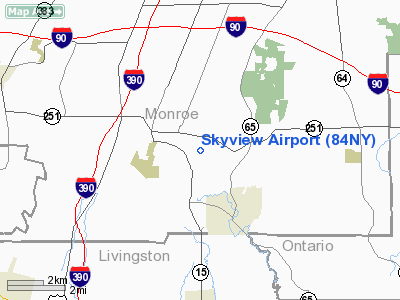
Location & QuickFacts
| FAA Information Effective: | 2008-09-25 |
| Airport Identifier: | 84NY |
| Airport Status: | Operational |
| Longitude/Latitude: | 077-36-44.9980W/42-59-10.2260N
-77.612499/42.986174 (Estimated) |
| Elevation: | 642 ft / 195.68 m (Surveyed) |
| Land: | 0 acres |
| From nearest city: | 2 nautical miles E of Rush, NY |
| Location: | Monroe County, NY |
| Magnetic Variation: | 11W (1985) |
Owner & Manager
| Ownership: | Privately owned |
| Owner: | Richard Szustakowski |
| Address: | 164 Schofield Rd
Honeoye Falls, NY 14472 |
| Phone number: | 716-533-1479 |
| Address: |
|
Airport Operations and Facilities
| Airport Use: | Private |
| Wind indicator: | Yes |
| Segmented Circle: | No |
| Control Tower: | No |
| Lighting Schedule: | RDO-CTL
ACTVT MIRL RY 07/25 & ROTG BCN - 123.0. |
| Beacon Color: | Clear-Green (lighted land airport) |
| Landing fee charge: | No |
| Sectional chart: | Detroit |
| Region: | AEA - Eastern |
| Boundary ARTCC: | ZOB - Cleveland |
| Tie-in FSS: | BUF - Buffalo |
| FSS on Airport: | No |
| FSS Toll Free: | 1-800-WX-BRIEF |
Airport Services
| Fuel available: | 100 |
| Airframe Repair: | NONE |
| Power Plant Repair: | NONE |
Runway Information
Runway 07/25
| Dimension: | 2000 x 35 ft / 609.6 x 10.7 m |
| Surface: | ASPH, |
| Edge Lights: | Non-standard lighting system
NSTD MIRL ALONG NORTH EDGE OF RY. |
| |
Runway 07 |
Runway 25 |
| Traffic Pattern: | Left | Left |
|
Radio Navigation Aids
| ID |
Type |
Name |
Ch |
Freq |
Var |
Dist |
| AVN | NDB | Avon | | 344.00 | 09W | 7.0 nm |
| PYA | NDB | Penn Yan | | 260.00 | 12W | 32.0 nm |
| GEE | VOR/DME | Geneseo | 019X | 108.20 | 09W | 10.5 nm |
| BUF | VOR/DME | Buffalo | 111X | 116.40 | 08W | 45.6 nm |
| ROC | VORTAC | Rochester | 037X | 110.00 | 09W | 8.5 nm |
| BUF | VOT | Buffalo | | 109.00 | | 49.4 nm |
Remarks
- SPORT PAJA ON ARPT.
- VFR USE ONLY
Images and information placed above are from
http://www.airport-data.com/airport/84NY/
We thank them for the data!
| General Info
|
| Country |
United States
|
| State |
NEW YORK
|
| FAA ID |
84NY
|
| Latitude |
42-59-10.226N
|
| Longitude |
077-36-44.998W
|
| Elevation |
642 feet
|
| Near City |
RUSH
|
We don't guarantee the information is fresh and accurate. The data may
be wrong or outdated.
For more up-to-date information please refer to other sources.
|
|


