 |
|
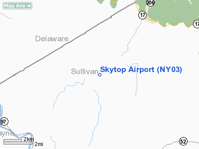
Location & QuickFacts
| FAA Information Effective: | 2008-09-25 |
| Airport Identifier: | NY03 |
| Airport Status: | Operational |
| Longitude/Latitude: | 074-58-48.5920W/41-52-30.3170N
-74.980164/41.875088 (Estimated) |
| Elevation: | 2094 ft / 638.25 m (Estimated) |
| Land: | 37 acres |
| From nearest city: | 5 nautical miles SW of Roscoe, NY |
| Location: | Sullivan County, NY |
| Magnetic Variation: | 13W (1985) |
Owner & Manager
| Ownership: | Privately owned |
| Owner: | Ian Borrowdale |
| Address: | 908 County Rd 93
Roscoe, NJ 12776 |
| Phone number: | 607-498-5577 |
| Manager: | Ian Borrowdale |
| Address: | 908 County Rd 93
Roscoe, NY 12776 |
| Phone number: | 607-498-5577 |
Airport Operations and Facilities
| Airport Use: | Private |
| Wind indicator: | Yes |
| Segmented Circle: | No |
| Control Tower: | No |
| Landing fee charge: | No |
| Sectional chart: | New York |
| Region: | AEA - Eastern |
| Boundary ARTCC: | ZBW - Boston |
| Tie-in FSS: | BUF - Buffalo |
| FSS on Airport: | No |
| FSS Toll Free: | 1-800-WX-BRIEF |
Airport Communications
Airport Services
| Airframe Repair: | MINOR |
| Power Plant Repair: | MINOR |
Runway Information
Runway 18/36
| Dimension: | 1540 x 110 ft / 469.4 x 33.5 m |
| Surface: | TURF, |
| |
Runway 18 |
Runway 36 |
| Traffic Pattern: | Left | Left |
| Obstruction: | 22 ft pline, 4.0 ft from runway, 35 ft left of centerline, 1:1 slope to clear | 43 ft trees, 0.0 ft from runway, 130 ft right of centerline, 1:1 slope to clear |
|
Radio Navigation Aids
| ID |
Type |
Name |
Ch |
Freq |
Var |
Dist |
| SKU | FAN MARKER | Stanwyck | | | 12W | 46.9 nm |
| MS | NDB | Monga | | 359.00 | 12W | 8.4 nm |
| SW | NDB | Neely | | 335.00 | 14W | 41.1 nm |
| SKU | NDB | Stanwyck | | 261.00 | 12W | 46.9 nm |
| PO | NDB | Meier | | 403.00 | 12W | 49.0 nm |
| DNY | VOR/DME | De Lancey | 058X | 112.10 | 11W | 18.3 nm |
| HNK | VOR/DME | Hancock | 115X | 116.80 | 11W | 18.8 nm |
| HUO | VOR/DME | Huguenot | 108X | 116.10 | 11W | 33.0 nm |
| RKA | VOR/DME | Rockdale | 073X | 112.60 | 11W | 37.4 nm |
| LHY | VORTAC | Lake Henry | 045X | 110.80 | 10W | 32.9 nm |
| LVZ | VORTAC | Wilkes-barre | 053X | 111.60 | 10W | 48.2 nm |
Remarks
- CLSD FIRST SNOWFALL
- VFR OPERS ONLY.
Images and information placed above are from
http://www.airport-data.com/airport/NY03/
We thank them for the data!
| General Info
|
| Country |
United States
|
| State |
NEW YORK
|
| FAA ID |
NY03
|
| Latitude |
41-52-30.317N
|
| Longitude |
074-58-48.592W
|
| Elevation |
2094 feet
|
| Near City |
ROSCOE
|
We don't guarantee the information is fresh and accurate. The data may
be wrong or outdated.
For more up-to-date information please refer to other sources.
|
|


