 |
|
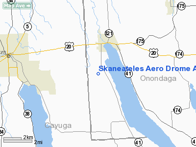
Skaneateles Aero Drome Airport |
Location & QuickFacts
| FAA Information Effective: | 2008-09-25 |
| Airport Identifier: | 6B9 |
| Airport Status: | Operational |
| Longitude/Latitude: | 076-26-26.7680W/42-54-50.2410N
-76.440769/42.913956 (Estimated) |
| Elevation: | 1038 ft / 316.38 m (Surveyed) |
| Land: | 100 acres |
| From nearest city: | 2 nautical miles SW of Skaneateles, NY |
| Location: | Onondaga County, NY |
| Magnetic Variation: | 10W (1965) |
Owner & Manager
| Ownership: | Privately owned |
| Owner: | Skaneateles Aerodrome Llc |
| Address: | 250 South Clinton St.
Syracuse, NY 13202 |
| Phone number: | 315-471-2181 |
| Manager: | Michael Falcone |
| Address: | 3074 West Lake Road
Skaneateles, NY 13152 |
| Phone number: | 315-685-8606 |
Airport Operations and Facilities
| Airport Use: | Open to public |
| Wind indicator: | Yes |
| Segmented Circle: | No |
| Control Tower: | No |
| Lighting Schedule: | RDO-CTL
ACTVT MIRL RY 10/28 AND ROTG BCN - CTAF. |
| Beacon Color: | Clear-Green (lighted land airport)
BEACON OUT OF SERVICE |
| Landing fee charge: | No |
| Sectional chart: | New York |
| Region: | AEA - Eastern |
| Traffic Pattern Alt: | 800 ft |
| Boundary ARTCC: | ZNY - New York |
| Responsible ARTCC: | ZBW - Boston |
| Tie-in FSS: | BUF - Buffalo |
| FSS on Airport: | No |
| FSS Toll Free: | 1-800-WX-BRIEF |
| NOTAMs Facility: | BUF (NOTAM-d service avaliable) |
| Federal Agreements: | N |
Airport Communications
| CTAF: | 122.800 |
| Unicom: | 122.800 |
Airport Services
| Bottled Oxygen: | NONE |
| Bulk Oxygen: | NONE |
Runway Information
Runway 04/22
| Dimension: | 3350 x 130 ft / 1021.1 x 39.6 m |
| Surface: | TURF, Good Condition
& 10/28 HAVE VARIATIONS IN RY SFC.
RY 10/28 LOOSE AGGREGATE, POTHOLES, ERODED AREAS. |
| |
Runway 04 |
Runway 22 |
| Longitude: | 076-26-44.7690W | 076-26-25.7680W |
| Latitude: | 42-54-37.2420N | 42-55-07.2410N |
| Alignment: | 25 | 127 |
| Traffic Pattern: | Left | Left |
| Obstruction: | 78 ft trees, 18.0 ft from runway, 76 ft left of centerline | 33 ft trees, 42.0 ft from runway, 1:1 slope to clear |
|
Runway 10/28
| Dimension: | 3134 x 58 ft / 955.2 x 17.7 m |
| Surface: | ASPH, Poor Condition
& 10/28 HAVE VARIATIONS IN RY SFC.
RY 10/28 LOOSE AGGREGATE, POTHOLES, ERODED AREAS. |
| Weight Limit: | Single wheel: 9000 lbs. |
| Edge Lights: | Non-standard lighting system
RY 10/28 NSTD MIRL; LGTS ARE 38 FT FM PAVEMENT EDGE; NO THLD LGTS. RY 28 HAS 4 LGTS OUT & 2 LGTS VERY DIM. ONE THLD LGT IS ROTATED 90 DEGS (RED/GREEN LENS). ARPT LGTS OTS INDEFLY. |
| |
Runway 10 |
Runway 28 |
| Longitude: | 076-26-38.6100W | 076-25-56.6810W |
| Latitude: | 42-54-49.5870N | 42-54-46.6760N |
| Elevation: | 1006.00 ft | 994.00 ft |
| Alignment: | 95 | 127 |
| Traffic Pattern: | Left | Left |
| Markings: | Basic, Poor Condition
RWY 10 /28 MARKINGS FADED. | Basic, Poor Condition
RY 10 /28 MARKINGS FADED. |
| Centerline Lights: | No | No |
| Touchdown Lights: | No | No |
| Obstruction: | 47 ft trees, 237.0 ft from runway, 116 ft left of centerline
RWY 10 TWO 30 FT POWER POLES 80 FT EITHER SIDE OF CNTRLN 60 FT FM THLD & 50 FT TREES 100 FT OB. +3' FENCE, OB, 20' FRM THRHLD. +15' ROAD, OB, 30' FRM THRHLD. +4' FENCE, OB, 80' FRM THRHLD. | 31 ft trees, 267.0 ft from runway, 89 ft right of centerline, 2:1 slope to clear
+24 FT HIGH TREE, 107 FT RIGHT, 161 FT FROM RY. |
|
Radio Navigation Aids
| ID |
Type |
Name |
Ch |
Freq |
Var |
Dist |
| PYA | NDB | Penn Yan | | 260.00 | 12W | 31.6 nm |
| ALP | NDB | Alpine | | 245.00 | 12W | 43.0 nm |
| BK | NDB | Plein | | 329.00 | 12W | 46.0 nm |
| GSS | TACAN | Griffiss | 057X | | 12W | 49.1 nm |
| ITH | VOR/DME | Ithaca | 055X | 111.80 | 10W | 25.2 nm |
| SYR | VORTAC | Syracuse | 117X | 117.00 | 11W | 18.1 nm |
| GGT | VORTAC | Georgetown | 125X | 117.80 | 11W | 28.1 nm |
| CFB | VORTAC | Binghamton | 059X | 112.20 | 10W | 47.4 nm |
Remarks
- RY 04/22 AVBL 15 MAY TO 15 OCT.
- TWO 55' POWER POLES 70' EITHER SIDE OF CNTRLN 700' FROM AER 28.
- RY 10 HAS +3 FT FENCE 20 FT FM THLD ON BOTH SIDES, +15 FT ROAD 30 FT FRM THLD ON BOTH SIDES & 4 FT FENCE 80 FT FRM THLD ON BOTH SIDES.
Images and information placed above are from
http://www.airport-data.com/airport/6B9/
We thank them for the data!
| General Info
|
| Country |
United States
|
| State |
NEW YORK
|
| FAA ID |
6B9
|
| Latitude |
42-54-50.241N
|
| Longitude |
076-26-26.768W
|
| Elevation |
1038 feet
|
| Near City |
SKANEATELES
|
We don't guarantee the information is fresh and accurate. The data may
be wrong or outdated.
For more up-to-date information please refer to other sources.
|
|


