 |
|
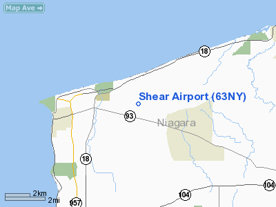
Location & QuickFacts
| FAA Information Effective: | 2008-09-25 |
| Airport Identifier: | 63NY |
| Airport Status: | Operational |
| Longitude/Latitude: | 078-57-55.1500W/43-15-40.1900N
-78.965319/43.261164 (Estimated) |
| Elevation: | 325 ft / 99.06 m () |
| Land: | 100 acres |
| From nearest city: | 4 nautical miles E of Ransomville, NY |
| Location: | Niagara County, NY |
| Magnetic Variation: | 11W (2000) |
Owner & Manager
| Ownership: | Privately owned |
| Owner: | James J Shear |
| Address: | 1698 Braley Rd
Youngstown, NY 14174 |
| Phone number: | 716-745-3268 |
| Manager: | James J Shear |
| Address: | 1698 Braley Rd
Youngstown, NY 14174 |
| Phone number: | 716-745-3268 |
Airport Operations and Facilities
| Airport Use: | Private |
| Wind indicator: | Yes |
| Segmented Circle: | No |
| Control Tower: | No |
| Sectional chart: | Detroit |
| Region: | AEA - Eastern |
| Boundary ARTCC: | ZOB - Cleveland |
| Tie-in FSS: | BUF - Buffalo |
| FSS Toll Free: | 1-800-WX-BRIEF |
Runway Information
Runway 18/36
| Dimension: | 3200 x 60 ft / 975.4 x 18.3 m |
| Surface: | TURF, |
| |
Runway 18 |
Runway 36 |
| Traffic Pattern: | Left | Left |
| Displaced threshold: | 600.00 ft | 0.00 ft |
| Obstruction: | 25 ft pline, 10.0 ft from runway | 4 ft brush, 5.0 ft from runway |
|
Radio Navigation Aids
| ID |
Type |
Name |
Ch |
Freq |
Var |
Dist |
| SN | NDB | St Catherines | | 408.00 | 01E | 14.4 nm |
| TZ | NDB | Gibraltar Point | | 257.00 | 10W | 28.0 nm |
| L | NDB | Lima | | 368.00 | 10W | 33.3 nm |
| YZD | NDB | Downsview | | 356.00 | 09W | 37.1 nm |
| ZLB | NDB | Britannia | | 236.00 | 10W | 38.1 nm |
| J | NDB | Juliett | | 236.00 | 10W | 38.1 nm |
| X | NDB | Xray | | 385.00 | 09W | 39.0 nm |
| OO | NDB | Oshawa | | 391.00 | 10W | 39.8 nm |
| T | NDB | Tango | | 341.00 | 09W | 40.0 nm |
| R | NDB | Romeo | | 403.00 | 09W | 43.1 nm |
| KZ | NDB | Buttonville | | 248.00 | 09W | 43.4 nm |
| HM | NDB | Hamilton | | 221.00 | 08W | 46.4 nm |
| IAG | TACAN | Niagara Falls | 047X | | 10W | 8.9 nm |
| BUF | VOR/DME | Buffalo | 111X | 116.40 | 08W | 24.4 nm |
| YYZ | VOR/DME | Toronto | 058Y | 112.15 | 10W | 37.6 nm |
| DKK | VORTAC | Dunkirk | 109X | 116.20 | 07W | 48.3 nm |
| BUF | VOT | Buffalo | | 109.00 | | 21.8 nm |
Remarks
- VFR DALGT ONLY, 20:1 APCH/DEP PATH.
Images and information placed above are from
http://www.airport-data.com/airport/63NY/
We thank them for the data!
| General Info
|
| Country |
United States
|
| State |
NEW YORK
|
| FAA ID |
63NY
|
| Latitude |
43-15-40.190N
|
| Longitude |
078-57-55.150W
|
| Elevation |
325 feet
|
| Near City |
RANSOMVILLE
|
We don't guarantee the information is fresh and accurate. The data may
be wrong or outdated.
For more up-to-date information please refer to other sources.
|
|


