 |
|
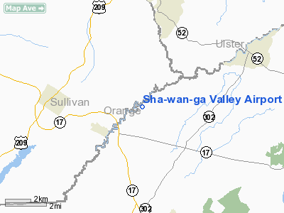
Sha-wan-ga Valley Airport |
Location & QuickFacts
| FAA Information Effective: | 2008-09-25 |
| Airport Identifier: | 8NY7 |
| Airport Status: | Operational |
| Longitude/Latitude: | 074-24-08.5590W/41-34-17.3370N
-74.402378/41.571483 (Estimated) |
| Elevation: | 437 ft / 133.20 m (Surveyed) |
| Land: | 39 acres |
| From nearest city: | 2 nautical miles NE of Bloomingburg, NY |
| Location: | Orange County, NY |
| Magnetic Variation: | 13W (1985) |
Owner & Manager
| Ownership: | Privately owned |
| Owner: | Schoolhouse Road Associates |
| Address: | Bx 289a Stone Schoolhouse Rd
Bloomingburg, NY 12721 |
| Phone number: | 914-733-4501 |
| Manager: | Howard Bowen |
| Address: | Bx 289a Stone Schoolhouse Rd
Bloomingburg, NY 12721 |
| Phone number: | 914-733-4501 |
Airport Operations and Facilities
| Airport Use: | Private |
| Wind indicator: | Yes |
| Segmented Circle: | No |
| Control Tower: | No |
| Landing fee charge: | No |
| Sectional chart: | New York |
| Region: | AEA - Eastern |
| Boundary ARTCC: | ZBW - Boston |
| Tie-in FSS: | ISP - New York |
| FSS on Airport: | No |
| FSS Toll Free: | 1-800-WX-BRIEF |
Airport Services
| Airframe Repair: | NONE |
| Power Plant Repair: | NONE |
Runway Information
Runway 15/33
| Dimension: | 800 x 40 ft / 243.8 x 12.2 m |
| Surface: | TURF, Good Condition |
| |
Runway 15 |
Runway 33 |
| Traffic Pattern: | Left | Left |
| Obstruction: | 67 ft trees, 70.0 ft from runway, 110 ft right of centerline, 1:1 slope to clear | 49 ft trees, 300.0 ft from runway, 100 ft right of centerline, 6:1 slope to clear |
|
Runway 18/36
| Dimension: | 1860 x 40 ft / 566.9 x 12.2 m |
| Surface: | GRVL-TRTD, Poor Condition |
| |
Runway 18 |
Runway 36 |
| Traffic Pattern: | Left | Left |
| Obstruction: | 38 ft trees, 230.0 ft from runway, 130 ft right of centerline
71' TREE 115' FROM THR 110' LEFT. | 26 ft trees, 200.0 ft from runway
34' TREES 90' FROM THR 40' LEFT; ROAD 70-200' FROM THR. |
|
Radio Navigation Aids
| ID |
Type |
Name |
Ch |
Freq |
Var |
Dist |
| SKU | FAN MARKER | Stanwyck | | | 12W | 16.3 nm |
| SW | NDB | Neely | | 335.00 | 14W | 9.4 nm |
| SKU | NDB | Stanwyck | | 261.00 | 12W | 16.3 nm |
| PO | NDB | Meier | | 403.00 | 12W | 19.7 nm |
| MS | NDB | Monga | | 359.00 | 12W | 23.7 nm |
| PNJ | NDB | Paterson | | 347.00 | 12W | 39.2 nm |
| CAT | NDB | Chatham | | 254.00 | 11W | 49.9 nm |
| HUO | VOR/DME | Huguenot | 108X | 116.10 | 11W | 12.9 nm |
| IGN | VOR/DME | Kingston | 123X | 117.60 | 12W | 26.7 nm |
| PWL | VOR/DME | Pawling | 090X | 114.30 | 12W | 37.9 nm |
| STW | VOR/DME | Stillwater | 033X | 109.60 | 11W | 40.5 nm |
| CMK | VOR/DME | Carmel | 113X | 116.60 | 12W | 40.9 nm |
| DNY | VOR/DME | De Lancey | 058X | 112.10 | 11W | 44.1 nm |
| TEB | VOR/DME | Teterboro | 021X | 108.40 | 11W | 46.1 nm |
| SAX | VORTAC | Sparta | 104X | 115.70 | 11W | 30.9 nm |
| LHY | VORTAC | Lake Henry | 045X | 110.80 | 10W | 49.0 nm |
Remarks
- NO WINTER SNOW REMOVAL.
- ULTRALIGHT ACTIVITY ON & INVOF ARPT.
Images and information placed above are from
http://www.airport-data.com/airport/8NY7/
We thank them for the data!
| General Info
|
| Country |
United States
|
| State |
NEW YORK
|
| FAA ID |
8NY7
|
| Latitude |
41-34-17.337N
|
| Longitude |
074-24-08.559W
|
| Elevation |
437 feet
|
| Near City |
BLOOMINGBURG
|
We don't guarantee the information is fresh and accurate. The data may
be wrong or outdated.
For more up-to-date information please refer to other sources.
|
|


