 |
|
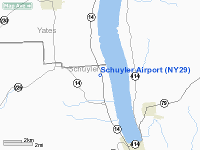
Location & QuickFacts
| FAA Information Effective: | 2008-09-25 |
| Airport Identifier: | NY29 |
| Airport Status: | Operational |
| Longitude/Latitude: | 076-54-41.8580W/42-27-07.2590N
-76.911627/42.452016 (Estimated) |
| Elevation: | 870 ft / 265.18 m (Estimated) |
| Land: | 70 acres |
| From nearest city: | 4 nautical miles N of Watkins Glen, NY |
| Location: | Schuyler County, NY |
| Magnetic Variation: | 11W (1985) |
Owner & Manager
| Ownership: | Privately owned |
| Owner: | Franklin & Marlene Miller |
| Address: | 275 Jacola Drive
Merritt Island, FL 32953 |
| Phone number: | 607-535-7392 |
| Manager: | Franklin & Marlene Miller |
| Address: | 275 Jacola Drive
Merritt Island, FL 32953 |
| Phone number: | 607-535-7392 |
Airport Operations and Facilities
| Airport Use: | Private |
| Wind indicator: | Yes |
| Segmented Circle: | No |
| Control Tower: | No |
| Landing fee charge: | No |
| Sectional chart: | New York |
| Region: | AEA - Eastern |
| Boundary ARTCC: | ZNY - New York |
| Tie-in FSS: | BUF - Buffalo |
| FSS on Airport: | No |
| FSS Toll Free: | 1-800-WX-BRIEF |
Airport Services
| Airframe Repair: | NONE |
| Power Plant Repair: | NONE |
Runway Information
Runway 17/35
| Dimension: | 2100 x 45 ft / 640.1 x 13.7 m |
| Surface: | TURF, Good Condition |
| |
Runway 17 |
Runway 35 |
| Traffic Pattern: | Left | Left |
| Obstruction: | 20 ft brush, 2.0 ft from runway, 100 ft right of centerline, 1:1 slope to clear | 8 ft tree, 2.0 ft from runway, 36 ft left of centerline, 1:1 slope to clear |
|
Radio Navigation Aids
| ID |
Type |
Name |
Ch |
Freq |
Var |
Dist |
| PYA | NDB | Penn Yan | | 260.00 | 12W | 13.2 nm |
| ALP | NDB | Alpine | | 245.00 | 12W | 14.4 nm |
| EL | NDB | Halos | | 269.00 | 09W | 49.1 nm |
| ITH | VOR/DME | Ithaca | 055X | 111.80 | 10W | 20.2 nm |
| ULW | VOR/DME | Elmira | 033Y | 109.65 | 12W | 22.1 nm |
| GEE | VOR/DME | Geneseo | 019X | 108.20 | 09W | 43.0 nm |
| CFB | VORTAC | Binghamton | 059X | 112.20 | 10W | 38.7 nm |
Remarks
- NON COMPLIANCE WITH FAR 157.
Images and information placed above are from
http://www.airport-data.com/airport/NY29/
We thank them for the data!
| General Info
|
| Country |
United States
|
| State |
NEW YORK
|
| FAA ID |
NY29
|
| Latitude |
42-27-07.259N
|
| Longitude |
076-54-41.858W
|
| Elevation |
870 feet
|
| Near City |
WATKINS GLEN
|
We don't guarantee the information is fresh and accurate. The data may
be wrong or outdated.
For more up-to-date information please refer to other sources.
|
|


