 |
|
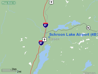
Location & QuickFacts
| FAA Information Effective: | 2008-09-25 |
| Airport Identifier: | 4B7 |
| Airport Status: | Operational |
| Longitude/Latitude: | 073-44-33.4670W/43-51-45.2190N
-73.742630/43.862561 (Estimated) |
| Elevation: | 830 ft / 252.98 m (Estimated) |
| Land: | 26 acres |
| From nearest city: | 2 nautical miles N of Schroon Lake, NY |
| Location: | Essex County, NY |
| Magnetic Variation: | 15W (1985) |
Owner & Manager
| Ownership: | Publicly owned |
| Owner: | Town Of Schroon Lake |
| Address: |
Schroon Lake, NY 12870 |
| Phone number: | 518-532-7737 |
| Manager: | Town Supervisor |
| Address: | C/o Town Of Schroon Lake
Schroon Lake, NY 12870 |
| Phone number: | 518-532-7737
FOR SVC CALL MGR PHONE 518-532-7737 OR 532-7878. |
Airport Operations and Facilities
| Airport Use: | Open to public |
| Wind indicator: | Yes |
| Segmented Circle: | No |
| Control Tower: | No |
| Landing fee charge: | No |
| Sectional chart: | New York |
| Region: | AEA - Eastern |
| Boundary ARTCC: | ZBW - Boston |
| Tie-in FSS: | BTV - Burlington |
| FSS on Airport: | No |
| FSS Toll Free: | 1-800-WX-BRIEF |
| NOTAMs Facility: | BTV (NOTAM-d service avaliable) |
| Federal Agreements: | N |
Airport Communications
Airport Services
| Airframe Repair: | NONE |
| Power Plant Repair: | NONE |
| Bottled Oxygen: | NONE |
| Bulk Oxygen: | NONE |
Runway Information
Runway 16/34
| Dimension: | 3000 x 60 ft / 914.4 x 18.3 m |
| Surface: | ASPH, Good Condition |
| Weight Limit: | Single wheel: 13000 lbs. |
| |
Runway 16 |
Runway 34 |
| Traffic Pattern: | Left | Left |
| Markings: | Basic, Good Condition | Basic, Good Condition |
| Displaced threshold: | 100.00 ft | 0.00 ft |
| Runway End Identifier: | No | No |
| Centerline Lights: | No | No |
| Touchdown Lights: | No | No |
| Obstruction: | 12 ft road, 200.0 ft from runway
RY 16 APCH RATIO 14:1 TO DSPLCD THLD.
+15 FT ROAD 110-200 FT FM THLD 115 FT RIGHT-120 FT LEFT. | 60 ft trees, 200.0 ft from runway
RY 34 +46 FT TREES 0-200 FT FM THLD 55 FT RIGHT. |
|
Radio Navigation Aids
| ID |
Type |
Name |
Ch |
Freq |
Var |
Dist |
| R | FAN MARKER | Chitt | | | 14W | 36.0 nm |
| DYO | NDB | Smuto | | 221.00 | 15W | 35.4 nm |
| SLK | VOR/DME | Saranac Lake | 029X | 109.20 | 14W | 37.2 nm |
| RUT | VOR/DME | Rutland | 47X | 111.00 | 15W | 39.9 nm |
| GFL | VORTAC | Glens Falls | 039X | 110.20 | 14W | 31.8 nm |
| BTV | VORTAC | Burlington | 122X | 117.50 | 15W | 40.2 nm |
| BTV | VOT | Burlington Intl | | 109.00 | | 44.4 nm |
Remarks
- DEBRIS FM ADJACENT LAND FILL IS OCCASIONALLY BLOWN ONTO AND ACROSS RY.
- TREES AT RY 34 END PENETRATE APCH SLOPE, TREES PENETRATE TRANSITION SFC BOTH SIDES, ROCK LEDGE PENETRATES TRANSITION SFC RIGHT SIDE.
- RECOMMENDED LDG RY 16, TKOF RY 34.
- VFR USE ONLY.
Images and information placed above are from
http://www.airport-data.com/airport/4B7/
We thank them for the data!
| General Info
|
| Country |
United States
|
| State |
NEW YORK
|
| FAA ID |
4B7
|
| Latitude |
43-51-45.219N
|
| Longitude |
073-44-33.467W
|
| Elevation |
830 feet
|
| Near City |
SCHROON LAKE
|
We don't guarantee the information is fresh and accurate. The data may
be wrong or outdated.
For more up-to-date information please refer to other sources.
|
|


