 |
|
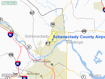
Schenectady County Airport |
| Schenectady County Airport |
| IATA: SCH – ICAO: KSCH |
| Summary |
| Airport type |
Public |
| Operator |
Schenectady County |
| Location |
Glenville, Schenectady County, near Schenectady, New York |
| Elevation AMSL |
378 ft / 115.2 m |
| Coordinates |
42°51′08.84″N 73°55′43.92″W / 42.8524556°N 73.9288667°W / 42.8524556; -73.9288667Coordinates: 42°51′08.84″N 73°55′43.92″W / 42.8524556°N 73.9288667°W / 42.8524556; -73.9288667 |
| Runways |
| Direction |
Length |
Surface |
| ft |
m |
| 4/22 |
7,000 |
2,134 |
Asphalt |
| 10/28 |
4,840 |
1,475 |
Asphalt |
| 15/33 |
2,640 |
805 |
Asphalt |
Schenectady County Airport (IATA: SCH, ICAO: KSCH) is a joint civil-military public airport located three miles (5 km) north of the city of Schenectady in Schenectady County, New York, USA.
Founded in 1927, the airport is home to Richmor Aviation, Fortune Air, the 109th Airlift Wing (109 AW) of the New York Air National Guard, the Empire State Aerosciences Museum, and several private aircraft.
Facilities
Schenectady County Airport covers 750 acres (304 ha) and has three runways:
- Runway 4/22: 7,000 x 150 ft. (2,134 x 46 m), Surface: Asphalt
- Runway 10/28: 4,840 x 150 ft. (1,475 x 46 m), Surface: Asphalt
- Runway 15/33: 2,640 x 50 ft. (805 x 15 m), Surface: Asphalt
The above content comes from Wikipedia and is published under free licenses – click here to read more.
Location & QuickFacts
| FAA Information Effective: | 2008-09-25 |
| Airport Identifier: | SCH |
| Airport Status: | Operational |
| Longitude/Latitude: | 073-55-43.9230W/42-51-08.8400N
-73.928868/42.852456 (Estimated) |
| Elevation: | 378 ft / 115.21 m (Surveyed) |
| Land: | 750 acres |
| From nearest city: | 3 nautical miles N of Schenectady, NY |
| Location: | Schenectady County, NY |
| Magnetic Variation: | 14W (2000) |
Owner & Manager
| Ownership: | Publicly owned |
| Owner: | Schenectady County |
| Address: | County Office Bldg
Schenectady, NY 12305-2114 |
| Phone number: | 518-388-4355 |
| Manager: | Stephen S Israel |
| Address: | 21 Tower Road
Scotia, NY 12302-3487 |
| Phone number: | 518-399-0111 |
Airport Operations and Facilities
| Airport Use: | Open to public |
| Wind indicator: | Yes |
| Segmented Circle: | No |
| Control Tower: | Yes |
| Lighting Schedule: | DUSK-DAWN
WHEN ATCT CLSD, ACTVT HIRL RY 04/22, MIRL RY 10/28 & MALSR RY 04 - CTAF. |
| Beacon Color: | Clear-Green (lighted land airport) |
| Landing fee charge: | Yes |
| Sectional chart: | New York |
| Region: | AEA - Eastern |
| Boundary ARTCC: | ZBW - Boston |
| Tie-in FSS: | BTV - Burlington |
| FSS on Airport: | No |
| FSS Toll Free: | 1-800-WX-BRIEF |
| NOTAMs Facility: | SCH (NOTAM-d service avaliable) |
| Federal Agreements: | NGY3 |
Airport Communications
| CTAF: | 121.300 |
| Unicom: | 122.975
USE FREQ 130.55 FOR SVC FM FBO. |
Airport Services
| Fuel available: | 100LLA
J8 FUEL ALSO AVBL. |
| Airframe Repair: | MINOR |
| Power Plant Repair: | MAJOR |
| Bottled Oxygen: | NONE |
| Bulk Oxygen: | LOW |
Runway Information
Runway 04/22
| Dimension: | 7000 x 150 ft / 2133.6 x 45.7 m |
| Surface: | ASPH, Good Condition
RY 15/33 CRACKS ON RY WITH WEEDS IN CRACKS. |
| Surface Treatment: | Saw-cut or plastic Grooved |
| Weight Limit: | Single wheel: 95000 lbs.
Dual wheel: 175000 lbs.
Dual tandem wheel: 348000 lbs.
Dual dual tandem wheel: 850000 lbs. |
| Edge Lights: | High |
| |
Runway 04 |
Runway 22 |
| Longitude: | 073-56-01.6680W | 073-55-20.4900W |
| Latitude: | 42-50-48.8320N | 42-51-50.9810N |
| Elevation: | 318.00 ft | 378.00 ft |
| Alignment: | 26 | 127 |
| ILS Type: | ILS
| |
| Traffic Pattern: | Left | Left |
| Markings: | Precision instrument, Good Condition | Precision instrument, Good Condition |
| Crossing Height: | 55.00 ft | 50.00 ft |
| VASI: | 2-light PAPI on left side | 2-light PAPI on left side |
| Visual Glide Angle: | 3.00° | 3.00° |
| Approach lights: | MALSR | |
| Runway End Identifier: | No | No |
| Obstruction: | 56 ft tree, 1873.0 ft from runway, 235 ft right of centerline, 30:1 slope to clear | 39 ft tree, 1138.0 ft from runway, 632 ft right of centerline, 24:1 slope to clear |
|
Runway 10/28
| Dimension: | 4840 x 150 ft / 1475.2 x 45.7 m |
| Surface: | ASPH, Good Condition
RY 15/33 CRACKS ON RY WITH WEEDS IN CRACKS. |
| Surface Treatment: | Saw-cut or plastic Grooved |
| Weight Limit: | Single wheel: 55000 lbs.
Dual wheel: 134000 lbs.
Dual tandem wheel: 218000 lbs.
Dual dual tandem wheel: 541000 lbs. |
| Edge Lights: | Medium |
| |
Runway 10 |
Runway 28 |
| Longitude: | 073-56-26.6870W | 073-55-21.7570W |
| Latitude: | 42-50-54.3050N | 42-50-56.0540N |
| Elevation: | 325.00 ft | 320.00 ft |
| Alignment: | 88 | 127 |
| Traffic Pattern: | Left | Left |
| Markings: | Non-precision instrument, Good Condition | Non-precision instrument, Good Condition |
| Crossing Height: | 50.00 ft | 50.00 ft |
| Displaced threshold: | 200.00 ft | 0.00 ft |
| VASI: | 2-light PAPI on left side | 2-light PAPI on left side |
| Visual Glide Angle: | 4.00° | 3.00° |
| Runway End Identifier: | No | Yes |
| Obstruction: | 72 ft tree, 838.0 ft from runway, 209 ft right of centerline, 8:1 slope to clear
RWY 10 APCH RATIO 17:1 TO DSPLCD THLD. | 24 ft tree, 422.0 ft from runway, 264 ft left of centerline, 9:1 slope to clear |
|
Runway 15/33
| Dimension: | 2640 x 50 ft / 804.7 x 15.2 m |
| Surface: | ASPH, Fair Condition
RY 15/33 CRACKS ON RY WITH WEEDS IN CRACKS. |
| |
Runway 15 |
Runway 33 |
| Longitude: | 073-55-45.1830W | 073-55-19.9780W |
| Latitude: | 42-51-13.7000N | 42-50-55.3760N |
| Elevation: | 336.00 ft | 320.00 ft |
| Alignment: | 127 | 127 |
| Traffic Pattern: | Left | Left |
| Markings: | Basic, | Nonstandard,
ARROWHEADS AHEAD OF THLD BAR PAINTED WHITE. |
| Obstruction: | 17 ft pole, 378.0 ft from runway, 108 ft left of centerline, 10:1 slope to clear | 22 ft tree, 771.0 ft from runway, 50 ft right of centerline, 25:1 slope to clear |
|
Radio Navigation Aids
| ID |
Type |
Name |
Ch |
Freq |
Var |
Dist |
| PSF | FAN MARKER | Abyss | | | 13W | 39.6 nm |
| HEU | NDB | Hunter | | 356.00 | 14W | 0.2 nm |
| JJH | NDB | Johnstown | | 523.00 | 14W | 19.8 nm |
| PFH | NDB | Philmont | | 272.00 | 13W | 37.2 nm |
| DXT | NDB | Dalton | | 370.00 | 15W | 40.6 nm |
| GBR | NDB | Great Barrington | | 395.00 | 14W | 46.5 nm |
| VWD | NDB | Mount Snow | | 224.00 | 15W | 47.1 nm |
| CAM | VOR/DME | Cambridge | 097X | 115.00 | 14W | 27.1 nm |
| ALB | VORTAC | Albany | 100X | 115.30 | 13W | 8.4 nm |
| GFL | VORTAC | Glens Falls | 039X | 110.20 | 14W | 32.5 nm |
| ALB | VOT | Albany County | | 108.20 | | 8.1 nm |
Remarks
- FEE FOR ACFT REQUESTING TWR SVC 2230-0700.
- NO FIELD OR BRAKING ACTION REPORTS AVBL BTN 2230-0730.
- +60 FT DROPOFF 150 FT FM RY 28 END.
- RY 15 AVBL FOR TKOF, RY 33 AVBL FOR LNDG.
- BIRDS ON & INVOF ARPT.
- CAUTION: TWY ECHO CLSD TO ACFT WITH WINGSPAN GREATER THAN 164 FT DUE TO WINGTIP OBSTRUCTION (GUIDEWIRE TRANSFORMWER POLE) LOCATED BEHIND BLDG 11 NOSE DOCK.
- PPR BASE OPS DURG DUTY HR DSN 344-2321, C518-344-2321.
- CAUTION: BASH PHASE II PERIOD (15 SEP-1 DEC) AND (15 MAR-1 MAY). BIRD WATCH CONDITION SEVERE (TKOFF & LANDINGS PROH UNLESS EMERGENCY OR IMMEDIATE OPR NECESSARY; LOCAL & TACTICAL TRAINING PROH). BIRD WATCH CONDITION MODERATE (MULTI APCHS PROHI, DEP & FULL STOP ALLOWED IF RTE AVOIDS BIRD ACTIVITY.)
Images and information placed above are from
http://www.airport-data.com/airport/SCH/
We thank them for the data!
| General Info
|
| Country |
United States
|
| State |
NEW YORK
|
| FAA ID |
SCH
|
| Latitude |
42-51-08.840N
|
| Longitude |
073-55-43.923W
|
| Elevation |
378 feet
|
| Near City |
SCHENECTADY
|
We don't guarantee the information is fresh and accurate. The data may
be wrong or outdated.
For more up-to-date information please refer to other sources.
|
|


