 |
|
Sands Point Seaplane Base Airport |
| Sands Point Seaplane Base |
| IATA: none – ICAO: none – FAA LID: 7N3 |
| Summary |
| Airport type |
Public |
| Operator |
Brewer Capri Marina |
| Location |
Port Washington, New York |
| Elevation AMSL |
0 ft / 0 m |
| Coordinates |
40°50′15″N 073°42′58″W / 40.8375°N 73.71611°W / 40.8375; -73.71611Coordinates: 40°50′15″N 073°42′58″W / 40.8375°N 73.71611°W / 40.8375; -73.71611 |
| Runways |
| Direction |
Length |
Surface |
| ft |
m |
| 1/19 |
6,000 |
1,829 |
Water |
| 12/30 |
6,000 |
1,829 |
Water |
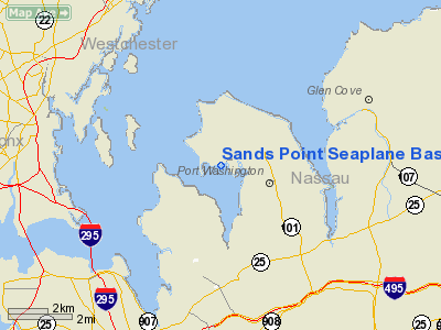
Sands Point Seaplane Base (FAA LID: 7N3) is a seaplane landing area located in Manhasset Bay, two miles (3 km) northwest of the central business district (CBD) of Port Washington, in Nassau County, New York, USA. During part of the 1930s Sands Point served as the New York base of the Boeing 314(a.k.a.; Yankee Clipper).
The above content comes from Wikipedia and is published under free licenses – click here to read more.
Location & QuickFacts
| FAA Information Effective: | 2008-09-25 |
| Airport Identifier: | 7N3 |
| Airport Status: | Operational |
| Longitude/Latitude: | 073-42-58.4700W/40-50-15.3610N
-73.716242/40.837600 (Estimated) |
| Elevation: | 0 ft / 0.00 m (Estimated) |
| Land: | 1 acres |
| From nearest city: | 2 nautical miles NW of Port Washington, NY |
| Location: | Nassau County, NY |
| Magnetic Variation: | 13W (1985) |
Owner & Manager
| Ownership: | Privately owned |
| Owner: | Brewer Capri Marina |
| Address: | 15 Orchard Beach Blvd
Port Washington, NY 11050 |
| Manager: | Steve Wachter
CAPRI MARINA. |
| Address: | Brewer Capri Marina, 15 Orchard Beach Blvd
Port Washington, NY 11050 |
| Phone number: | 516-883-7800 |
Airport Operations and Facilities
| Airport Use: | Open to public |
| Segmented Circle: | No |
| Control Tower: | No |
| Landing fee charge: | No |
| Sectional chart: | New York |
| Region: | AEA - Eastern |
| Boundary ARTCC: | ZNY - New York |
| Tie-in FSS: | ISP - New York |
| FSS on Airport: | No |
| FSS Toll Free: | 1-800-WX-BRIEF |
| NOTAMs Facility: | ISP (NOTAM-d service avaliable) |
Airport Communications
Airport Services
| Bottled Oxygen: | NONE |
| Bulk Oxygen: | NONE |
Runway Information
Runway 01/19
| Dimension: | 6000 x 300 ft / 1828.8 x 91.4 m |
| Surface: | WATER, |
| |
Runway 01 |
Runway 19 |
| Traffic Pattern: | Left | Left |
| Runway End Identifier: | No | No |
| Centerline Lights: | No | No |
| Touchdown Lights: | No | No |
|
Runway 12/30
| Dimension: | 6000 x 300 ft / 1828.8 x 91.4 m |
| Surface: | WATER, |
| |
Runway 12 |
Runway 30 |
| Traffic Pattern: | Left | Left |
| Runway End Identifier: | No | No |
| Centerline Lights: | No | No |
| Touchdown Lights: | No | No |
|
Radio Navigation Aids
| ID |
Type |
Name |
Ch |
Freq |
Var |
Dist |
| EWR | FAN MARKER | Maryann | | | 11W | 22.9 nm |
| SKU | FAN MARKER | Stanwyck | | | 12W | 44.1 nm |
| OGY | NDB | Bridge | | 414.00 | 12W | 17.9 nm |
| BBN | NDB | Babylon | | 275.00 | 14W | 18.1 nm |
| PNJ | NDB | Paterson | | 347.00 | 12W | 20.8 nm |
| OP | NDB | Old Field Point Light | | 316.00 | 13W | 28.4 nm |
| CAT | NDB | Chatham | | 254.00 | 11W | 33.0 nm |
| SKU | NDB | Stanwyck | | 261.00 | 12W | 44.1 nm |
| SW | NDB | Neely | | 335.00 | 14W | 45.3 nm |
| PO | NDB | Meier | | 403.00 | 12W | 45.7 nm |
| TBY | NDB | Waterbury | | 257.00 | 14W | 49.0 nm |
| FOK | TACAN | Suffolk Co | 047X | | 13W | 49.3 nm |
| LGA | VOR/DME | La Guardia | 078X | 113.10 | 12W | 7.9 nm |
| JFK | VOR/DME | Kennedy | 106X | 115.90 | 12W | 12.6 nm |
| TEB | VOR/DME | Teterboro | 021X | 108.40 | 11W | 15.7 nm |
| CRI | VOR/DME | Canarsie | 070X | 112.30 | 11W | 15.8 nm |
| DPK | VOR/DME | Deer Park | 124X | 117.70 | 12W | 19.0 nm |
| CMK | VOR/DME | Carmel | 113X | 116.60 | 12W | 27.3 nm |
| BDR | VOR/DME | Bridgeport | 25X | 108.80 | 12W | 33.1 nm |
| COL | VOR/DME | Colts Neck | 101X | 115.40 | 11W | 37.5 nm |
| CCC | VOR/DME | Calverton | 119X | 117.20 | 13W | 42.1 nm |
| HVN | VOR/DME | New Haven | 035X | 109.80 | 13W | 45.5 nm |
| SBJ | VOR/DME | Solberg | 076X | 112.90 | 10W | 49.2 nm |
| IGN | VOR/DME | Kingston | 123X | 117.60 | 12W | 50.0 nm |
| SAX | VORTAC | Sparta | 104X | 115.70 | 11W | 39.8 nm |
| JFK | VOT | Kennedy | | 115.10 | | 12.5 nm |
| ISP | VOT | Long Island Mac Arthur | | 109.40 | | 28.4 nm |
| BDR | VOT | Bridgeport | | 109.25 | | 33.1 nm |
Remarks
- ALL LANDINGS TO BE MADE 2000' FROM SHORE UNLESS EMERGENCY.
- NUMEROUS +60 FT SAILBOATS & MASTS
- EXISTED PRIOR TO 1959
Images and information placed above are from
http://www.airport-data.com/airport/7N3/
We thank them for the data!
| General Info
|
| Country |
United States
|
| State |
NEW YORK
|
| FAA ID |
7N3
|
| Latitude |
40-50-15.361N
|
| Longitude |
073-42-58.470W
|
| Elevation |
0 feet
|
| Near City |
PORT WASHINGTON
|
We don't guarantee the information is fresh and accurate. The data may
be wrong or outdated.
For more up-to-date information please refer to other sources.
|
|


