 |
|
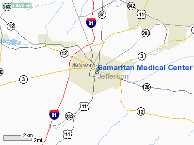
Samaritan Medical Center Heliport |
Location & QuickFacts
| FAA Information Effective: | 2008-09-25 |
| Airport Identifier: | 60NY |
| Airport Status: | Operational |
| Longitude/Latitude: | 075-54-30.0000W/43-58-20.0000N
-75.908333/43.972222 (Estimated) |
| Elevation: | 490 ft / 149.35 m () |
| Land: | 0 acres |
| From nearest city: | 1 nautical miles N of Watertown, NY |
| Location: | Jefferson County, NY |
| Magnetic Variation: | 13W (2000) |
Owner & Manager
| Ownership: | Privately owned |
| Owner: | Samaritan Medical Center |
| Address: | 830 Washington St
Watertown, NY 13601 |
| Phone number: | 315-785-4133 |
| Manager: | Gary Kehne |
| Address: | Samaritan Medical Center, 830 Washington St
Watertown, NY 13601 |
| Phone number: | 315-785-4133 |
Airport Operations and Facilities
| Airport Use: | Private
MEDICAL. |
| Segmented Circle: | No |
| Control Tower: | No |
| Lighting Schedule: | SS-SR |
| Sectional chart: | New York |
| Region: | AEA - Eastern |
| Boundary ARTCC: | ZBW - Boston |
| Tie-in FSS: | BTV - Burlington |
| FSS Toll Free: | 1-800-WX-BRIEF |
Runway Information
Helipad H1
| Dimension: | 125 x 100 ft / 38.1 x 30.5 m |
| Surface: | ASPH, |
| |
Runway H1 |
Runway |
| Traffic Pattern: | Left | Left |
|
Radio Navigation Aids
| ID |
Type |
Name |
Ch |
Freq |
Var |
Dist |
| GTB | NDB | Drum | | 257.00 | 13W | 9.4 nm |
| BK | NDB | Plein | | 329.00 | 12W | 48.7 nm |
| GSS | TACAN | Griffiss | 057X | | 12W | 49.5 nm |
| ART | VORTAC | Watertown | 035X | 109.80 | 12W | 6.9 nm |
Remarks
- SEE AIRSPACE LTR DATED 5/25/1998 FOR CONDITIONS.
Images and information placed above are from
http://www.airport-data.com/airport/60NY/
We thank them for the data!
| General Info
|
| Country |
United States
|
| State |
NEW YORK
|
| FAA ID |
60NY
|
| Latitude |
43-58-20.000N
|
| Longitude |
075-54-30.000W
|
| Elevation |
490 feet
|
| Near City |
WATERTOWN
|
We don't guarantee the information is fresh and accurate. The data may
be wrong or outdated.
For more up-to-date information please refer to other sources.
|
|


