 |
|
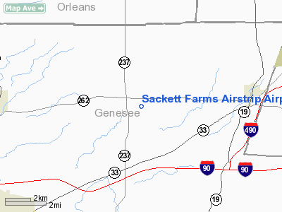
Sackett Farms Airstrip Airport |
Location & QuickFacts
| FAA Information Effective: | 2008-09-25 |
| Airport Identifier: | 2NY4 |
| Airport Status: | Operational |
| Longitude/Latitude: | 078-03-00.0000W/43-04-25.5000N
-78.050000/43.073750 (Estimated) |
| Elevation: | 665 ft / 202.69 m (Estimated) |
| Land: | 5 acres |
| From nearest city: | 1 nautical miles SE of Byron, NY |
| Location: | Genesee County, NY |
| Magnetic Variation: | 11W (1995) |
Owner & Manager
| Ownership: | Privately owned |
| Owner: | Jean L Charles & John L Sackett Jr |
| Address: | 6548 Rt 262
Byron, NY 14422 |
| Phone number: | 716-548-2434 |
| Manager: | John L. Sackett, Jr. |
| Address: | 6548 Rt 262
Byron, NY 14422 |
| Phone number: | 716-548-2434 |
Airport Operations and Facilities
| Airport Use: | Private |
| Wind indicator: | Yes |
| Segmented Circle: | No |
| Control Tower: | No |
| Sectional chart: | Detroit |
| Region: | AEA - Eastern |
| Boundary ARTCC: | ZOB - Cleveland |
| Tie-in FSS: | BUF - Buffalo |
| FSS Toll Free: | 1-800-WX-BRIEF |
Runway Information
Runway 10/28
| Dimension: | 2130 x 85 ft / 649.2 x 25.9 m |
| Surface: | TURF, |
| |
Runway 10 |
Runway 28 |
| Traffic Pattern: | Left | Left |
| Obstruction: | 25 ft pline, 860.0 ft from runway | 25 ft pline, 824.0 ft from runway |
|
Radio Navigation Aids
| ID |
Type |
Name |
Ch |
Freq |
Var |
Dist |
| AVN | NDB | Avon | | 344.00 | 09W | 12.9 nm |
| LYS | NDB | Olean | | 360.00 | 09W | 49.1 nm |
| IAG | TACAN | Niagara Falls | 047X | | 10W | 40.0 nm |
| GEE | VOR/DME | Geneseo | 019X | 108.20 | 09W | 20.0 nm |
| BUF | VOR/DME | Buffalo | 111X | 116.40 | 08W | 27.6 nm |
| ROC | VORTAC | Rochester | 037X | 110.00 | 09W | 16.8 nm |
| BUF | VOT | Buffalo | | 109.00 | | 31.1 nm |
Remarks
- PRVDD DAY VFR OPNS ONLY, TREES ADJACENT REMOVED TO PROVIDE 125 FT CLEARANCE EITHER SIDE OF RY.
Images and information placed above are from
http://www.airport-data.com/airport/2NY4/
We thank them for the data!
| General Info
|
| Country |
United States
|
| State |
NEW YORK
|
| FAA ID |
2NY4
|
| Latitude |
43-04-25.500N
|
| Longitude |
078-03-00.000W
|
| Elevation |
665 feet
|
| Near City |
BYRON
|
We don't guarantee the information is fresh and accurate. The data may
be wrong or outdated.
For more up-to-date information please refer to other sources.
|
|


