 |
|
Location & QuickFacts
| FAA Information Effective: | 2008-09-25 |
| Airport Identifier: | 32NY |
| Airport Status: | Operational |
| Longitude/Latitude: | 072-13-00.2930W/42-25-47.3230N
-72.216748/42.429812 (Estimated) |
| Elevation: | 380 ft / 115.82 m (Estimated) |
| Land: | 2 acres |
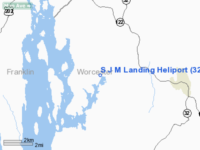
| From nearest city: | 5 nautical miles NW of Washingtonville, NY |
| Location: | Orange County, NY |
| Magnetic Variation: | 15W (1990) |
Owner & Manager
| Ownership: | Privately owned |
| Owner: | Steven Cattaneo |
| Address: | Rd 1 Box 553
Campbell Hall, NY 10916 |
| Phone number: | 914-496-7784 |
| Manager: | Steven Cattaneo |
| Address: | Rd 1 Box 553
Campbell Hall, NY 10916 |
| Phone number: | 914-496-7784 |
Airport Operations and Facilities
| Airport Use: | Private |
| Wind indicator: | Yes |
| Segmented Circle: | No |
| Control Tower: | No |
| Sectional chart: | New York |
| Region: | AEA - Eastern |
| Boundary ARTCC: | ZBW - Boston |
| Tie-in FSS: | ISP - New York |
| FSS on Airport: | No |
| FSS Toll Free: | 1-800-WX-BRIEF |
Airport Communications
Runway Information
Helipad H1
| Dimension: | 100 x 100 ft / 30.5 x 30.5 m |
| Surface: | TURF, |
| |
Runway H1 |
Runway |
| Traffic Pattern: | Left | Left |
|
Radio Navigation Aids
| ID |
Type |
Name |
Ch |
Freq |
Var |
Dist |
| PSF | FAN MARKER | Abyss | | | 13W | 44.2 nm |
| ORE | NDB | Orange | | 205.00 | 15W | 8.9 nm |
| FIT | NDB | Fitchburg | | 365.00 | 15W | 21.6 nm |
| AS | NDB | Chern | | 359.00 | 16W | 36.0 nm |
| VWD | NDB | Mount Snow | | 224.00 | 15W | 41.4 nm |
| DXT | NDB | Dalton | | 370.00 | 15W | 42.4 nm |
| SFZ | NDB | Central | | 241.00 | 15W | 44.7 nm |
| DRY | NDB | Derry | | 338.00 | 16W | 44.9 nm |
| SKR | NDB | Shaker Hill | | 251.00 | 16W | 46.1 nm |
| PUT | VOR/DME | Putnam | 121X | 117.40 | 14W | 33.0 nm |
| CTR | VOR/DME | Chester | 098X | 115.10 | 13W | 33.6 nm |
| MHT | VOR/DME | Manchester | 091X | 114.40 | 15W | 45.8 nm |
| HFD | VOR/DME | Hartford | 096X | 114.90 | 13W | 49.7 nm |
| GDM | VORTAC | Gardner | 043X | 110.60 | 14W | 9.9 nm |
| CEF | VORTAC | Westover | 87X | 114.00 | 14W | 19.6 nm |
| EEN | VORTAC | Keene | 031X | 109.40 | 14W | 22.2 nm |
| BAF | VORTAC | Barnes | 077X | 113.00 | 14W | 27.4 nm |
| BDL | VORTAC | Bradley | 027X | 109.00 | 14W | 36.1 nm |
| ORH | VOT | Worcester | | 108.20 | | 18.3 nm |
| BDL | VOT | Bradley Intl | | 111.40 | | 36.1 nm |
| BED | VOT | Laurence G Hanscom Fld | | 110.00 | | 41.2 nm |
| HFD | VOT | Hartford | | 108.20 | | 46.0 nm |
Remarks
- VFR; ECT AS NOTED IN LETTER DATED 7/26/91.
Images and information placed above are from
http://www.airport-data.com/airport/32NY/
We thank them for the data!
| General Info
|
| Country |
United States
|
| State |
NEW YORK
|
| FAA ID |
32NY
|
| Latitude |
42-25-47.323N
|
| Longitude |
072-13-00.293W
|
| Elevation |
380 feet
|
| Near City |
WASHINGTONVILLE
|
We don't guarantee the information is fresh and accurate. The data may
be wrong or outdated.
For more up-to-date information please refer to other sources.
|
|


