 |
|
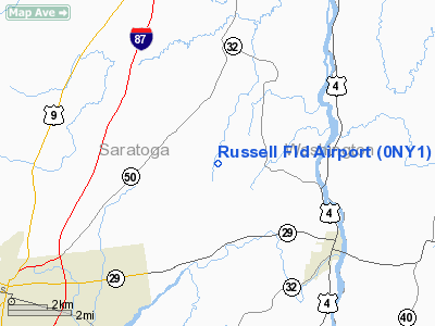
Location & QuickFacts
| FAA Information Effective: | 2008-09-25 |
| Airport Identifier: | 0NY1 |
| Airport Status: | Operational |
| Longitude/Latitude: | 073-39-11.4220W/43-08-21.2680N
-73.653173/43.139241 (Estimated) |
| Elevation: | 260 ft / 79.25 m (Estimated) |
| Land: | 0 acres |
| From nearest city: | 0 nautical miles of Northumberland, NY |
| Location: | Saratoga County, NY |
| Magnetic Variation: | 14W (1985) |
Owner & Manager
| Ownership: | Privately owned |
| Owner: | Lawrence A. Russell |
| Address: | 320 Colebrook Rd
Gansevoort, NY 12831 |
| Phone number: | 518-695-3607 |
| Address: |
|
Airport Operations and Facilities
| Airport Use: | Private
PERSONAL USE. |
| Wind indicator: | Yes |
| Segmented Circle: | No |
| Control Tower: | No |
| Landing fee charge: | No |
| Sectional chart: | New York |
| Region: | AEA - Eastern |
| Boundary ARTCC: | ZBW - Boston |
| Tie-in FSS: | BTV - Burlington |
| FSS on Airport: | No |
| FSS Toll Free: | 1-800-WX-BRIEF |
Airport Services
| Airframe Repair: | NONE |
| Power Plant Repair: | NONE |
Runway Information
Runway 03/21
| Dimension: | 1360 x 125 ft / 414.5 x 38.1 m |
| Surface: | TURF, |
| |
Runway 03 |
Runway 21 |
| Traffic Pattern: | Left | Left |
|
Radio Navigation Aids
| ID |
Type |
Name |
Ch |
Freq |
Var |
Dist |
| R | FAN MARKER | Chitt | | | 14W | 42.1 nm |
| PSF | FAN MARKER | Abyss | | | 13W | 45.4 nm |
| HEU | NDB | Hunter | | 356.00 | 14W | 21.2 nm |
| JJH | NDB | Johnstown | | 523.00 | 14W | 31.0 nm |
| VWD | NDB | Mount Snow | | 224.00 | 15W | 36.9 nm |
| DXT | NDB | Dalton | | 370.00 | 15W | 45.5 nm |
| DYO | NDB | Smuto | | 221.00 | 15W | 45.7 nm |
| SXD | NDB | Springfield | | 265.00 | 15W | 47.4 nm |
| CAM | VOR/DME | Cambridge | 097X | 115.00 | 14W | 16.1 nm |
| RUT | VOR/DME | Rutland | 47X | 111.00 | 15W | 38.5 nm |
| GFL | VORTAC | Glens Falls | 039X | 110.20 | 14W | 12.3 nm |
| ALB | VORTAC | Albany | 100X | 115.30 | 13W | 24.5 nm |
| ALB | VOT | Albany County | | 108.20 | | 25.0 nm |
Remarks
- TREES E, PLINE & TREES W, UNMRKD.
- VFR ONLY.
Images and information placed above are from
http://www.airport-data.com/airport/0NY1/
We thank them for the data!
| General Info
|
| Country |
United States
|
| State |
NEW YORK
|
| FAA ID |
0NY1
|
| Latitude |
43-08-21.268N
|
| Longitude |
073-39-11.422W
|
| Elevation |
260 feet
|
| Near City |
NORTHUMBERLAND
|
We don't guarantee the information is fresh and accurate. The data may
be wrong or outdated.
For more up-to-date information please refer to other sources.
|
|


