 |
|
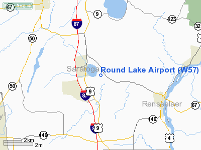
Location & QuickFacts
| FAA Information Effective: | 2008-09-25 |
| Airport Identifier: | W57 |
| Airport Status: | Operational |
| Longitude/Latitude: | 073-46-13.4320W/42-55-45.2740N
-73.770398/42.929243 (Estimated) |
| Elevation: | 175 ft / 53.34 m (Estimated) |
| Land: | 66 acres |
| From nearest city: | 2 nautical miles E of Round Lake, NY |
| Location: | Saratoga County, NY |
| Magnetic Variation: | 14W (1985) |
Owner & Manager
| Ownership: | Privately owned |
| Owner: | James F. Ferrick |
| Address: | 410 Rt 67
Mechanicville, NY 12118 |
| Phone number: | 518-899-6316 |
| Manager: | James F. Ferrick |
| Address: | 410 Route 67
Mechanicville, NY 12118 |
| Phone number: | 518-899-6316 |
Airport Operations and Facilities
| Airport Use: | Open to public |
| Wind indicator: | Yes |
| Segmented Circle: | No |
| Control Tower: | No |
| Landing fee charge: | No |
| Sectional chart: | New York |
| Region: | AEA - Eastern |
| Boundary ARTCC: | ZBW - Boston |
| Tie-in FSS: | BTV - Burlington |
| FSS on Airport: | No |
| FSS Toll Free: | 1-800-WX-BRIEF |
| NOTAMs Facility: | BTV (NOTAM-d service avaliable) |
Airport Communications
| CTAF: | 122.800 |
| Unicom: | 122.800 |
Airport Services
| Fuel available: | 100LL
PPR FOR FUEL CALL (518) 899-6316. |
Runway Information
Runway 14/32
| Dimension: | 2028 x 76 ft / 618.1 x 23.2 m |
| Surface: | TURF, Fair Condition |
| |
Runway 14 |
Runway 32 |
| Traffic Pattern: | Left | Left |
| Obstruction: | 20 ft tree, 60 ft right of centerline | 30 ft tree, 194.0 ft from runway, 6:1 slope to clear |
|
Runway 14W/32W
| Dimension: | 4000 x 600 ft / 1219.2 x 182.9 m |
| Surface: | WATER, |
| |
Runway 14W |
Runway 32W |
| Elevation: | 155.00 ft | 155.00 ft |
| Traffic Pattern: | Left | Left |
|
Radio Navigation Aids
| ID |
Type |
Name |
Ch |
Freq |
Var |
Dist |
| PSF | FAN MARKER | Abyss | | | 13W | 37.6 nm |
| HEU | NDB | Hunter | | 356.00 | 14W | 8.6 nm |
| JJH | NDB | Johnstown | | 523.00 | 14W | 25.1 nm |
| DXT | NDB | Dalton | | 370.00 | 15W | 38.2 nm |
| VWD | NDB | Mount Snow | | 224.00 | 15W | 39.9 nm |
| PFH | NDB | Philmont | | 272.00 | 13W | 40.7 nm |
| GBR | NDB | Great Barrington | | 395.00 | 14W | 47.7 nm |
| CAM | VOR/DME | Cambridge | 097X | 115.00 | 14W | 19.2 nm |
| ALB | VORTAC | Albany | 100X | 115.30 | 13W | 11.0 nm |
| GFL | VORTAC | Glens Falls | 039X | 110.20 | 14W | 25.7 nm |
| ALB | VOT | Albany County | | 108.20 | | 11.5 nm |
Remarks
- ARPT CLSD TO ITINERANT ACFT NOV THRU APR.
- MILITARY HELICOPTERS & ULTRALIGHTS ACFT USE RY.
- RY 14/32 HAS 80 FT TREES R/L OF CNTRLN IN PRIMARY SFC.
- EXISTED PRIOR TO 1959.
Images and information placed above are from
http://www.airport-data.com/airport/W57/
We thank them for the data!
| General Info
|
| Country |
United States
|
| State |
NEW YORK
|
| FAA ID |
W57
|
| Latitude |
42-55-45.274N
|
| Longitude |
073-46-13.432W
|
| Elevation |
175 feet
|
| Near City |
ROUND LAKE
|
We don't guarantee the information is fresh and accurate. The data may
be wrong or outdated.
For more up-to-date information please refer to other sources.
|
|


