 |
|
Location & QuickFacts
| FAA Information Effective: | 2008-09-25 |
| Airport Identifier: | NK57 |
| Airport Status: | Operational |
| Longitude/Latitude: | 078-56-09.1460W/43-07-10.2010N
-78.935874/43.119500 (Estimated) |
| Elevation: | 635 ft / 193.55 m (Estimated) |
| Land: | 0 acres |
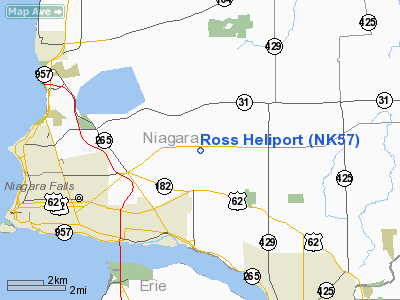
| From nearest city: | 5 nautical miles W of Niagara Falls, NY |
| Location: | Niagara County, NY |
| Magnetic Variation: | 10W (1985) |
Owner & Manager
| Ownership: | Privately owned |
| Owner: | Ross Steel Erection Corp. |
| Address: | 8555 Packard Road
Niagara Falls, NY 14304 |
| Phone number: | 716-297-3240 |
| Manager: | Martin Ve Rost |
| Address: | 8555 Packard Rd
Niagara Falls, NY 14304 |
Airport Operations and Facilities
| Airport Use: | Private |
| Wind indicator: | Yes |
| Segmented Circle: | Yes |
| Control Tower: | No |
| Landing fee charge: | No |
| Sectional chart: | New York |
| Region: | AEA - Eastern |
| Boundary ARTCC: | ZOB - Cleveland |
| Tie-in FSS: | BUF - Buffalo |
| FSS on Airport: | No |
| FSS Toll Free: | 1-800-WX-BRIEF |
Runway Information
Helipad H1
| Dimension: | 50 x 50 ft / 15.2 x 15.2 m |
| Surface: | ASPH, |
| |
Runway H1 |
Runway |
| Traffic Pattern: | Left | Left |
|
Radio Navigation Aids
| ID |
Type |
Name |
Ch |
Freq |
Var |
Dist |
| SN | NDB | St Catherines | | 408.00 | 01E | 14.1 nm |
| TZ | NDB | Gibraltar Point | | 257.00 | 10W | 35.6 nm |
| L | NDB | Lima | | 368.00 | 10W | 40.2 nm |
| ZLB | NDB | Britannia | | 236.00 | 10W | 44.4 nm |
| J | NDB | Juliett | | 236.00 | 10W | 44.4 nm |
| YZD | NDB | Downsview | | 356.00 | 09W | 44.9 nm |
| T | NDB | Tango | | 341.00 | 09W | 46.3 nm |
| X | NDB | Xray | | 385.00 | 09W | 46.4 nm |
| HM | NDB | Hamilton | | 221.00 | 08W | 47.0 nm |
| OO | NDB | Oshawa | | 391.00 | 10W | 48.2 nm |
| IAG | TACAN | Niagara Falls | 047X | | 10W | 1.1 nm |
| BUF | VOR/DME | Buffalo | 111X | 116.40 | 08W | 17.1 nm |
| YYZ | VOR/DME | Toronto | 058Y | 112.15 | 10W | 44.4 nm |
| DKK | VORTAC | Dunkirk | 109X | 116.20 | 07W | 40.6 nm |
| BUF | VOT | Buffalo | | 109.00 | | 14.0 nm |
Remarks
- VFR USE ONLY; PRIOR TO INITIATING OPERATIONS, CTC NIAGARA FALLS ATCT TO DEVELOP INGRESS/EGRESS ROUTES & COMMUNICATION PROCEDURES.
Images and information placed above are from
http://www.airport-data.com/airport/NK57/
We thank them for the data!
| General Info
|
| Country |
United States
|
| State |
NEW YORK
|
| FAA ID |
NK57
|
| Latitude |
43-07-10.201N
|
| Longitude |
078-56-09.146W
|
| Elevation |
635 feet
|
| Near City |
NIAGARA FALLS
|
We don't guarantee the information is fresh and accurate. The data may
be wrong or outdated.
For more up-to-date information please refer to other sources.
|
|


