 |
|
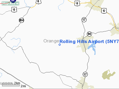
Location & QuickFacts
| FAA Information Effective: | 2008-09-25 |
| Airport Identifier: | 5NY7 |
| Airport Status: | Operational |
| Longitude/Latitude: | 074-24-35.5590W/41-19-40.3390N
-74.409878/41.327872 (Estimated) |
| Elevation: | 410 ft / 124.97 m (Estimated) |
| Land: | 0 acres |
| From nearest city: | 6 nautical miles SW of Goshen, NY |
| Location: | Orange County, NY |
| Magnetic Variation: | 13W (1985) |
Owner & Manager
| Ownership: | Privately owned |
| Owner: | Muriel E Bray |
| Address: | Box 206
Goshen, NY 10924 |
| Manager: | V.l.fredericks |
| Address: | Box 206
Goshen, NY 10924 |
| Phone number: | 914-294-5867 |
Airport Operations and Facilities
| Airport Use: | Private |
| Wind indicator: | Yes |
| Segmented Circle: | No |
| Control Tower: | No |
| Landing fee charge: | No |
| Sectional chart: | New York |
| Region: | AEA - Eastern |
| Boundary ARTCC: | ZNY - New York |
| Tie-in FSS: | ISP - New York |
| FSS on Airport: | No |
| FSS Toll Free: | 1-800-WX-BRIEF |
Airport Communications
Airport Services
| Airframe Repair: | NONE |
| Power Plant Repair: | NONE |
Runway Information
Runway 14/32
| Dimension: | 1500 x 100 ft / 457.2 x 30.5 m |
| Surface: | TURF, |
| |
Runway 14 |
Runway 32 |
| Traffic Pattern: | Left | Left |
|
Radio Navigation Aids
| ID |
Type |
Name |
Ch |
Freq |
Var |
Dist |
| SKU | FAN MARKER | Stanwyck | | | 12W | 20.4 nm |
| EWR | FAN MARKER | Maryann | | | 11W | 38.9 nm |
| SW | NDB | Neely | | 335.00 | 14W | 12.5 nm |
| SKU | NDB | Stanwyck | | 261.00 | 12W | 20.4 nm |
| PO | NDB | Meier | | 403.00 | 12W | 25.0 nm |
| PNJ | NDB | Paterson | | 347.00 | 12W | 25.7 nm |
| MS | NDB | Monga | | 359.00 | 12W | 33.3 nm |
| CAT | NDB | Chatham | | 254.00 | 11W | 35.3 nm |
| HUO | VOR/DME | Huguenot | 108X | 116.10 | 11W | 9.6 nm |
| STW | VOR/DME | Stillwater | 033X | 109.60 | 11W | 28.8 nm |
| TEB | VOR/DME | Teterboro | 021X | 108.40 | 11W | 32.8 nm |
| IGN | VOR/DME | Kingston | 123X | 117.60 | 12W | 33.3 nm |
| BWZ | VOR/DME | Broadway | 089X | 114.20 | 11W | 36.9 nm |
| CMK | VOR/DME | Carmel | 113X | 116.60 | 12W | 37.5 nm |
| LGA | VOR/DME | La Guardia | 078X | 113.10 | 12W | 40.5 nm |
| PWL | VOR/DME | Pawling | 090X | 114.30 | 12W | 45.1 nm |
| SBJ | VOR/DME | Solberg | 076X | 112.90 | 10W | 47.2 nm |
| CRI | VOR/DME | Canarsie | 070X | 112.30 | 11W | 49.0 nm |
| SAX | VORTAC | Sparta | 104X | 115.70 | 11W | 16.7 nm |
| LHY | VORTAC | Lake Henry | 045X | 110.80 | 10W | 49.2 nm |
Images and information placed above are from
http://www.airport-data.com/airport/5NY7/
We thank them for the data!
| General Info
|
| Country |
United States
|
| State |
NEW YORK
|
| FAA ID |
5NY7
|
| Latitude |
41-19-40.339N
|
| Longitude |
074-24-35.559W
|
| Elevation |
410 feet
|
| Near City |
GOSHEN
|
We don't guarantee the information is fresh and accurate. The data may
be wrong or outdated.
For more up-to-date information please refer to other sources.
|
|


