 |
|
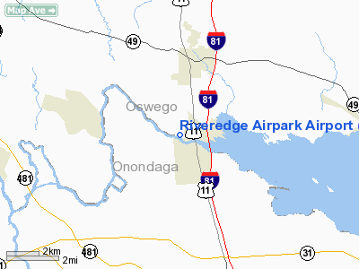
Riveredge Airpark Airport |
Location & QuickFacts
| FAA Information Effective: | 2008-09-25 |
| Airport Identifier: | 19NK |
| Airport Status: | Operational |
| Longitude/Latitude: | 076-09-10.0000W/43-14-38.0000N
-76.152778/43.243889 (Estimated) |
| Elevation: | 378 ft / 115.21 m (Estimated) |
| Land: | 0 acres |
| From nearest city: | 3 nautical miles S of Central Square, NY |
| Location: | Oswego County, NY |
| Magnetic Variation: | () |
Owner & Manager
| Ownership: | Privately owned |
| Owner: | Paul V Jonza |
| Address: | 697 C T Rt 37
Central Square, NY 13036 |
| Phone number: | 315-668-8041 |
| Manager: | Paul V Jonza |
| Address: | 697 C T Rt 37
Central Square, NY 13036 |
| Phone number: | 315-668-8041 |
Airport Operations and Facilities
| Airport Use: | Private |
| Wind indicator: | Yes |
| Control Tower: | No |
| Sectional chart: | New York |
| Region: | AEA - Eastern |
| Boundary ARTCC: | ZBW - Boston |
| Tie-in FSS: | BTV - Burlington |
| FSS Toll Free: | 1-800-WX-BRIEF |
Runway Information
Runway 01/19
| Dimension: | 1600 x 100 ft / 487.7 x 30.5 m |
| Surface: | TURF, |
| |
Runway 01 |
Runway 19 |
| Traffic Pattern: | Left | Left |
| Obstruction: | 30 ft bldg, 600.0 ft from runway | 30 ft trees, 200.0 ft from runway |
|
Radio Navigation Aids
| ID |
Type |
Name |
Ch |
Freq |
Var |
Dist |
| BK | NDB | Plein | | 329.00 | 12W | 29.4 nm |
| CJY | NDB | Clay | | 275.00 | 12W | 40.6 nm |
| GSS | TACAN | Griffiss | 057X | | 12W | 32.5 nm |
| ITH | VOR/DME | Ithaca | 055X | 111.80 | 10W | 47.0 nm |
| SYR | VORTAC | Syracuse | 117X | 117.00 | 11W | 5.5 nm |
| GGT | VORTAC | Georgetown | 125X | 117.80 | 11W | 30.9 nm |
| ART | VORTAC | Watertown | 035X | 109.80 | 12W | 42.7 nm |
| UCA | VORTAC | Utica | 049X | 111.20 | 12W | 45.3 nm |
Remarks
- PRVDD DALGT OPNS AND/OR NGTTIME IF PROPERLY LGTD; A CLEAR APCH/DEP PATH; AND OPERATE IN AMANNER TO MINIMIZE NOISE.
Images and information placed above are from
http://www.airport-data.com/airport/19NK/
We thank them for the data!
|
|


