 |
|
Location & QuickFacts
| FAA Information Effective: | 2008-09-25 |
| Airport Identifier: | 28NK |
| Airport Status: | Operational |
| Longitude/Latitude: | 076-04-35.0000W/44-11-13.0000N
-76.076389/44.186944 (Estimated) |
| Elevation: | 385 ft / 117.35 m (Estimated) |
| Land: | 0 acres |
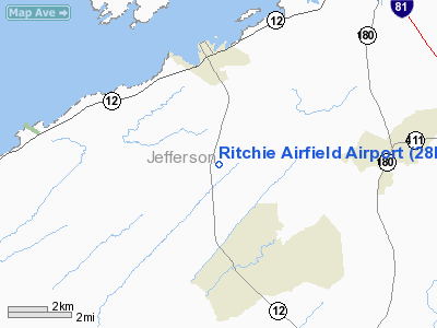
| From nearest city: | 3 nautical miles S of Clayton, NY |
| Location: | Jefferson County, NY |
| Magnetic Variation: | () |
Owner & Manager
| Ownership: | Privately owned |
| Owner: | Steven H. Ritchie |
| Address: | P. O. Box 128
Clayton, NY 13624 |
| Phone number: | 718-464-2909 |
| Manager: | Steven H. Ritchie |
| Address: | P. O. Box 128
Clayton, NY 13624 |
| Phone number: | 718-464-2909 |
Airport Operations and Facilities
| Airport Use: | Private |
| Wind indicator: | Yes |
| Control Tower: | No |
| Sectional chart: | New York |
| Region: | AEA - Eastern |
| Boundary ARTCC: | ZBW - Boston |
| Tie-in FSS: | BTV - Burlington |
| FSS Toll Free: | 1-800-WX-BRIEF |
Runway Information
Runway 07/25
| Dimension: | 2000 x 100 ft / 609.6 x 30.5 m |
| Surface: | TURF, |
| |
Runway 07 |
Runway 25 |
| Traffic Pattern: | Right | Left |
|
Radio Navigation Aids
| ID |
Type |
Name |
Ch |
Freq |
Var |
Dist |
| GTB | NDB | Drum | | 257.00 | 13W | 16.3 nm |
| YSH | NDB | Smiths Falls | | 334.00 | 13W | 43.0 nm |
| ART | VORTAC | Watertown | 035X | 109.80 | 12W | 14.1 nm |
Remarks
- 25 FT PLINE 300 FT WEST OF THE RY.
- NOISE ABATEMENT PROCEDURES IN EFFECT CTC APRT MGMT FOR DETAILS. GOLF COURSE, SCHOOL AND CHURCH NORTH OF THE ARPT.
- PRVDD VFR OPNS; PVT USE; AND BE ALERT FOR PLINE WEST OF THE RY.
Images and information placed above are from
http://www.airport-data.com/airport/28NK/
We thank them for the data!
|
|


