 |
|
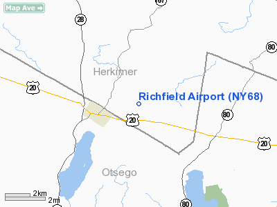
Location & QuickFacts
| FAA Information Effective: | 2008-09-25 |
| Airport Identifier: | NY68 |
| Airport Status: | Operational |
| Longitude/Latitude: | 074-56-43.5540W/42-51-40.2600N
-74.945432/42.861183 (Estimated) |
| Elevation: | 1450 ft / 441.96 m (Estimated) |
| Land: | 80 acres |
| From nearest city: | 2 nautical miles E of Richfield Springs, NY |
| Location: | Herkimer County, NY |
| Magnetic Variation: | 13W (1985) |
Owner & Manager
| Ownership: | Privately owned |
| Owner: | Arthur And Marcella Neeves |
| Address: | Rd 2 Box 144 Millstone Road
Richfield Springs, NY 13439 |
| Phone number: | 315-858-0901 |
| Manager: | Arthur Neeves |
| Address: | Rd 2 Box 144 Millstone Road
Richfield Springs, NY 13439 |
| Phone number: | 315-858-0901 |
Airport Operations and Facilities
| Airport Use: | Private |
| Wind indicator: | Yes |
| Segmented Circle: | No |
| Control Tower: | No |
| Landing fee charge: | No |
| Sectional chart: | New York |
| Region: | AEA - Eastern |
| Boundary ARTCC: | ZBW - Boston |
| Tie-in FSS: | BUF - Buffalo |
| FSS on Airport: | No |
| FSS Toll Free: | 1-800-WX-BRIEF |
Runway Information
Runway 10/28
| Dimension: | 3000 x 75 ft / 914.4 x 22.9 m |
| Surface: | TURF, |
| |
Runway 10 |
Runway 28 |
| Traffic Pattern: | Left | Left |
| Displaced threshold: | 100.00 ft | 0.00 ft |
|
Radio Navigation Aids
| ID |
Type |
Name |
Ch |
Freq |
Var |
Dist |
| CJY | NDB | Clay | | 275.00 | 12W | 18.2 nm |
| JJH | NDB | Johnstown | | 523.00 | 14W | 28.2 nm |
| BK | NDB | Plein | | 329.00 | 12W | 32.1 nm |
| HEU | NDB | Hunter | | 356.00 | 14W | 44.6 nm |
| GSS | TACAN | Griffiss | 057X | | 12W | 30.2 nm |
| RKA | VOR/DME | Rockdale | 073X | 112.60 | 11W | 27.1 nm |
| DNY | VOR/DME | De Lancey | 058X | 112.10 | 11W | 41.1 nm |
| UCA | VORTAC | Utica | 049X | 111.20 | 12W | 13.8 nm |
| GGT | VORTAC | Georgetown | 125X | 117.80 | 11W | 39.1 nm |
Remarks
- VFR DALGT OPNS ONLY; RY DSPLCD 100'; TREES AT RY 28 THR REMOVED/LOWERED.
Images and information placed above are from
http://www.airport-data.com/airport/NY68/
We thank them for the data!
| General Info
|
| Country |
United States
|
| State |
NEW YORK
|
| FAA ID |
NY68
|
| Latitude |
42-51-40.260N
|
| Longitude |
074-56-43.554W
|
| Elevation |
1450 feet
|
| Near City |
RICHFIELD SPRINGS
|
We don't guarantee the information is fresh and accurate. The data may
be wrong or outdated.
For more up-to-date information please refer to other sources.
|
|


