|
|
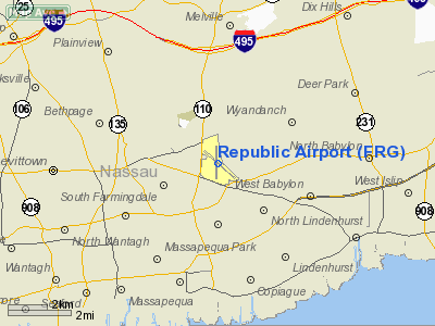
| Republic Airport |
 |
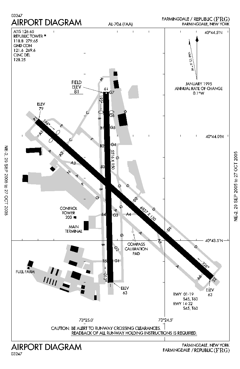
| FAA airport diagram |
| IATA: FRG – ICAO: KFRG – FAA LID: FRG |
| Summary |
| Airport type |
Public |
| Owner |
New York State Department of Transportation |
| Serves |
Long Island |
| Location |
East Farmingdale, New York |
| Elevation AMSL |
82 ft / 25 m |
| Coordinates |
40°43′44″N 073°24′48″W / 40.72889°N 73.41333°W / 40.72889; -73.41333 |
| Runways |
| Direction |
Length |
Surface |
| ft |
m |
| 1/19 |
5,516 |
1,681 |
Asphalt |
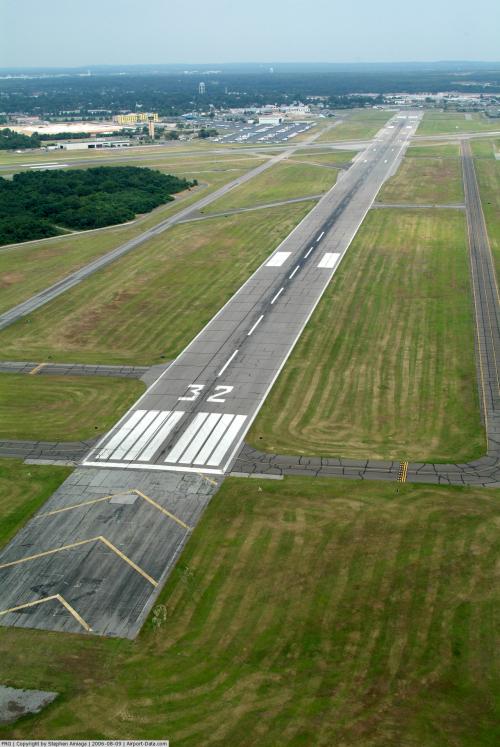
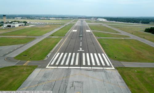
| 14/32 |
6,827 |
2,081 |
Asphalt |
| Statistics (2006) |
| Aircraft operations |
190,723 |
| Based aircraft |
546 |
| Source: Federal Aviation Administration |
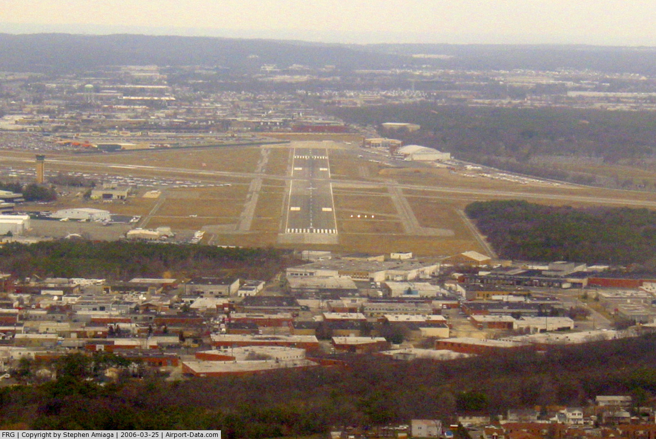
Republic Airport (IATA: FRG, ICAO: KFRG, FAA LID: FRG) is a state-owned public-use airport located in East Farmingdale, Suffolk County, New York, United States. The airport is on Long Island, one mile (2 km) east of the central business district of Farmingdale.
Although mainly a general aviation airport, it is designated as a reliever airport according to Federal Aviation Administration records. The airport had 1,692 passenger boardings (enplanements) in calendar year 2004 and 1,634 enplanements in 2005. History
Republic Airport was developed by Sherman Fairchild as the Fairchild Flying Field in East Farmingdale on Long Island, NY in late 1927 as his flying field and airplane factory on Motor Avenue in South Farmingdale was inadequate to support the mass production of his FC-2 and Model 71 airplanes. Fairchild purchased property on the south side of Route 24-Conklin Street and had the airport's original layout plan prepared on November 3, 1927. The 77.967-acre (315,520 m) flying field was developed in the late winter and early spring of 1928 and was originally owned and operated by Fairchild Engine & Airplane Manufacturing Company. The first flights from the Fairchild Flying Field took place in late spring of 1928 after the Fairchild Airplane and Airplane Engine factories and hangar were completed and aircraft were produced in the new factories. After Fairchild moved to Hagerstown, Maryland in 1931, Grumman Aircraft Engineering built planes at the airport from 1932 until the spring of 1937.
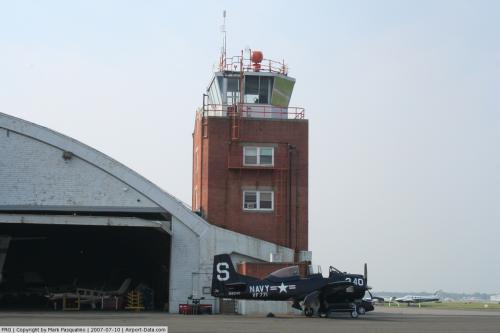
Seversky Aircraft moved there in January 1935 from College Point in Queens, and became Republic Aviation in 1939. Republic built more than 9,000 P-47 Thunderbolts in Farmingdale during World War II and expanded Republic Field, erected three hangars and a control tower and lengthened and hardened the runways. Republic built the straight-wing F-84 Thunderjet and the swept-wing F-84 Thunderstreak during the Korean War and extended runway 14-32 substantially to the southeast over the objections of Long Island State Parks Commissioner Robert Moses. Republic Aviation produced over 800 F-105 Thunderchief fighter bombers during the Vietnam Era. Republic Aviation was acquired by the Fairchild-Hiller Corp. in 1965 for $24.5 million and Fairchild stock. Flight Safety Inc. ran the Republic Airport as a general aviation airport beginning on December 7, 1966 for the Mailman brothers Farmingdale Corporation, which had purchased the field from Fairchild Hiller for $8 million in 1965. Republic Airport was acquired by the Metropolitan Transportation Authority (MTA) on March 31, 1969. The MTA installed an instrument landing system (ILS) on runway 14-32, built the Republic Airport Terminal building,cooperated with the Federal Aviation Administration, which built the new 100' high control tower and got the US Government to transfer 94 acres (380,000 m) to the airport in 1971 and purchased the 77-acre (310,000 m) Lambert property on the north side of Route 109 and the Breslau Gardens property between New Highway and Route 109 in 1972. After complaints that the MTA was not contributing taxes to local governments and questions about the MTA spending at Republic, ownership of the airport was transferred to the New York State Department of Transportation (NYSDOT) by the New York State Legislature in April 1983, to promote economic development in the surrounding Long Island region. The Republic Airport Commission was created by the New York State Legislature in 1982 (Chap. 370, L.1982) "as an advisory council to the Commissioner of Transportation in the administration and management of the Republic Airport facilities and its surrounding areas with respect to projects to be undertaken at such airport." Fairchild went out of business in 1987, and much of its historic Fairchild-Republic factory complex was sold and developed as the Airport Plaza shopping mall.
The Long Island Republic Airport Historical Society, formed in 1984,and chartered by the Board of Regents of the State of New York in 1987, maintains fifteen photographic exhibits illustrating the history of aviation, and historical archives, on the first floor of the Republic Airport terminal building behind the FAA tower on the east side of Route 110.The most recent exhibit illustrates: "The Origins of Airplane Manufacturing in Farmingdale, NY: The Foundation Years: 1917-1928," which documents airplanes built by Lawrence Sperry, Sydney Breese and Sherman Fairchild. The airport is also home to the American Airpower Museum which offers visitors the opportunity to see WWII aircraft in flight.
The airport was once served by scheduled passenger air service on Cosmopolitan Airlines in the 1980s and Northwest Airlink in the 1990s.
Facilities and aircraft
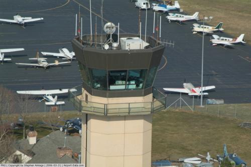
Republic Airport has a two-story terminal building serving passengers boarding charter flights to short distance destinations such as Atlantic City, New Jersey. Two fixed based operators serve corporate and light general aviation customers: SheltAir and Atlantic Aviation. Adjacent to the airport is the 56th Fighter Group restaurant, operated by Specialty Restaurants Corp. Also, Troop L of the New York State Police, which covers Nassau and Suffolk Counties, is headquartered at the airport.
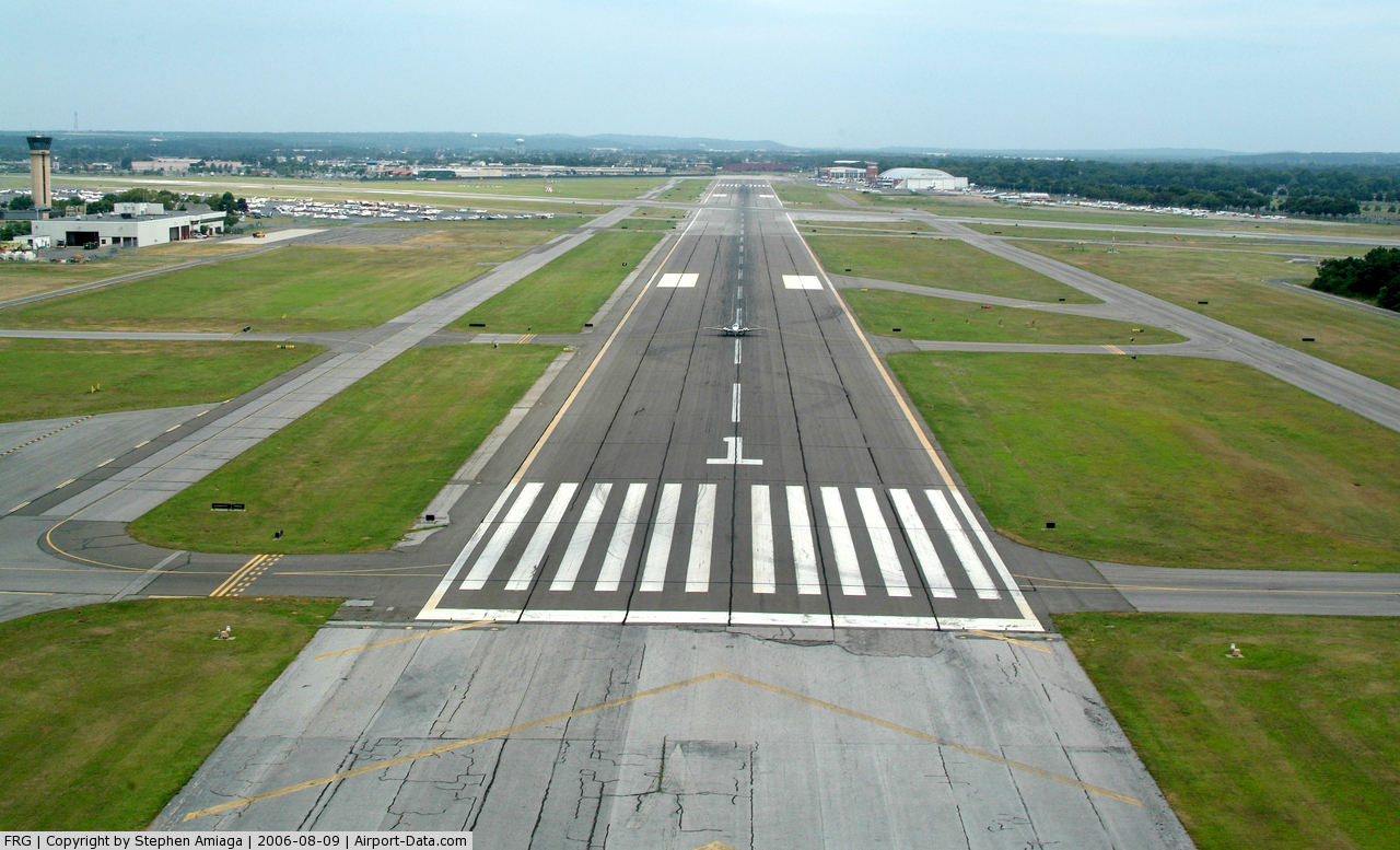
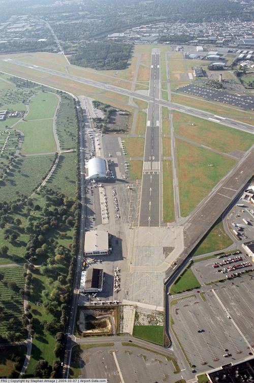
The airport covers an area of 526 acres (213 ha) which contains two asphalt paved runways: 14/32 measuring 6,827 x 150 ft (2,081 x 46 m) and 1/19 measuring 5,516 x 150 ft (1,681 x 46 m). For the 12-month period ending December 31, 2006, the airport had 190,723 aircraft operations, an average of 522 per day: 93% general aviation, 6% air taxi, 1% military and <1% scheduled commercial. At that time there were 546 aircraft based at this airport: 72% single-engine, 16% multi-engine, 8% jet and 4% helicopter.
Airlines
- NetJets
- SheltAir
- Atlantic Aviation
- Pet Airways (Baltimore, Fort Lauderdale)
The above content comes from Wikipedia and is published under free licenses – click here to read more.
 |
(Click on the photo to enlarge) |
 |
(Click on the photo to enlarge) |
 |
(Click on the photo to enlarge) |
 |
(Click on the photo to enlarge) |
 |
(Click on the photo to enlarge) |
 |
(Click on the photo to enlarge) |
 |
(Click on the photo to enlarge) |
Location & QuickFacts
| FAA Information Effective: | 2008-09-25 |
| Airport Identifier: | FRG |
| Airport Status: | Operational |
| Longitude/Latitude: | 073-24-48.2660W/40-43-43.6120N
-73.413407/40.728781 (Estimated) |
| Elevation: | 82 ft / 24.99 m (Surveyed) |
| Land: | 526 acres |
| From nearest city: | 1 nautical miles E of Farmingdale, NY |
| Location: | Suffolk County, NY |
| Magnetic Variation: | 14W (2000) |
Owner & Manager
| Ownership: | Publicly owned |
| Owner: | New York State Dept Trans |
| Address: | 1220 Washington Ave
Albany, NY 12232 |
| Phone number: | 518-457-2821 |
| Manager: | Shelley Larose-arken |
| Address: | 7150 Republic Arpt. Ste. 216
E Farmingdale, NY 11735 |
| Phone number: | 631-752-7707
EXTENSION 6108. |
Airport Operations and Facilities
| Airport Use: | Open to public |
| Wind indicator: | Yes |
| Segmented Circle: | Yes |
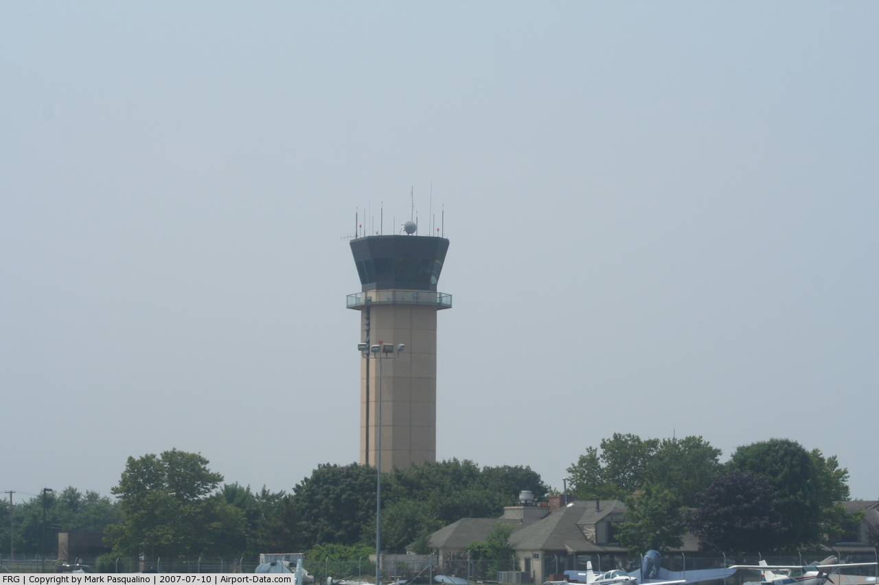
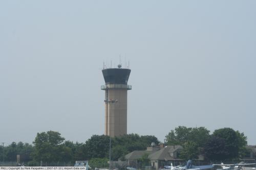
| Control Tower: | Yes |
| Lighting Schedule: | DUSK-DAWN
WHEN ATCT CLSD ACTVT HIRL RY 14/32; MIRL 01/19; MALSR RY 14; REIL RYS 01 19 & 32; PAPI RYS 01 19 14 & 32; TWY LGTS - CTAF. |
| Beacon Color: | Clear-Green (lighted land airport) |
| Landing fee charge: | Yes
LNDG FEE FOR ALL ACFT EXCP MIL/GOVT. |
| Sectional chart: | New York |
| Region: | AEA - Eastern |
| Traffic Pattern Alt: | 1100 ft |
| Boundary ARTCC: | ZNY - New York |
| Tie-in FSS: | ISP - New York |
| FSS on Airport: | No |
| FSS Toll Free: | 1-800-WX-BRIEF |
| NOTAMs Facility: | FRG (NOTAM-d service avaliable) |
| Certification type/date: | IV A U 11/198 |
| Federal Agreements: | NGHSY |
Airport Communications
| CTAF: | 118.800 |
| Unicom: | 122.950 |
Airport Services
| Fuel available: | 100LLA |
| Airframe Repair: | MAJOR |
| Power Plant Repair: | MAJOR |
| Bottled Oxygen: | HIGH/LOW |
| Bulk Oxygen: | HIGH/LOW |
Runway Information
Runway 01/19
| Dimension: | 5516 x 150 ft / 1681.3 x 45.7 m |
| Surface: | ASPH, Good Condition |
| Surface Treatment: | Saw-cut or plastic Grooved |
| Weight Limit: | Single wheel: 45000 lbs.
Dual wheel: 60000 lbs. |
| Edge Lights: | Medium |
| |
Runway 01 |
Runway 19 |
| Longitude: | 073-24-51.3350W | 073-24-52.3640W |
| Latitude: | 40-43-18.3960N | 40-44-12.8960N |
| Elevation: | 63.00 ft | 82.00 ft |
| Alignment: | 127 | 127 |
| Traffic Pattern: | Right | Left |
| Markings: | Non-precision instrument, Good Condition | Non-precision instrument, Good Condition |
| Crossing Height: | 35.00 ft | 39.00 ft |
| Displaced threshold: | 0.00 ft | 789.00 ft |
| VASI: | 4-light PAPI on right side | 2-light PAPI on left side |
| Visual Glide Angle: | 3.00° | 3.00° |
| Runway End Identifier: | Yes | Yes |
| Obstruction: | 29 ft pole, 775.0 ft from runway, 210 ft left of centerline, 19:1 slope to clear | 41 ft bldg, 250.0 ft from runway, 250 ft left of centerline, 1:1 slope to clear
APCH SLOPE 25:1 TO DSPLCD THLD. |
|
Runway 14/32
| Dimension: | 6827 x 150 ft / 2080.9 x 45.7 m |
| Surface: | ASPH, Good Condition |
| Surface Treatment: | Saw-cut or plastic Grooved |
| Weight Limit: | Single wheel: 45000 lbs.
Dual wheel: 60000 lbs. |
| Edge Lights: | High |
| |
Runway 14 |
Runway 32 |
| Longitude: | 073-25-18.2000W | 073-24-12.5450W |
| Latitude: | 40-44-04.6400N | 40-43-19.2960N |
| Elevation: | 79.00 ft | 63.00 ft |
| Alignment: | 127 | 127 |
| ILS Type: | ILS
| |
| Traffic Pattern: | Left | Right |
| Markings: | Precision instrument, Good Condition | Non-precision instrument, Good Condition |
| Crossing Height: | 50.00 ft | 53.00 ft |
| Displaced threshold: | 660.00 ft | 0.00 ft |
| VASI: | 4-light PAPI on left side | 4-light PAPI on left side |
| Visual Glide Angle: | 3.00° | 3.00° |
| Approach lights: | MALSR | |
| Runway End Identifier: | | Yes |
| Obstruction: | 23 ft pole, 400.0 ft from runway, 390 ft right of centerline, 8:1 slope to clear
APCH SLOPE 46:1 TO DSPLCD THLD.
+8 FT FENCE 0-200 FT FR RWY END, 240 FT LEFT. | 26 ft road, 200.0 ft from runway, 1:1 slope to clear
+8 FT FENCE 180 FT FM RY END 500 FT LEFT; +8 FT LGTD BLAST FENCE AT AER 460 FT RIGHT. |
|
Radio Navigation Aids
| ID |
Type |
Name |
Ch |
Freq |
Var |
Dist |
| EWR | FAN MARKER | Maryann | | | 11W | 35.3 nm |
| BBN | NDB | Babylon | | 275.00 | 14W | 3.6 nm |
| OP | NDB | Old Field Point Light | | 316.00 | 13W | 20.1 nm |
| OGY | NDB | Bridge | | 414.00 | 12W | 23.5 nm |
| PNJ | NDB | Paterson | | 347.00 | 12W | 36.0 nm |
| CAT | NDB | Chatham | | 254.00 | 11W | 46.3 nm |
| TBY | NDB | Waterbury | | 257.00 | 14W | 49.6 nm |
| FOK | TACAN | Suffolk Co | 047X | | 13W | 36.2 nm |
| DPK | VOR/DME | Deer Park | 124X | 117.70 | 12W | 6.3 nm |
| JFK | VOR/DME | Kennedy | 106X | 115.90 | 12W | 17.3 nm |
| LGA | VOR/DME | La Guardia | 078X | 113.10 | 12W | 21.4 nm |
| CRI | VOR/DME | Canarsie | 070X | 112.30 | 11W | 23.0 nm |
| BDR | VOR/DME | Bridgeport | 25X | 108.80 | 12W | 29.1 nm |
| TEB | VOR/DME | Teterboro | 021X | 108.40 | 11W | 30.4 nm |
| CCC | VOR/DME | Calverton | 119X | 117.20 | 13W | 30.4 nm |
| CMK | VOR/DME | Carmel | 113X | 116.60 | 12W | 34.0 nm |
| HVN | VOR/DME | New Haven | 035X | 109.80 | 13W | 40.0 nm |
| COL | VOR/DME | Colts Neck | 101X | 115.40 | 11W | 42.3 nm |
| MAD | VOR/DME | Madison | 041X | 110.40 | 13W | 48.0 nm |
| ISP | VOT | Long Island Mac Arthur | | 109.40 | | 14.9 nm |
| JFK | VOT | Kennedy | | 115.10 | | 17.6 nm |
| BDR | VOT | Bridgeport | | 109.25 | | 29.1 nm |
Remarks
- BIRDS INVOF ARPT.
- VOLUNTARY NOISE ABATEMENT PROCEDURES IN EFFECT FOR FIXED WING AND HELICOPTER. CONTACT ARPT MGMT 631-752-7707 EXT 6108.
- ACFT WITH WINGSPAN 79 FT OR LARGER ARE ADVISED TO TAXI OR BACK-TAXI ON RYS. TWYS MAY NOT PRVD ADEQUATE WIDTH, TURNING RADIUS, AND OR SEPARATION FROM OBSTRUCTIONS.
- ACFT WITH WINGSPAN OF 79 FT OR LARGER ARE ADVISED THAT CLEARANCE DSTCS MAY NOT BE ADEQUATE FOR TKOF ON RY 01/19 WHEN ACFT ARE ON TWY B OR TWY G BTWN TWYS G4 AND D AND ARE RSTRD ON TWY A BTWN TWYS A BTWN TWYS A1 AND A2.
- RY 01/19 HOLD LINES LCTD 125 FT FM THE RY CNTRLN.
- LANDING FEE FOR ALL ACFT EXCP MILITARY AND GOVT, NOTE: SEE LAND AND HOLD SHORT OPERATIONS SECTION.
Images and information placed above are from
http://www.airport-data.com/airport/FRG/
We thank them for the data!
| General Info
|
| Country |
United States
|
| State |
NEW YORK
|
| FAA ID |
FRG
|
| Latitude |
40-43-43.612N
|
| Longitude |
073-24-48.266W
|
| Elevation |
82 feet
|
| Near City |
FARMINGDALE
|
We don't guarantee the information is fresh and accurate. The data may
be wrong or outdated.
For more up-to-date information please refer to other sources.
|
|