 |
|
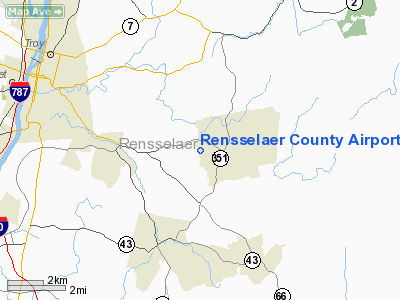
Rensselaer County Airport |
Location & QuickFacts
| FAA Information Effective: | 2008-09-25 |
| Airport Identifier: | 5B7 |
| Airport Status: | Operational |
| Longitude/Latitude: | 073-34-46.4160W/42-41-27.2830N
-73.579560/42.690912 (Estimated) |
| Elevation: | 440 ft / 134.11 m (Estimated) |
| Land: | 65 acres |
| From nearest city: | 6 nautical miles SE of Troy, NY |
| Location: | Rensselaer County, NY |
| Magnetic Variation: | 14W (1985) |
Owner & Manager
| Ownership: | Privately owned |
| Owner: | Du This Du That Inc |
| Address: | Po Box 3095
Troy, NY 12181 |
| Phone number: | 518-286-1376 |
| Manager: | George Dujack, Jr. |
| Address: | P.o. 3095
Troy, NY 12181 |
| Phone number: | 518-286-1394 |
Airport Operations and Facilities
| Airport Use: | Open to public |
| Wind indicator: | Yes |
| Segmented Circle: | No |
| Control Tower: | No |
| Landing fee charge: | No |
| Sectional chart: | New York |
| Region: | AEA - Eastern |
| Traffic Pattern Alt: | 1060 ft |
| Boundary ARTCC: | ZBW - Boston |
| Tie-in FSS: | BTV - Burlington |
| FSS on Airport: | No |
| FSS Toll Free: | 1-800-WX-BRIEF |
| NOTAMs Facility: | BTV (NOTAM-d service avaliable) |
| Federal Agreements: | N |
Airport Communications
| CTAF: | 122.700 |
| Unicom: | 122.700 |
Airport Services
Runway Information
Runway 18/36
| Dimension: | 2670 x 50 ft / 813.8 x 15.2 m
RY 18 FIRST 40 FT OVERGROWN WITH GRASS. |
| Surface: | ASPH, Poor Condition
RY 18/36 PAVEMENT CRACKED, LOOSE ROCKS & VEGETATION. |
| Weight Limit: | Single wheel: 8000 lbs. |
| |
Runway 18 |
Runway 36 |
| Traffic Pattern: | Left | Left |
| Markings: | ,
RY 18 MARKINGS NOT VSBL. | Numbers only, Poor Condition
MARKING NUMBERS FADED |
| Obstruction: | 41 ft trees, 290.0 ft from runway, 89 ft left of centerline, 2:1 slope to clear
RY HAS +43 FT TREES, 23 FT FM RY END, 118 FT LEFT. | 80 ft trees, 343.0 ft from runway, 98 ft right of centerline, 1:1 slope to clear
HAS +41 FT TO +78 FT TREES, 30 FT TO 167 FT FM RY, 88 FT TO 102 FT RIGHT. |
|
Radio Navigation Aids
| ID |
Type |
Name |
Ch |
Freq |
Var |
Dist |
| PSF | FAN MARKER | Abyss | | | 13W | 21.5 nm |
| GBR | FAN MARKER | Sheffield | | | 13W | 35.2 nm |
| HEU | NDB | Hunter | | 356.00 | 14W | 18.4 nm |
| DXT | NDB | Dalton | | 370.00 | 15W | 22.4 nm |
| PFH | NDB | Philmont | | 272.00 | 13W | 27.1 nm |
| GBR | NDB | Great Barrington | | 395.00 | 14W | 31.5 nm |
| VWD | NDB | Mount Snow | | 224.00 | 15W | 34.6 nm |
| JJH | NDB | Johnstown | | 523.00 | 14W | 38.0 nm |
| CAM | VOR/DME | Cambridge | 097X | 115.00 | 14W | 21.0 nm |
| CTR | VOR/DME | Chester | 098X | 115.10 | 13W | 36.8 nm |
| ALB | VORTAC | Albany | 100X | 115.30 | 13W | 10.4 nm |
| GFL | VORTAC | Glens Falls | 039X | 110.20 | 14W | 39.1 nm |
| BAF | VORTAC | Barnes | 077X | 113.00 | 14W | 49.8 nm |
| ALB | VOT | Albany County | | 108.20 | | 11.1 nm |
Remarks
- DEER & BIRDS ON & INVOF ARPT.
- SURROUNDING TERRAIN SLOPES DOWN TO RY; DUE TO HIGHER SURROUNDING TERRAIN RECOMMEND USE OF THE FOLLOWING PROCEDURES: DEP RY 36 - USE BEST ANGLE OF CLIMB SPEED UNTIL WELL CLEAR OF RESIDENTIAL AREA N OF RY 36;
- ARRIVALS RY 18 - MAINTAIN SUFFICIENT ALT ON FINAL SO AS TO AVOID LOW ALT AND/OR HIGH POWER OVER RESIDENTIAL AREA WHICH UNDERLIES FINAL APCH TO RY 18. DEPARTURES RY 18 & ARRIVALS RY 36 - USE NORMAL PROCEDURES.
- TRANSIENT ACFT CALL (518) 279-1394 FOR FIELD CONDS PRIOR TO ARR.
- VFR ONLY
Images and information placed above are from
http://www.airport-data.com/airport/5B7/
We thank them for the data!
| General Info
|
| Country |
United States
|
| State |
NEW YORK
|
| FAA ID |
5B7
|
| Latitude |
42-41-27.283N
|
| Longitude |
073-34-46.416W
|
| Elevation |
440 feet
|
| Near City |
TROY
|
We don't guarantee the information is fresh and accurate. The data may
be wrong or outdated.
For more up-to-date information please refer to other sources.
|
|


