 |
|
Location & QuickFacts
| FAA Information Effective: | 2008-09-25 |
| Airport Identifier: | NY57 |
| Airport Status: | Operational |
| Longitude/Latitude: | 075-11-04.5950W/43-21-36.2480N
-75.184610/43.360069 (Estimated) |
| Elevation: | 1220 ft / 371.86 m (Estimated) |
| Land: | 0 acres |
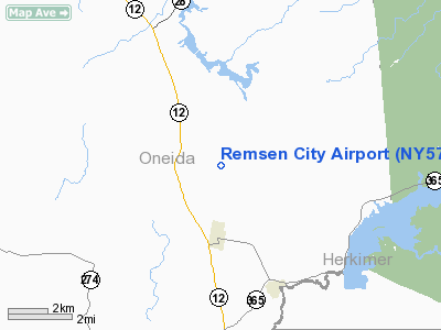
| From nearest city: | 3 nautical miles N of Remsen, NY |
| Location: | Oneida County, NY |
| Magnetic Variation: | 13W (1985) |
Owner & Manager
| Ownership: | Privately owned |
| Owner: | Richard R Davis |
| Address: | P.o.box 49
Remsen, NY 13438 |
| Phone number: | 315-831-5241 |
| Manager: | Richard R Davis |
| Address: | P.o.box 49
Remsen, NY 13438 |
| Phone number: | 315-831-5241 |
Airport Operations and Facilities
| Airport Use: | Private |
| Wind indicator: | Yes |
| Segmented Circle: | No |
| Control Tower: | No |
| Lighting Schedule: | PHONE REQ
FOR ROTG BCN CALL 315-831-5241. |
| Beacon Color: | Clear-Green (lighted land airport) |
| Sectional chart: | New York |
| Region: | AEA - Eastern |
| Boundary ARTCC: | ZBW - Boston |
| Tie-in FSS: | BUF - Buffalo |
| FSS Toll Free: | 1-800-WX-BRIEF |
Airport Services
Runway Information
Runway 09/27
| Dimension: | 2000 x 100 ft / 609.6 x 30.5 m |
| Surface: | TURF, |
| |
Runway 09 |
Runway 27 |
| Traffic Pattern: | Left | Left |
|
Runway 18/36
| Dimension: | 1600 x 50 ft / 487.7 x 15.2 m |
| Surface: | TURF, |
| |
Runway 18 |
Runway 36 |
| Traffic Pattern: | Left | Left |
|
Radio Navigation Aids
| ID |
Type |
Name |
Ch |
Freq |
Var |
Dist |
| BK | NDB | Plein | | 329.00 | 12W | 15.4 nm |
| CJY | NDB | Clay | | 275.00 | 12W | 18.8 nm |
| JJH | NDB | Johnstown | | 523.00 | 14W | 43.2 nm |
| GTB | NDB | Drum | | 257.00 | 13W | 48.9 nm |
| GSS | TACAN | Griffiss | 057X | | 12W | 12.6 nm |
| UCA | VORTAC | Utica | 049X | 111.20 | 12W | 20.1 nm |
| GGT | VORTAC | Georgetown | 125X | 117.80 | 11W | 44.4 nm |
| SYR | VORTAC | Syracuse | 117X | 117.00 | 11W | 46.2 nm |
Remarks
- PRVDD ARPT USE IS VFR ONLY; CNTRLN RY 09/27 IS 125' FM COMMONS RD; RY 17 THR DSPLCD 250' AND MARKED.
Images and information placed above are from
http://www.airport-data.com/airport/NY57/
We thank them for the data!
| General Info
|
| Country |
United States
|
| State |
NEW YORK
|
| FAA ID |
NY57
|
| Latitude |
43-21-36.248N
|
| Longitude |
075-11-04.595W
|
| Elevation |
1220 feet
|
| Near City |
REMSEN
|
We don't guarantee the information is fresh and accurate. The data may
be wrong or outdated.
For more up-to-date information please refer to other sources.
|
|


