 |
|
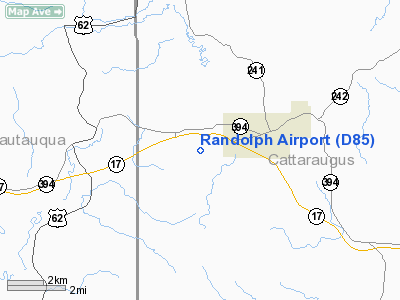
Location & QuickFacts
| FAA Information Effective: | 2008-09-25 |
| Airport Identifier: | D85 |
| Airport Status: | Operational |
| Longitude/Latitude: | 079-00-59.1470W/42-09-15.2160N
-79.016430/42.154227 (Estimated) |
| Elevation: | 1665 ft / 507.49 m (Estimated) |
| Land: | 82 acres |
| From nearest city: | 2 nautical miles W of Randolph, NY |
| Location: | Cattaraugus County, NY |
| Magnetic Variation: | 09W (1985) |
Owner & Manager
| Ownership: | Privately owned |
| Owner: | Robert & Anita Campbell |
| Address: | 4729 Whiteside Pk Wy
Maple Springs, NY 14756 |
| Phone number: | 716-386-6538 |
| Manager: | Robert Campbell |
| Address: | P. O. Box 302
Randolph, NY 14772 |
Airport Operations and Facilities
| Airport Use: | Open to public |
| Wind indicator: | Yes |
| Segmented Circle: | No |
| Control Tower: | No |
| Landing fee charge: | No |
| Sectional chart: | Detroit |
| Region: | AEA - Eastern |
| Boundary ARTCC: | ZOB - Cleveland |
| Tie-in FSS: | BUF - Buffalo |
| FSS on Airport: | No |
| FSS Toll Free: | 1-800-WX-BRIEF |
| NOTAMs Facility: | BUF (NOTAM-d service avaliable) |
Airport Communications
Airport Services
| Airframe Repair: | NONE |
| Power Plant Repair: | NONE |
Runway Information
Runway 08/26
| Dimension: | 2495 x 80 ft / 760.5 x 24.4 m |
| Surface: | TURF, |
| |
Runway 08 |
Runway 26 |
| Traffic Pattern: | Left | Left |
| Obstruction: | 8 ft brush, 1.0 ft from runway, 63 ft right of centerline | 3 ft brush, 1.0 ft from runway, 110 ft left of centerline |
|
Radio Navigation Aids
| ID |
Type |
Name |
Ch |
Freq |
Var |
Dist |
| LYS | NDB | Olean | | 360.00 | 09W | 31.3 nm |
| ORJ | NDB | Corry | | 258.00 | 09W | 31.7 nm |
| CQD | NDB | Cascade | | 372.00 | 08W | 48.5 nm |
| EL | NDB | Halos | | 269.00 | 09W | 49.2 nm |
| JHW | VOR/DME | Jamestown | 094X | 114.70 | 07W | 5.1 nm |
| BFD | VOR/DME | Bradford | 113X | 116.60 | 07W | 28.3 nm |
| BUF | VOR/DME | Buffalo | 111X | 116.40 | 08W | 49.4 nm |
| DKK | VORTAC | Dunkirk | 109X | 116.20 | 07W | 23.2 nm |
| TDT | VORTAC | Tidioute | 123X | 117.60 | 09W | 32.0 nm |
| ELZ | VORTAC | Wellsville | 051X | 111.40 | 09W | 45.5 nm |
| BUF | VOT | Buffalo | | 109.00 | | 48.8 nm |
Remarks
- DEER ON INVOF ARPT OCCASIONALLY AT DUSK AND EARLY MORNING.
- +15 FT BRUSH ALONG SOUTH EDGE OF RY, 50-60 FT FM RY CTRLN.
- RY 8 HAS +44 FT TREE, 20 FT FM RY END, 75 FT RIGHT OF CTRLN; +63 FT TREE, 135 FT FM RY END, 115 FT RIGHT OF CTRLN; +63 FT TREES, 520 FT FM RY END,125 FT RIGHT OF CTRLN.
- RY 26 HAS +82 FT TREES, 760 FT FM RY END, ACROSS RY CTRLN.
- LTD VSBY DOWN RY, CANNOT SEE ACFT ON RY END FROM OPPOSITE RY END.
- EXISTED PRIOR TO 1959.
Images and information placed above are from
http://www.airport-data.com/airport/D85/
We thank them for the data!
| General Info
|
| Country |
United States
|
| State |
NEW YORK
|
| FAA ID |
D85
|
| Latitude |
42-09-15.216N
|
| Longitude |
079-00-59.147W
|
| Elevation |
1665 feet
|
| Near City |
RANDOLPH
|
We don't guarantee the information is fresh and accurate. The data may
be wrong or outdated.
For more up-to-date information please refer to other sources.
|
|


