 |
|
Location & QuickFacts
| FAA Information Effective: | 2008-09-25 |
| Airport Identifier: | NY34 |
| Airport Status: | Operational |
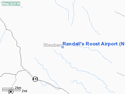
| Longitude/Latitude: | 077-25-39.0600W/42-09-44.0100N
-77.427517/42.162225 (Estimated) |
| Elevation: | 1825 ft / 556.26 m () |
| Land: | 160 acres |
| From nearest city: | 3 nautical miles S of Cameron, NY |
| Location: | Steuben County, NY |
| Magnetic Variation: | () |
Owner & Manager
| Ownership: | Privately owned |
| Owner: | Peter W. Randall |
| Address: | 3264 Jackson Hill Rd
Jasper, NY 14855 |
| Phone number: | 607-792-3614 |
| Manager: | Peter W. Randall |
| Address: | 3264 Jackson Hill Rd
Jasper, NY 14855 |
| Phone number: | 607-792-3614 |
Airport Operations and Facilities
| Airport Use: | Private |
| Wind indicator: | Yes |
| Segmented Circle: | No |
| Control Tower: | No |
| Sectional chart: | Detroit |
| Region: | AEA - Eastern |
| Boundary ARTCC: | ZOB - Cleveland |
| Tie-in FSS: | BUF - Buffalo |
| FSS Toll Free: | 1-800-WX-BRIEF |
Runway Information
Runway 04/22
| Dimension: | 2100 x 50 ft / 640.1 x 15.2 m |
| Surface: | TURF, |
| |
Runway 04 |
Runway 22 |
| Traffic Pattern: | Left | Left |
| Obstruction: | | 20 ft trees, 390.0 ft from runway |
|
Radio Navigation Aids
| ID |
Type |
Name |
Ch |
Freq |
Var |
Dist |
| EL | NDB | Halos | | 269.00 | 09W | 22.0 nm |
| ALP | NDB | Alpine | | 245.00 | 12W | 29.9 nm |
| PYA | NDB | Penn Yan | | 260.00 | 12W | 33.3 nm |
| LYS | NDB | Olean | | 360.00 | 09W | 41.0 nm |
| ULW | VOR/DME | Elmira | 033Y | 109.65 | 12W | 18.4 nm |
| SFK | VOR/DME | Stonyfork | 023X | 108.60 | 08W | 28.1 nm |
| GEE | VOR/DME | Geneseo | 019X | 108.20 | 09W | 42.6 nm |
| ITH | VOR/DME | Ithaca | 055X | 111.80 | 10W | 47.4 nm |
| ELZ | VORTAC | Wellsville | 051X | 111.40 | 09W | 25.9 nm |
| SLT | VORTAC | Slate Run | 086X | 113.90 | 08W | 46.0 nm |
Images and information placed above are from
http://www.airport-data.com/airport/NY34/
We thank them for the data!
|
|


