 |
|
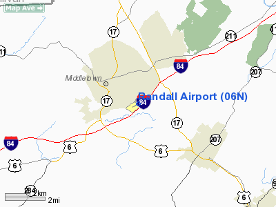
| Randall Airport |
| IATA: none – ICAO: none – FAA LID: 06N |
| Summary |
| Airport type |
Public |
| Owner |
Aerodrome Dev Corp |
| Serves |
Middletown, New York |
| Elevation AMSL |
523 ft / 159 m |
| Coordinates |
41°25′54.8832″N 074°23′29.6199″W / 41.431912°N 74.391561083°W / 41.431912; -74.391561083 |
| Runways |
| Direction |
Length |
Surface |
| ft |
m |
| 08/26 |
2,811 |
857 |
Asphalt |
| Statistics (2006) |
| Aircraft operations |
22,504 |
| Based aircraft |
43 |
| Source: Federal Aviation Administration |
Randall Airport is a public use airport in Orange County, New York, United States. It is owned by Aerodrome Dev Corp and is located two nautical miles (3.74 km) southeast of the central business district of the City of Middletown. According to the FAA's National Plan of Integrated Airport Systems for 2007-2011, it is categorized as a reliever airport.
Although most U.S. airports use the same three-letter location identifier for the FAA and IATA, this airport is assigned 06N by the FAA but has no designation from the IATA.
Facilities and aircraft
Randall Airport covers an area of 77 acres (31.2 ha) at an elevation of 523 feet (159 m) above mean sea level. It has one runway designated 08/26 with an asphalt surface measuring 2,811 by 60 feet (857 x 18 m).
For the 12-month period ending August 6, 2006, the airport had 22,504 aircraft operations, an average of 27 per day: 100% general aviation with a few ultralights. At that time there were 43 aircraft based at this airport: 47% single-engine, 44% gliders and 9% ultralights.
The above content comes from Wikipedia and is published under free licenses – click here to read more.
Location & QuickFacts
| FAA Information Effective: | 2008-09-25 |
| Airport Identifier: | 06N |
| Airport Status: | Operational |
| Longitude/Latitude: | 074-23-29.7410W/41-25-55.0580N
-74.391595/41.431961 (Estimated) |
| Elevation: | 523 ft / 159.41 m (Surveyed) |
| Land: | 77 acres |
| From nearest city: | 2 nautical miles SE of Middletown, NY |
| Location: | Orange County, NY |
| Magnetic Variation: | 13W (2000) |
Owner & Manager
| Ownership: | Privately owned |
| Owner: | Aerodrome Dev Corp |
| Address: | Po Box 3062, 100 Airport Rd
Middletown, NY 10940 |
| Phone number: | 845-343-5965 |
| Manager: | Charles Brodie |
| Address: | P O Box 3062, 100 Airport Rd
Middletown, NY 10940 |
| Phone number: | 845-343-5965
PAY PHONE IN ADMIN BLDG (845) 343-9491. |
Airport Operations and Facilities
| Airport Use: | Open to public |
| Wind indicator: | Yes |
| Segmented Circle: | No |
| Control Tower: | No |
| Lighting Schedule: | PHONE REQ
FOR MIRL & PAPI RWY 08/26 CALL 845-343-5965. |
| Landing fee charge: | No |
| Sectional chart: | New York |
| Region: | AEA - Eastern |
| Boundary ARTCC: | ZNY - New York |
| Tie-in FSS: | ISP - New York |
| FSS on Airport: | No |
| FSS Toll Free: | 1-800-WX-BRIEF |
| NOTAMs Facility: | ISP (NOTAM-d service avaliable) |
| Federal Agreements: | NGY |
Airport Communications
| CTAF: | 122.800 |
| Unicom: | 122.800 |
Airport Services
| Fuel available: | 100LL
FUEL AVAILABLE FOR BASED AIRCRAFT OWNERS WITH SPECIAL KEY. |
| Airframe Repair: | NONE |
| Power Plant Repair: | NONE |
| Bottled Oxygen: | NONE |
| Bulk Oxygen: | NONE |
Runway Information
Runway 08/26
| Dimension: | 2810 x 60 ft / 856.5 x 18.3 m
EAST END EXTNDD 200 FT. |
| Surface: | ASPH, Good Condition |
| Weight Limit: | Single wheel: 25000 lbs. |
| Edge Lights: | Medium
THRESHOLD LIGHTS RIGHT OF DISPLACED THRESHOLD COVERED WHEN LIGHTS ARE NOT ON. CALL AIRPORT MANAGER FOR RWY LIGHTS AT 845-343-5965. |
| |
Runway 08 |
Runway 26 |
| Longitude: | 074-23-46.0580W | 074-23-13.4230W |
| Latitude: | 41-25-48.5860N | 41-26-01.5290N |
| Elevation: | 503.00 ft | 519.00 ft |
| Alignment: | 62 | 127 |
| Traffic Pattern: | Left | Left |
| Markings: | Non-precision instrument, Good Condition | Non-precision instrument, Good Condition |
| Displaced threshold: | 563.00 ft
O OBSTRUCTION SLOPE FROM DISPLACED THRESHOLD, +15 FT HANGAR ROOF 129 FT RIGHT AND 0 FT DISTANCE. | 0.00 ft |
| VASI: | 2-light PAPI on left side | 2-light PAPI on left side |
| Runway End Identifier: | No | No |
| Centerline Lights: | No | No |
| Touchdown Lights: | No | No |
| Obstruction: | 15 ft road, 200.0 ft from runway, 86 ft right of centerline
RWY 08 APCH RATIO 0:0 TO DSPLCD THLD DUE TO HANGAR ROOF PENETRATION. +65 TREES IN RWY 08 APCH APPEAR TO PENETRATE 20:1 FROM DISPLACED THRESHOLD.
+15 FT VEHICLE AT 0 FT DISTANCE FROM RWY END AND 163 FT RIGHT. | 18 ft gnd, 200.0 ft from runway, 180 ft right of centerline
RY 34 APCH RATIO 20:1 TO DSPLCD THLD.
+9 FT TERRAIN 186 FT FROM RWY END AND 180 FT RIGHT. |
|
Radio Navigation Aids
| ID |
Type |
Name |
Ch |
Freq |
Var |
Dist |
| SKU | FAN MARKER | Stanwyck | | | 12W | 16.6 nm |
| EWR | FAN MARKER | Maryann | | | 11W | 44.8 nm |
| SW | NDB | Neely | | 335.00 | 14W | 8.0 nm |
| SKU | NDB | Stanwyck | | 261.00 | 12W | 16.6 nm |
| PO | NDB | Meier | | 403.00 | 12W | 21.0 nm |
| MS | NDB | Monga | | 359.00 | 12W | 29.1 nm |
| PNJ | NDB | Paterson | | 347.00 | 12W | 31.1 nm |
| CAT | NDB | Chatham | | 254.00 | 11W | 41.6 nm |
| HUO | VOR/DME | Huguenot | 108X | 116.10 | 11W | 9.1 nm |
| IGN | VOR/DME | Kingston | 123X | 117.60 | 12W | 29.2 nm |
| STW | VOR/DME | Stillwater | 033X | 109.60 | 11W | 34.0 nm |
| CMK | VOR/DME | Carmel | 113X | 116.60 | 12W | 37.7 nm |
| TEB | VOR/DME | Teterboro | 021X | 108.40 | 11W | 38.1 nm |
| PWL | VOR/DME | Pawling | 090X | 114.30 | 12W | 40.9 nm |
| BWZ | VOR/DME | Broadway | 089X | 114.20 | 11W | 42.8 nm |
| LGA | VOR/DME | La Guardia | 078X | 113.10 | 12W | 45.2 nm |
| SAX | VORTAC | Sparta | 104X | 115.70 | 11W | 22.9 nm |
| LHY | VORTAC | Lake Henry | 045X | 110.80 | 10W | 49.2 nm |
Remarks
- HEAVY GLIDER & HANG GLIDER ACTIVITY ON WKENDS & HOLS.
- ULTRA LGT IN & AROUND VICINITY OF ARPT.
- 200 FT RY SAFETY AREA RY END 26.
- NON COMPLIANCE WITH FAR 157.
Images and information placed above are from
http://www.airport-data.com/airport/06N/
We thank them for the data!
| General Info
|
| Country |
United States
|
| State |
NEW YORK
|
| FAA ID |
06N
|
| Latitude |
41-25-53.637N
|
| Longitude |
074-23-30.902W
|
| Elevation |
523 feet
|
| Near City |
MIDDLETOWN
|
We don't guarantee the information is fresh and accurate. The data may
be wrong or outdated.
For more up-to-date information please refer to other sources.
|
|


