 |
|
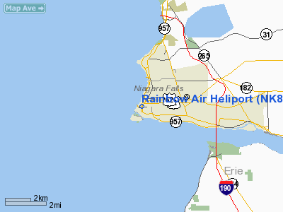
Location & QuickFacts
| FAA Information Effective: | 2008-09-25 |
| Airport Identifier: | NK80 |
| Airport Status: | Operational |
| Longitude/Latitude: | 079-03-44.1600W/43-05-20.2000N
-79.062267/43.088944 (Estimated) |
| Elevation: | 583 ft / 177.70 m (Estimated) |
| Land: | 0 acres |
| From nearest city: | 0 nautical miles W of Niagara Falls, NY |
| Location: | Niagara County, NY |
| Magnetic Variation: | 10W (1985) |
Owner & Manager
| Ownership: | Privately owned |
| Owner: | Wafer Inc. |
| Address: | 454 Main Street
Niagara Falls, NY 14303 |
| Phone number: | 716-284-2800 |
| Manager: | Robert Culbreeh |
| Address: | 454 Main St.
Niagara Falls, NY 14303 |
| Phone number: | 716-284-2800 |
Airport Operations and Facilities
| Airport Use: | Private |
| Wind indicator: | Yes |
| Segmented Circle: | No |
| Control Tower: | No |
| Landing fee charge: | No |
| Sectional chart: | Detroit |
| Region: | AEA - Eastern |
| Boundary ARTCC: | ZOB - Cleveland |
| Tie-in FSS: | BUF - Buffalo |
| FSS on Airport: | No |
| FSS Toll Free: | 1-800-WX-BRIEF |
Airport Services
Runway Information
Helipad H1
| Dimension: | 78 x 40 ft / 23.8 x 12.2 m |
| Surface: | CONC, |
| |
Runway H1 |
Runway |
| Traffic Pattern: | Left | Left |
|
Radio Navigation Aids
| ID |
Type |
Name |
Ch |
Freq |
Var |
Dist |
| SN | NDB | St Catherines | | 408.00 | 01E | 9.1 nm |
| TZ | NDB | Gibraltar Point | | 257.00 | 10W | 34.5 nm |
| L | NDB | Lima | | 368.00 | 10W | 38.3 nm |
| HM | NDB | Hamilton | | 221.00 | 08W | 41.5 nm |
| ZLB | NDB | Britannia | | 236.00 | 10W | 41.9 nm |
| J | NDB | Juliett | | 236.00 | 10W | 41.9 nm |
| T | NDB | Tango | | 341.00 | 09W | 43.6 nm |
| YZD | NDB | Downsview | | 356.00 | 09W | 43.9 nm |
| X | NDB | Xray | | 385.00 | 09W | 44.9 nm |
| R | NDB | Romeo | | 403.00 | 09W | 48.0 nm |
| IAG | TACAN | Niagara Falls | 047X | | 10W | 4.7 nm |
| BUF | VOR/DME | Buffalo | 111X | 116.40 | 08W | 20.7 nm |
| YYZ | VOR/DME | Toronto | 058Y | 112.15 | 10W | 42.3 nm |
| DKK | VORTAC | Dunkirk | 109X | 116.20 | 07W | 37.2 nm |
| BUF | VOT | Buffalo | | 109.00 | | 17.0 nm |
Images and information placed above are from
http://www.airport-data.com/airport/NK80/
We thank them for the data!
| General Info
|
| Country |
United States
|
| State |
NEW YORK
|
| FAA ID |
NK80
|
| Latitude |
43-05-20.200N
|
| Longitude |
079-03-44.160W
|
| Elevation |
583 feet
|
| Near City |
NIAGARA FALLS
|
We don't guarantee the information is fresh and accurate. The data may
be wrong or outdated.
For more up-to-date information please refer to other sources.
|
|


