 |
|
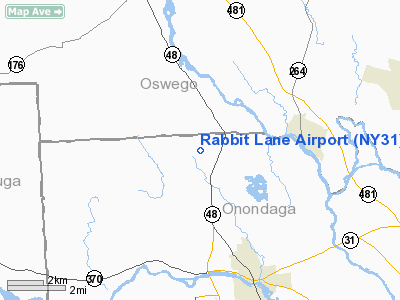
Location & QuickFacts
| FAA Information Effective: | 2008-09-25 |
| Airport Identifier: | NY31 |
| Airport Status: | Operational |
| Longitude/Latitude: | 076-22-07.7600W/43-13-25.2450N
-76.368822/43.223679 (Estimated) |
| Elevation: | 405 ft / 123.44 m (Estimated) |
| Land: | 70 acres |
| From nearest city: | 4 nautical miles W of Phoenix, NY |
| Location: | Onondaga County, NY |
| Magnetic Variation: | 12W (1985) |
Owner & Manager
| Ownership: | Privately owned |
| Owner: | Richard Murdoch |
| Address: | Rabbit Lane
Phoenix, NY 13135 |
| Phone number: | 315-695-2585 |
| Manager: | Richard Murdoch |
| Address: |
|
| Phone number: | 315-695-2585 |
Airport Operations and Facilities
| Airport Use: | Private |
| Wind indicator: | Yes |
| Segmented Circle: | No |
| Control Tower: | No |
| Landing fee charge: | No |
| Sectional chart: | New York |
| Region: | AEA - Eastern |
| Boundary ARTCC: | ZBW - Boston |
| Tie-in FSS: | BUF - Buffalo |
| FSS on Airport: | No |
| FSS Toll Free: | 1-800-WX-BRIEF |
Airport Communications
Runway Information
Runway 11/29
| Dimension: | 1600 x 75 ft / 487.7 x 22.9 m
RY 11/29 SHORTENED EAST END. |
| Surface: | TURF, |
| |
Runway 11 |
Runway 29 |
| Traffic Pattern: | Left | Left |
|
Radio Navigation Aids
| ID |
Type |
Name |
Ch |
Freq |
Var |
Dist |
| BK | NDB | Plein | | 329.00 | 12W | 38.8 nm |
| PYA | NDB | Penn Yan | | 260.00 | 12W | 46.1 nm |
| CJY | NDB | Clay | | 275.00 | 12W | 49.5 nm |
| GSS | TACAN | Griffiss | 057X | | 12W | 41.9 nm |
| ITH | VOR/DME | Ithaca | 055X | 111.80 | 10W | 44.0 nm |
| SYR | VORTAC | Syracuse | 117X | 117.00 | 11W | 8.1 nm |
| GGT | VORTAC | Georgetown | 125X | 117.80 | 11W | 35.4 nm |
| ART | VORTAC | Watertown | 035X | 109.80 | 12W | 45.7 nm |
Remarks
- VFR USE ONLY; TREES ARE REMOVED/LOWERED TO ENSURE 20:1 APPROACH SURFACES.
Images and information placed above are from
http://www.airport-data.com/airport/NY31/
We thank them for the data!
| General Info
|
| Country |
United States
|
| State |
NEW YORK
|
| FAA ID |
NY31
|
| Latitude |
43-13-25.245N
|
| Longitude |
076-22-07.760W
|
| Elevation |
405 feet
|
| Near City |
PHOENIX
|
We don't guarantee the information is fresh and accurate. The data may
be wrong or outdated.
For more up-to-date information please refer to other sources.
|
|


